Bruce Stainsby's Blog: Muttering from the mo

N’York. (August/September 2015)

December 22nd, 2015

DSC07266

We drove into New York City at midday and went straight to Ev and Steph’s new apartment in East Harlem.

It was then time to return the car to Dollar Car Rental. Given the problems we had had in Seattle and the time it took to get a new contract and car – we feared the worst.

After presenting our heavily modified Thrifty contract to the Dollar staff, we were greeted with confused looks, lots of head shaking and eventually a smile of inevitability.

Everything was resolved and we were sent on our way.

I can’t help thinking that this wasn’t the first time this problem had occurred.

We had spent the last two months on the road, in rented cars. Then once we hit NYC we were on our feet.

We seemed to walk everywhere.

This was good and much needed exercise after all the time sitting on our bums.

One of our first tasks was to get a bed and a few essentials, so we headed for K-Mart. We had planned to stay with Ev and Steph, rather than a hotel so it was only fair to help them out and get what was needed. After all we were saving on a New York Hotel, which wouldn’t have been cheap.

On our first full day of site seeing we explored some of the parks, especially Central Park and the Jacqueline Kennedy Onassis Reservoir.

Central Park was first opened in 1857 on 315 ha and in 1873 is was increased to its present size of 341 ha. It attracts about 37.5 million visitors each year, so we were not alone.

On 5th Avenue, very close to the eastern easter edge of the park, is the Solomon R Guggenheim Museum. This day we just looked and took some external snaps. Built in 1959, this is one of Frank Lloyd Wrights masterpieces. We planned to come back and explore the museum further in a few days time.

Ev and Steph’s apartment was a stones-throw from the West 125 Street Metro Station. This was on the ‘A’ line which runs both north and south through Manhattan.

We had bought a Seven Day Metro Pass and headed south of Harlem into Downtown.

I was commenting to myself about the lack of buskers on the Metro, that quickly changed at the next station. A group of four middle aged African Americans hopped on and proceeded to croon the carriage. They weren’t that good and didn’t get much money but they did brighten up the subway ride.

Evan had tracked down some good coffee, so we headed to one of the Bluestone Cafes. This chain of Melbourne inspired cafes was started in 2013 by Nick Stone, an ex VFL player, banker and now coffee shop entrepreneur. Nick is hoping to have 6 or 7 of his Bluestone Cafes open by the end of 2015.

After a few days of exploring, we escaped Manhattan and boarded the Staten Island Ferry. Our main objective was to get a good look at the Statue of Liberty as we sailed past.

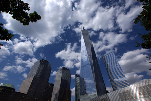
Back on the island we did more sight seeing, visiting the September Eleven Memorial and One World Tower. The last time I was in NYC was in 1986 and the World Trade Centre Towers were still standing. The September Eleven Memorial is a very poignant reminder of how much the world has changed since 2001.

The remainder of that day was spent exploring some of New York’s older architectural landmarks.

Some of my favorites were: the Manhattan Municipal Building (1914); Surrogate’s Court (1907); Emigrants Industrial Savings Bank (1912); the Chrysler Building (1930) and the neo-Gothic Woolworth Building (1913)

We then walked to Times Square and the famous neon signs. One particular LED display was an animated logo sequence for the Swedish fast-fashion giant H&M.

We completed our architectural jaunt with the Rockefeller Centre (1939) and the Art Deco General Electric Building (1933) in the Rockefeller Plaza.

I believe that it’s these early to mid 20th century buildings that really gives NYC its charm.

New York is a city full of tourists, even this late in the summer.

The one thing I have noticed, both in NY and in most other tourist destinations, is the scarcity of Single Lens Reflex Cameras (SLR).

Ten years ago most travellers carried an SLR or at least a small digital camera. Now it’s all smart phones, tablets or GoPros on a Selfie Stick. I can’t help but wonder if a smaller camera isn’t a better way to take my snaps, rather than schlepping 9 kg of camera gear around all day.

There is always an exception and that came from older Japanese gentlemen, who still maintain the tradition of toting around large SLRs with the accompanying big bag of accessories.

We had set aside the next day to visit the Guggenheim, but we hadn’t done our homework as it was closed.

Unperturbed we wandered down 5th Avenue to the Metropolitan Museum of Art, another venue that was high on our list of ‘must does’.

Many international luminaries of modern art were in this exhibition such as Picasso, Dali, Chagall, Miró and many more.

Plus there were the home-grown artists like Pollock, Warhol, Hopper and even Rockwell. Norman Rockwell (1894-!978) was a popular painter and illustrator who became famous with his reflections of American culture during the first half of the 20th century. For nearly 50 years his iconic illustrations could be found on the covers of The Saturday Evening Post.

Apart from the wonderful collection of art, the highlight for me was finding a 1937 Purma Special Camera in the industrial design exhibition. This was designed by Raymond Loewy (1893-1986) an American citizen who was born in France. It was manufactured by Thomas De La Rue and Beck for Purma Camera Limited, England from 1937 to 1951.

The reason for my excitement, was that I own one of these quirky old Bakelite models.

New York City consists of five boroughs or council areas. Manhattan, Brooklyn, Queens, The Bronx and Staten Island.

We had been to Staten Island so still had a few to go.

We crossed the Brooklyn Bridge and walked into Brooklyn and then took a ferry ride up the East River from Brooklyn to Williamsburg.

Williamsburg is a neighbourhood of the borough of Brooklyn and sometimes referred to as ‘Little Berlin’ due to its large hipster culture. There is also a big music culture and it’s here that we found the Rough Trade Record store. Rough Trade originated in London in 1976 and specialises in post-punk but these days has a range of genres. The store in Williamsburg was opened in 2013 and is now one of the largest music stores in NYC.

We finally got to the Guggenheim Museum and stumbled into their current exhibition titled ‘Storylines’ This was a collection of over 100 works from the Guggenheim’s contemporary collection and themed under the idea of storytelling.

I must admit that I didn’t understand much of the exhibition.

It seemed to reflect a disjointed, almost fractured approach to art that uses many disciplines – all at the same time.

Much like contemporary adults and children who can text their friends, follow Facebook and ‘Google’ on their laptop, all while watching TV.

My biggest criticism of much of the work was that it lacked an aesthetic.

To my mind art should engage the audience and tell a story, but do it in a way that’s rewarding and artistically stimulating.

Apart from the art there’s the Guggenheim Museum’s architecture. Frank Lloyd Wright designed the gallery with five floors, built in a seamless circular spiral, allowing the visitor to descend from the top floor via a gently sloping ramp. Wright was initially approached in 1943 to design the building but it took him 15 years to complete the project.

As with much of Wright’s other work, a repetitive theme appears. Not surprisingly in this case, it’s a circle.

This simple motif is seen throughout the gallery, which even includes the typography on the exterior of the building.

The High Line is a 2.33 km stretch of the disused New York Central Railroad. Similar in concept to the Promenade Plantée in Paris which we visited at the end of 2014, this aerial greenway is a wonderful way to get an elevated view of parts of NYC, along the Hudson River.

Along the way there are many art installations and attractions, such as Manhattan by Yutaka Sone and Spencer Finch’s “The River That Flows Both Ways’. This Window installation features coloured glass that is a symbolic representation of the Hudson River.

One of the last exhibits we discovered on the High Line was Olafur Eliasson’s ‘The Collectivity Project’ This is a cityscape, made from white Lego, that is built and re built by the public.

On the Sunday all four of us had lunch at Cipriani Restaurant, Downtown, with Sean and Michele Cummins. This was a great opportunity to catch up with Sean and Michele since they moved to New York.

Sean has taken the brave step of setting up an ad agency in what must be one of the world’s toughest markets.

This Soho restaurant was very New York with great food and a multi national clientele. There was even a table of rather drunk Australians misbehaving in a corner.

We tried hard to avoid them.

On our last full day we visited the American Museum of Natural History. This is one of the world’s largest museums with over 32 million exhibits, covering the gambit of nature and all housed in 190,000 square metres of elegant classical architecture. Only a small percentage of the exhibits are on display at any given time.

Even so the exhibition is vast, so we restricted ourselves to a few areas and concentrated on North American animals and birds.

The Hall of North American Mammals was built in stages between 1936 and 1963. It was restored in 2011-12.

The dioramas all contain expertly painted backgrounds. These depict famous locations, such as Yellowstone, the Grand Canyon and even the Devils Tower, at a particular season and time of day. This is accompanied by a story describing the action taking place within the scene.

The Hall of North American Birds is on a smaller scale and again features beautifully painted dioramas.

That night we had dinner at the Spotted Pig, a gastropub in the West Village. Unfortunately it has the annoying practice of not taking reservations. This means you just turn up and wait.

Their specialty is gourmet burgers and the thinest shoestring fries I have ever seen.

Unfortunately the red wine was served cold, as was our waitress.

Apart from that if was great.

On our last morning in NYC we had brunch, then wandered around the Columbia University Campus. It was great to see where Stephanie will be studying for the next two years and get a first hand look at this highly regarded institution.

Boston to New York and the end of the road trip. (August 2015)

December 19th, 2015

DSC07185

Our hotel in Boston was some distance from the down town area. It was here that we found the Tavern at the End of the World. It was ostensibly an Irish pub but more like a drinking, eating and music venue for the locals in Charlestown.

Like so many of these small establishments that we have found, this one also served great food, excellent beer and wine, all at an affordable price.

The music was Rhythm and Blues but sadly lacking the rhythm.

We discovered that there was a train line very close to our hotel and took a ride into Boston. We initially bought the wrong ticket but after some help from the locals and a reluctant railway employee we were on our way.

Founded in 1630 by Puritan settlers from England, Boston, Massachusetts is one of the oldest cities in the USA. It played an important role in the American Revolution, hosting such significant events as the Boston Tea Party, the Battle of Bunker Hill, the Boston Massacre and the Siege of Boston.

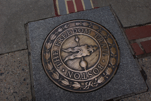
The sites of many of these incidents can be seen by following the Freedom Trail. This is a 4km brick path, created in 1953, that links all the local historical landmarks.

We stated in Boston Common and meandered past such sites as the Massachusetts State House, Granary Burying Grounds, King’s Chapel, the Old City Hall, the Old South Meeting House, the Old State House and Samuel Adams Park.

It then stated to pour down, so we took refuge in the fruit and vegetable market and waited for the deluge to subside.

An hour later we were back on the Freedom Trail and chasing history through the streets of Boston.

Next was the Paul Revere House and the Old North Church. From there we walked to the Charlestown Navy Yard where we discovered, in dry dock, the USS Constitution or ‘Old Ironsides’ as she is affectionately known.

Built in 1797, for the fledgling US Navy, this wooden-hulled, three-masted frigate was named by George Washington after the Constitution of the United States of America. Old Ironsides was most famous for her actions agains the British in the War of 1812 where she defeated five British warships.

The last stop on our walk through history was to the Bunker Monument.

The Battle of Bunker Hill, in 1775, actually took place on Breed’s Hill which is a lot closer to Boston. There is a popular belief that the Americans intended to set up their defenses at Bunker Hill but chose Breed’s Hill by mistake, thus surprising the British by their error.

It was then back onto the train for an easy trip back to Charlestown.

The next day we drove to Milford, our last stop before The Big Apple.

As we neared the end of our road trip across the US, I can’t help but recall the miles and miles of roadworks we have had to endure.

This is in part due to the poor state of many highways, that lacked funding following the GFC.

It’s also a result of the road building method. When freeways were first constructed in the States they followed the German method of laying them in concrete. Over time the concrete cracks, breaks down, leaving huge gaps between the concrete sections.

Rather than pull them up and replace them, with the much more elastic bitumen, most repairs are done by just covering over the concrete sections, breaks and all. After time the same problems reoccur, resulting in the large stretches of roads now under repair.

Henry Ford, while revolutionising the motor industry, could also be accused of being the single biggest cause of obesity in America.

The auto industry, that developed in Detroit, spawned a total reliance on the car.

The cities swelled leaving essential services such as shopping, banking, public transport and even hotels spread out over a large area. People have no choice but to hop into their car just to get a pint of milk.

All distances are measured by ‘minutes in the car’ not on foot. There are no strip shopping streets, like we found in Canada and the sort that are also an essential part of many urban Australian communities. Many towns don’t even have footpaths, so it becomes dangerous to walk from place to place.

The automobile rules.

The old public transport systems such as rail, trolly bus and trams that were set up at the end of the 1800, have been dismantled and replaced with freeways.

Many of the downtown city areas have been given over to parking, admittedly much of it is now under ground. While pedestrian streets are few and far between.

The average American rarely walks – they are forced to drive their car.

Hand in hand with the auto industry are the petrol companies.

Buses replaced trams and trolleys in many cities and the electrification of the train network only exists in the large urban areas. Except Milford that had an electric train, probably coming from NY.

All national rail and goods-trains are diesel, with no electrified railways between major cities.

All this reliance on the car means that in order to get any exercise people have to make a conscious decision to run, visit the gym or go to the park.

From what we could see this wasn’t happening in many places.

Lack of exercise isn’t the only cause of obesity, there are a lot of other factors that come into play.

The proliferation of fast food outlets, portion sizes and food type all have a part in adding to the problem.

My concern is that most Americans are forced to drive their car if they want to go anywhere.

And this situation was deliberately engineered to benefit the oil companies and car makers.

The last meal before getting to NYC was at the Stonebridge Restaurant in Milford, which not surprisingly was right beside an old stone bridge.

This was a real find with live music, excellent food and a pack of Cougars (forty plus, single women looking for action) on the prowl.

My first beer was unfortunately served in a plastic cup. I then asked for a second beer, this time in a glass, and was told: Oh, you want a ‘Big Boy’ glass.

An establishment that clearly separates the men from the boys.

Montreal and Quebec, a slice of France
in North America. (August 2015)

December 15th, 2015

DSC07213

Quebec's Fairmont Le Château Frontenac

It was another long day’s drive to Montreal, mainly on freeways, but even there, the traffic was frustratingly congested.

The speed limit in Canada is 100kph, but everyone drives much faster than that. Many of the secondary roads are also capable of higher speeds than the limits allow.

The signs on the side of the freeway indicate the fines if you speed. They start at 20kph above the speed limit, which seems rather lenient.

The Canadians drive more like the French than Americans, which is understandable, yet disconcerting, if you have just crossed the border.

Another big difference between Canada and the USA is the tipping regime. In the US you are over serviced and under pressure to tip. In Canada the service staff are payed a decent wage and don’t need 18%+ as a tip.

The entire experience is much more congenial.

A strange thing happened while we were in French speaking Montreal.

I have a T-Shirt with, “I used to be indecisive but now I’m not quite sure” on the front. I wore it throughout the US and never received a comment. Over two days I had three people openly laugh at it.

I can’t explain why.

It is even more interesting when you consider that Montreal has been a mono lingual, French speaking society since 1977 and 300,000 English speaking citizens left between 1980 and 1995.

I was so amused by the reaction to my T-Shirt that I wore a different one the next day. This one had, “Oh no, not déjá vu again” The reaction was similar with people laughing out loud and making comments.

At least this T-Shirt was bi-lingual.

Apart from the Westminster parliamentary system, the Queen and plastic money, it appears we also have a sense of humor in common with the Canadians.

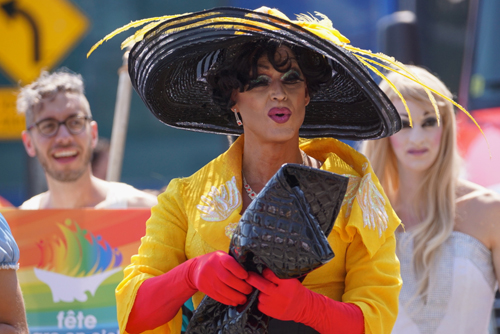
As with the Mourning Ceremony of Aman Hussein in Iran and the 75th Anniversary of the Sturges Motorcycle Rally in South Dakota, USA, we again fell into the middle of an important event. This was Montreal’s Gay Pride Parade or Défilé de la fierté gai. It was originally started, in 1979, as a symbol of solidarity with the 1969 Stonewall Riots in New York.

After spending an hour watching the weird, wonderful and strangely bizarre spectacle of the Gay Pride march, we headed off to explore the other parts of Montreal.

The city was incorporated in 1832 but the first European inhabitants were French explorers and trappers around 1611.

We walked past the Christ Church Cathedral, consecrated in 1867 and the Sun Life Building, which was opened in 1914. It was then on to the Basilica Marie-René-Du-Monde Cathedral, a minor basilica that was consecrated in 1894.

Next was the Place d’ Armes with the Notre-Dame Basilica and the two delightful Marc A J Fortier sculptures of ‘The English Pug and the French Poodle’

Erected in 2013 these sculptures seem to be a comment on the French/English dispute that bubbles beneath the surface of Canadian society.

Also in the Place d’ Armes is the statue of Paul Chomedey Maisonneuve. Built in 1895 it commemorates the founding of Montréal in 1642.

On our second full day in Montreal we headed out to tame the Metro.

Panhandling was as popular in Canada as anywhere.

There was one woman standing on a Metro platform pleading for money to buy a bus fare home. In the time we were there she had raised enough cash to purchase a first class airline ticket to New York.

The Biosphère at Parc Jean-Drapeau is a museum dedicated to the environment. It’s housed in the  former United States pavilion, originally used for the 1967 World Fair Expo and designed by Buckminster Fuller.

The original geodesic dome was covered by a transparent acrylic bubble but was destroyed by fire in 1976. Now all that remains is the steel truss frame.

Inside the dome was a 360° Eco presentation and an exhibition of diverted waste called, ‘O.N.E. Outfits from a New Era’ This showcased costumes, created from waste, by local Canadian artists and designers.

It was a relatively easy 2.5 hours drive from Montreal to Quebec. But before we left we drove to the top of Mount Royal, the mountain that gives Montreal its name. We were there to get a better view of the city.

Unfortunately the trees got the best vista as they completely blocked our view.

We had a coffee break at Le Trois-Riviéres, which is the half way point.

Quebec City celebrated its 400th anniversary in 2008 and is the oldest French speaking city in North America.

And it shows.

It was founded in 1608 by Samuel de Champlain, an explorer and diplomat, and contains the only remaining fortified city walls north of Mexico.

We took the bus into the city but had no idea where to get off. Quebec City is built in the European style, with winding narrow streets and history at every turn.

There are quaint old pubs, restaurants and the town hall or Hotel de Ville. Originally home to the Jesuit Barracks in the 1730s it was inaugurated as the town hall in 1896.

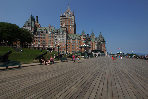
There are many other elegant buildings in the city, such at The Price Building (1930) and the Hotel Clarendon (1858) but one literally stands above them all. The Fairmont Le Château Frontenac dominates the city skyline.

It was built in 1893 for the Canadian Pacific Railway and designed by the American architect Bruce Price.

It is regarded as one of the most photographed hotels in the world.

I would certainly agree with this, as it’s almost impossible to take a snap of Quebec City without the hotel being in the shot.

Niagara Falls, one of the un-natural
wonders of the world. (August 2015)

December 8th, 2015

DSC07061

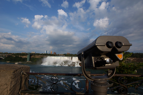
We wanted to see Niagara Falls and were told that the best views were from the Canadian side. Both the American and Horseshoe Falls can be seen from the western side of the Niagara River and this is in Ontario, Canada.

We arrived mid afternoon and as our motel was a fair distance from the attractions we decided to walk down to the falls and stay there for dinner.

Visiting Niagara Falls is like seeing one of the Wonders of the Natural World on a wide screen TV.

Apart from the falls themselves there is nothing natural about the surroundings or experience. They are the pinnacle of commercial exploitation of a natural phenomena.

Hotels, restaurants, fast food outlets, casinos, shopping centres and viewing points dominate the scene.

Then after dark the falls are bathed in an un-natural spectacle of coloured flood lights with a fireworks display on Friday and Saturday nights.

To compound the influence tourism has had, the water is regulated to flow less, after dark, when the tourists aren’t around. This is primarily to allow more water to be diverted for hydro electricity generation – it’s still screwing with nature.

The falls are spectacular, if you look beyond the commercialism, but it is a strain on the imagination.

This however isn’t a new phenomenon with world acclaimed tourist destinations.

The view of the Golden Arches (AKA McDonalds) behind the pyramids of Giza, is testament to this.

The first recorded siting of the falls, by a westerner, was by the French explorer Samuel de Champlain in 1604. I am sure that what he viewed with amazement back then, looks nothing like what tourists fall over themselves to see today.

The growth of Chicago and the demise of Detroit. (August 2015)

December 5th, 2015

DSC06952

DSC07031

Chicago is an amazing city.

Incorporated in 1837, it has a city population of 2.7 million and a further 10 million living in the metropolitan area. In 2012 it was named as an alpha or world city by the Globalisation and World Cities Research Network.

It’s also the eastern home of Frank Lloyd Wright and the birthplace of the Prairie School of Architecture.

We decided to spend a day with Frank and drove down to Oak Park. It’s here that he had his eastern Home and Studio.

We had visited Taliesin West, his architectural school and winter house in Scottsdale Arizona, so we were interested to compare.

The house was designed and built by Wright in 1889 with a loan from his then employer, Louis Sullivan (1856-1924). The Wrights raised six children in the house and it has been restored to its 1909 appearance, the last year Frank lived there with his family.

The original house was small and in 1898 it was enlarged to make room for the growing family and the thriving business of Frank Lloyd Wright and Associates.

Although it doesn’t seem much from the outside it’s the inside story that makes this particular house so significant.

Part of the team that was responsible for the development of the Prairie Style was Walter Burley Griffin of Canberra fame.

Born in Chicago in 1876, Walter was an architect and a landscape architect and very influenced by his early work with Frank Lloyd Wright. He spent a lot of time in Australia and apart from his extensive work in Canberra made major contributions to both urban and commercial architecture in Sydney and Melbourne. Both Newman College, at the University of Melbourne and the Capitol Theatre are fine examples of his work.

In later years he even went on to work in India, which is where he died in 1937.

Just around the corner from Wright’s home and studio is Forest Avenue. Along this treelined street are a number of houses designed by Wright.

This was all part of Wright’s plush middle class neighbourhood.

Here he designed his first independent commission, the Moore-Dugal Residence. Originally built in 1895 in a traditional style, it was extensively remodeled in 1922 after a fire destroyed much of the existing building.

Frank was much happier with the later design.

Also along Forest Avenue are the Hills-Decaro and Heurtley Houses, both designed by Wright in the Prairie Style. These are beautifully proportioned private homes on large well maintained grounds.

Looking around Oak Park there were plenty of well-healed neighbours that undoubtedly helped Wright’s business prosper.

We then drove over to the Robie House in the Hyde Park neighbourhood. This is situated on the campus of the University of Chicago and not far from the shores of Lake Michigan.

Designed between 1908 and 1909 for 28 year old Frederick C. Robie, the house is regarded by many as the finest example of the Prairie School style – it’s uniquely American.

Inside the Robie House all the influences of the Prairie Style are brought to bear on the visitor. It’s here Wright’s concept of compression and release can be experienced. In many of Wright’s designs the entrance was usually hidden from view and small in scale. The visitor would therefore have to ‘compress’ themselves to pass through the opening. Once inside the space would open up in a dramatic way thus ‘releasing’ the visitor to move on.

Like many artists of the late nineteenth and early twentieth centuries, Wright was profoundly influenced by Japanese art. This can be seen in the use of space, materials and decoration.

Part of the principles of the Prairie School allowed architects to go beyond designing buildings and took them into the area of furniture, light fittings, windows, carpet and textile design.

Wright was a master at this, evidenced by the Robie House’s carpet. Here Wright used the floor plan as a decorative motif.

Wright’s furniture owes much to the Arts and Crafts movement that had its roots in Britain around 1880. This style was largely a rebuttal of industrialisation and desire to return to making objects by hand from natural materials.

Chicago was a haven for architecture and building construction, a direct result of the Great Fire of 1871. The fire burned out of control from October 8 to 10, killing 300 and leaving 100,000 residents homeless. It also destroyed 9 square kilometres of the Chicago CBD.

With a need to re build much of the city centre, the Chicago School was born and with it came the development of the skyscraper.

Louis Sullivan was one of the original architects associated with the development of the skyscraper. He was also a partner in Adler and Sullivan, the firm that gave Frank Lloyd Wright his first job and financed his first home.

As a result of technical development the new Chicago was all steel, brick and glass. Far less flammable than the timber buildings that they replaced.

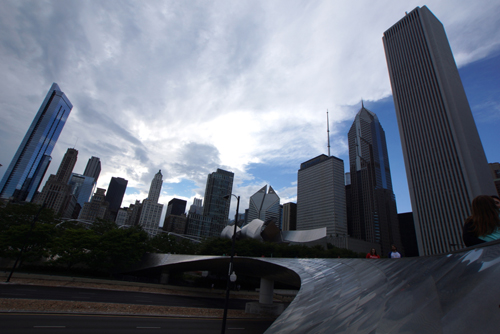
Chicago today is still a centre for good architecture and urban environmental design. This is seen in structures like Cloud Gate by Anish Kapoor and the Jay Pritzker Pavilion by Frank Gehry.

These are situated in or around Millennium Park in the Loop community area of the city.

Another wonderful piece of public art is the Crown Fountain. Designed by the Catalan artist Jaume Plensa. this interactive fountain and reflection pool is a magnet for the local children, especially on a warm summer’s day.

They wait, with huge anticipation, for the LED display of two faces to squirt water at them.

The Art Institute of Chicago is what’s described as an Encyclopaedic Gallery. This means it covers the full gambit of art history, from classical Egyptian, Greek and Roman eras to modern and contemporary art.

It has been in its present location in Grant Park since 1893 and is one of the most patronised art institutions in the world, with over 1.5 million visitors per year.

Apart from fine art, the furniture design exhibition was also very interesting. The styles in early American furniture design, from the 17th century, was influenced by where the craftsmen originated. For instance the Dutch settled in New York, while, understandably, the English settlers went to New England.

Two of the most recognisable pieces of art in the gallery were Grant Wood’s ‘American Gothic’ from 1930 and Edward Hopper’s ‘Nighthawks’ painted in 1942. Both were surrounded by crowds either wanting to look at it, or more importantly take a ‘selfie’ in front of it.

The fall of Paris to the Nazis in 1940 drove many European artists to the USA. This led to America becoming the centre of the contemporary art world. This was very evident in a lot of the exhibits in the Art Institute of Chicago.

After a day of art and architecture we met up with Chris and Susan Landers. After dinner on the river we had a night walk around Chicago where many of the new and old 20th century skyscrapers were lit up. This gave us yet another perspective of this mega city.

We drove the 460km from Chicago, Illinois, around the bottom of Lake Michigan, just touching on Indiana, to Detroit in Michigan,

In Detroit we stayed at the Roberts Riverwalk Hotel, which was opened in 2011, formerly being the Parke-Davis Research Laboratory. Built in 1902 it was the first industrial research laboratory in the USA. It’s also known as Building 55-Detroit Research and in 1976 was designated as a National Historic Landmark.

It’s situated on the banks of the Detroit River and we were lucky enough to have a room with a river view.

This is an up and coming area and part of the redevelopment of Detroit. While much of the city is derelict and looks like something post apocalyptic, this area was thriving.

We then spent a day in Motor Town.

First was The Henry Ford or the Henry Ford Museum as it is also known. Built in 1929, it’s so much more than a car museum and pays homage to transport and the Industrial Revolution in the USA. It initially started with Henry Ford’s private collection, established in 1906, and has grown from there.

Henry Ford (1863-1947) wasn’t an overnight success. He started building cars in 1896 and it was only in 1908, with the introduction of the Model T, that his vision became a reality.

There was a lot of hard work between his Model A and Model T.

Interestingly while Henry was developing his internal combustion engine and the assembly line system, there were electric cars operating within the USA. In 1923 there were dozens of charging stations around Manhattan.

In the USA the oil companies were winning even then – not much has changed.

With the popularity of the automobile came the interstate Highway system. Initiated in 1956 by President Eisenhower and completed in 1992. 65,000km of roads were constructed, inspired by German Autobahns of the 30s. Ironically the building of autobahns and the construction technique of reinforced concrete was championed by Adolf Hitler in 1933.

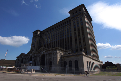
The Michigan Central Station, built in 1914 and now dilapidated, is another example of Detroit’s forgotten past. Its demise was a result of Amtrak ceasing operations in 1988. In its heyday, at the start of WWI, 200 trains left the station each day.

With the rise of importance of the car and the fact that there were no parking facilities at the station the rot set in.

Another of Detroit’s dinosaurs is the old Packard Automotive Plant. Started in 1903, the 325,000 square metre factory was the first US auto plant to use reinforced concrete.

Our last visit was to Heidelberg Street and the Heidelberg Project. Created in 1986 by artist Tyree Guyton and his grandfather Sam Mackey, it’s an urban art project in the mainly African-American area, amusingly called Black Bottom.

It’s a vast area with decorated houses, community gardens, graffiti and art installations. There is an ongoing war between the residents and the city for its survival.

Detroit was an interesting city as this was where America fell in love with the ‘automobile’ and the Industrial Revolution refined mass production.

It was also the place that saw the decline of the US car industry and a city that was hardest hit by the 2008 recession.

Marketing blunders of monumental proportions had a lot to do with the downfall of Detroit. The US car makers didn’t see the need for smaller cars and kept on designing and building what they wanted, not what the consumer needed. Once the Japanese, European and Korean car makers filled the gap, Detroit was destined for the scrap heap.

Towards Chicago it was Merlot, mountains,
motorcycles and the Mississippi. (August 2015)

December 1st, 2015

DSC07111

Given the distance we had to cover, moving towards Chicago, we knew we were in for a few long days of driving.

Lytton to Cawston, British Columbia.

We travelled along the Fraser River, stopping for breakfast at Hope, another town that developed as part of the Canadian gold rush. Given its history, it’s not hard to imagine how Hope got its name.

Descending from the Rockies we had another break in Princeton, not the university city but a small community on Highway 3. Mining was the main industry but now timber and sawmills dominate the economy.

Cawston is just a hamlet, about 7km from Keremeos. This is in a rich, fertile valley that sits adjacent to Canada’s only desert and is regarded as the ‘Fruit Stand Capital’ of Canada.

Keremeos is also near the site of a reported massacre of Spanish soldiers by Similkameen Natives nearly 200 years ago.

The attraction of Cawston was the Crowsnest Vineyards Guest House. This is a small family owned winery, run by the Heinecke family who were originally from Leipzig, Germany.

In fact the wine maker, Ann, was our waitress and her brother is the chef and local baker.

It’s a very small concern and everyone multitasks.

Their wines and food were excellent and very much in the European style. They only have one beer and that’s a draught Warsteiner Pilsener from Germany.

This was also very pleasant.

Cawston to Missoula, Montana.

Apart from a coffee stop in Oroville, which unfortunately was at a Starbucks, we only had one other stop. That was to look at the Coulee Dam and Franklin Delano Roosevelt Lake. The damming of the Columbia River, which was completed in 1942 created the largest hydro scheme in North America. The lake named after FDR, who promoted its construction resulted in the relocation of over 3,000, included many Native Americans. It also stopped salmon from swimming up the Columbia River to spawn.

The rest of the day was driving.

There are many differences between the USA and Canada.

The Canadians seemed to have adopted a far more European approach to the layout of their cities, their cuisine and their driving habits.

Driving is most evident in their approach to pedestrians.

You get the feeling that you are back in Italy or France when you cross the street in Vancouver. In Canada you avoid the cars while in the States they look out for you.

Missoula is a university town and as a result there are plenty of eating options, cafés and brewpubs.

We found the Flathead Lake Brewing Company, another fine craft brewer and restaurant.

The food, like many of these establishments, was innovative, tasty, not super-sized and sourced from local suppliers.

There were also 16 craft brews on tap.

Missoula to Sheridan, Wyoming.

Montana is known as Big Sky Country and you can understand why, as you head east along Highway 90. Unfortunately our ‘Big Sky’ was rather cloudy, yet still impressive.

Heading along the Rockies we stopped at Butte for our morning coffee.

An old mining town, Butte was full of late nineteenth and early twentieth century architecture.

Most of it was in red brick and reminiscent of the Gold Rush era buildings of Ballarat and Bendigo.

Just out of Butte we crossed the Continental Divide. Watershed on this side was now flowing eastward towards the Atlantic. Previously it had been flowing westward towards the Pacific. The ‘Great Divide’ runs from Alaska, in the north and almost reaches Cape Horn in South America.

Not far out of Sheridan and just off Highway 90 is the Little Bighorn Battlefield Monument.

Little Bighorn or ‘Custer’s Last Stand’ was a decisive win for the Indians but a very hollow victory in the course of history. On June 25 and 26, 1876, General George Armstrong Custer and 700 men went up against a combined force of Lakota, Northern Cheyenne and Arapaho tribes. Custer lost his life as did another 268 soldiers. They had little chance as their foes numbered somewhere between 900-2,500. The Native Americans led by the likes of Sitting Bull and Crazy Horse had a emphatic win. This gave the US government the impetus it needed to force the remaining native warriors back onto the reservations.

Little Bighorn is in the Black Hills region, which is regarded by the Lakota Indians as sacred ground. They were given to them under the Treaty of Fort Laramie in 1868. When gold was discovered in the Black Hills in 1874, the treaty was ignored by the prospectors, resulting in the Black Hills War. The Battle of Little Bighorn was a part of the Black Hills War and gave the US Government even more incentive to take back the Black Hills.

The move broke the Native American’s spirit and took away their independence.

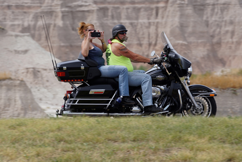
There were thousands of bikes and bikers on the road around South Dakota. Harley Davidson was by far the most popular brand of bike, occasionally I did see another brand but not many. They were all there for the 75th Anniversary of the Sturgis Motorcycle Rally. It was originally started as an event for stunts and races, but has since developed into a meeting place for motorcycle enthusiasts.

There were bikers from all over the globe. We sighted bikes from Canada, Italy, Germany and Great Britain. There was even a group of Aussies in a Rapid City.

Bikers and their bikes come to Sturgis in many ways. Some ride there, some bring their RVs with their bikes in tow, while other fly there and have their bikes shipped in. There are even a well healed few who fly both themselves and their bike to the rally.

On the whole they were a very well behaved group of riders, with a mixture of ages and gender, happy to cruise the highways at well under the speed limit.

The official attendance was 739,000 however the South Dakota Department of Transport put the number at over 1,000,000.

There is a dark side to the rally with 13 road deaths. This is not surprising considering that most of the rider we saw weren’t wearing helmets.

Sheridan to Rapid City, South Dakota.

We had our morning coffee break at Gillette and the number of Bikers were increasing. They were now thick on the roads and outnumbered the other vehicles.

The Devil’s Tower was our next destination and it appeared that it was also high on the agenda for the Sturgis bikers.

The Devil’s Tower is an eroded laccolith in the Bear Lodge Mountains, part of the Black Hills of Wyoming. In 1906 it was made a United States National Monument by President Theodore Roosevelt.

In more recent times it was featured in the 1977 movie, Close Encounters of the Third Kind, that was written and directed by Stephen Spielberg.

Next was Crazy Horse Mountain. This an ongoing project to carve an image of Chief Crazy Horse into a mountain side, similar to Mount Rushmore.

The project was the idea of Henry Standing Bear and started by sculptor Korczak Ziolkowski in 1948. Work continued until Ziolkowski’s death in 1982 and is now being continued by his family.

We viewed from a distance as the bikes and bikers were even thicker on the roads and in the car parks.

Mount Rushmore is another concocted tourist attraction in South Dakota. The sculpture of US Presidents George Washington, Thomas Jefferson, Theodore Roosevelt and Abraham Lincoln was started by Gutzon Borglum in 1927 and completed by his son Lincoln Borglum in 1939. The initial design was to have the presidents depicted from head to waist, but with lack of funds the Borglums  could only manage the heads.

Mount Rushmore was featured in the Alfred Hitchcock movie North by Northwest.

Even though we viewed the Devil’s Tower, Crazy Horse Mountain and Mount Rushmore, the day must go to Harley Davidson and the Sturgis Rally bikers. They added another dimension to these well known sites.

We found yet another brew pub and restaurant in Rapid City. And, as with every establishment in the area, it was full of bikers.

The Firehouse Brewery was, as you would expect, in an old fire station. The beer was great, as was the food, wine and atmosphere.

Bottles of Heinz Tomato Ketchup sat unwanted and untouched on the table. A great sign for US cuisine and just maybe the death knell for fast food.

We were entertained by ‘Broken Radio’ a Country, Blues and Classic Rock band. This was a conventional four piece band, but being Country, had a fiddle player.

About the only music I recognised was from ‘The Eagles’ but it was all great entertainment, especially given the environment of the Firehouse Brewery

Rapid City to Murdo, South Dakota.

The motorcycles were still dominant on the road as we drove east of Rapid City towards Wall and their famous drug store.

Wall Drug was started by Dorothy and Ted Hustead in 1931. It’s now a US$10 million business, with over 2 million visitors per year. It was built on giving away water and with catchy billboard advertising.

It’s crass and touristy but they did sell espresso, of sorts.

The walls of this vast retail outlet are full of all things Western. Especially interesting were the shots of the Hustead family, brandishing guns or proudly showing off their latest kill.

There were also many stuffed animals adorning the place to verify their hunting skills.

I couldn’t help but think of Walter Palmer, the dentist from Minnesota, who has now been made a pariah by social media for murdering Cecil the lion.

Wall Drug is one of those places that you wish you’d never gone to, but glad you did.

A bit like Las Vegas.

Badlands National Park is 242,750 acres of eroded buttes, pinnacles and spires in South Dakota. This is all set within the largest area of undisturbed mixed prairie grasses in the USA.

It was named by French trappers, “Les mauvaises terres á traverser” or bad lands to travel across.

The Badlands are also one of the most popular rides for the Sturgis bikers. I guess bikers and the Badlands seem to be a good fit.

Murdo is a small town on the edge of the Prairies and what we had come to the US to experience. We had dinner in the Rusty Spur, a strange combination of saloon and steak house. The food was palatable but just didn’t have the style and substance of the Brew Pubs we had been frequenting. One of the servers (waitresses) was only 14 and had no idea about what beer and wine was on offer. In fact she had to get an 18 year old to take our order and a 21 year old to server us the drinks.

Life for servers is very complicated in Murdo.

Again there were dead animals adorning the walls. ‘Huntn’, ‘shootn’ and taxidermy seem to go hand in hand in South Dakota.

Murdo to La Crosse, Wisconsin.

It was an early start as this was a long day of driving across the prairies of South Dakota, Minnesota and into La Crosse, Wisconsin, on the mighty Mississippi.

Our first stop was at Mitchell to see the Corn Palace, now the world’s last remaining corn palace. There were originally corn palaces in Gregory, South Dakota and  Sioux City and Creston both in Iowa.

My initial thought was, why?

But once I’d read the history, put everything in context and mixed with the other tourists, I realised why.

This, like Wall Drug, was as much about putting these small prairie towns on the map and attracting tourists. Between 200,000 and 500,000 people visit the Corn palace every year.

The original Mitchell Corn Palace was built in 1892 as The Corn Belt Exposition and designed to entice farmers to settle in Mitchell.

The current corn palace is a strange fusion of Russian onion domes and Moorish minarets that are covered each year with new designs made entirely out of that season’s corn.

Our motel in La Crosse was a few kilometres out of town. The walk was needed after a long day’s drive. We were surrounded by fast food restaurants but weren’t tempted.

We found a wine bar and restaurant, named Four Sisters. It had good food and a great terrace overlooking the Mississippi River.

Despite the pretense of being a developed, sophisticated country, the US fails in many ways.

Public transport, outside of the major cities, is woeful and in many places just non existent. Telecommunications is at its best patchy, with whopping great black holes between the major towns.

Then there’s the internet.

Most hotels provide a limited service, via a WiFi network, but come 5pm, when the guest numbers swell, if buckles under the weight of use.

It’s also a country of paradoxes.

Gridiron players wear helmets and protective clothing to play football. While Bikers, wearing nothing more than a T-shirt and shorts, can ride a 1,800 cc Harley Davidson, weighing up to 410kg, as fast as they like.

The Sturgis Rally bore testament to this.

La Crosse, to Chicago, Illinois.

It was just over 450 km from La Crosse, on the Mississippi, to Chicago on Lake Michigan. On the way we passed hundreds of typical North American farm houses and their accompanying barns, all painted in matching color schemes.

We had heard about one of Frank Lloyd Wright’s building, the AD German Warehouse in Richland Center, Wright’s hometown. This elegant construction, in the Mayan Revival style was completed in 1921 for a local commodity wholesaler, Albert Dell German.

It’s currently being renovated and only open on Sundays. We were in luck as it was Sunday when we passed briefly through Richland Centre, Wisconsin.

The design was an experiment in reinforced concrete columns that was a pre curser for the Johnson’s Wax Factory built for the company’s president, Herbert F. ‘Hib’ Johnson and completed 18 years later.

It was now on to Chicago, our first large city in quite some time.

Vancouver to Lytton, where it was a quiet
and peaceful night. (July/August 2015)

November 28th, 2015

DSC04196

On our way to Lytton we had a whistle-stop for breakfast at Whistler. (Sorry I just couldn’t help that pun)

Whistler is one of North Americas favorite resorts with over 2 million visitors annually.  There’s alpine skiing and snowboarding in winter and mountain biking and hiking in summer.

There are magnificent views of the Rocky Mountains on the road from Whistler. While lakes graced the valleys as we wound our way through the mountain passes.

One of the few view points that we were able to stop at was on the shores of Duffey Lake.

The temperature steadily climbed until it reached 38°C just outside of Lytton.

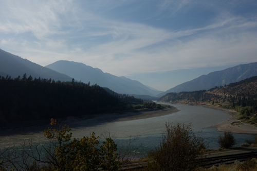
Lytton sits on the confluence of the Thompson and Fraser Rivers. The Thompson has clear water while the Fraser is heavily silted.

It was originally called ‘The Forks’ but in 1858 the name was changed in honour of the popular British Novelist and politician, Edward Bulwer-Lytton (1803-1873).

Lytton coined the phrases, “It was a dark and stormy night” and “The pen is mightier than the sword”

He also wrote The Last Days of Pompeii.

The name is mightier than the place as It’s a sleepy little town with two motels and a pub.

We stayed in the latter.

The Chinese have been here since the building of the Canadian Pacific Railway started in 1881. They still have a presence.

The Lytton Hotel was owned and operated by Chinese.

The restaurant served both western and Chinese cuisine. We opted for the Asian, it was very good and a real change from what we had been eating.

There is also a big indigenous community in the town and all the support groups that go with it.

Social Services, AA support, housing and medical services all had offices in the very short Main Street.

There were bush fires, or wild fires as they are known in North America, just across the Fraser River. Apparently they had been burning for several weeks and thought to be under control. Now they had flared up again.

Vancouver, the city of neighbourhoods. (July 2015)

November 25th, 2015

DSC06695

It’s only about two and a half hours from Seattle to Vancouver in Canada but we took a much longer route, via Highway 20, to the Mount Baker area.

The terrain was a complete change to what we had recently driven through in California. We were now on the edge of the Rockies and high pine covered escarpments dwarfed the valley roads. Except where there had been logging and their bald brown patches stood out against the verdant green.

In the valleys the greens were varied, a result of the huge variety of different trees.

We stopped for coffee in Concrete. This is not a typo but a small town surrounded by mountains, just off the Highway 20. Everyone there seemed to be passing through and asking directions to somewhere else.

We were no different.

After Concrete we crossed the border into Canada and the sun appeared.

We were back to kilometres, litres and a currency that was near parity with ours and also, like ours, made of plastic. The Canadian Dollar was just a few cents higher, which would certainly help the budget.

Vancouver was developed as a railhead of the Canadian Pacific Railroad. These days it’s the port that has prominence along with logging and film production.

Vancouver is sometimes referred to as ‘Hollywood North’.

We stayed in Mount Pleasant, south east of the city centre. Once a working class area it has now been gentrified. It’s Brunswick in the Pacific Northwest, with hipsters, organic restaurants, barber shops and everything arts and crafts.

The food was simple, imaginative and tasty and everyone ate with a knife in their right hand and a fork in their left.

We had been on the road for a month and felt that Vancouver and in particular Mount Pleasant was a good place to stop for a few days.

This however didn’t stop us from sightseeing.

We caught the Hop-on-Hop-off bus to Canada Place in downtown Vancouver. Our transport was an old converted trolly bus and the commentary was by a wisecracking local with a wonderfully sarcastic approach.

Vancouver has been voted as ‘The World’s Second Most Livable City’. Our driver was rather pissed off about that, especially when we told him we came from Melbourne, The World’s Most Livable City’.

We took the Green route to Stanley Park, 1,001 acres of what Vancouver used to look like in 1886, when it became Vancouver’s first official park. It isn’t a landscaped park, like most, but rather an evolution of the original terrain, with forests and open areas all set against the backdrop of Vancouver Harbor and English Bay.

Before there was Vancouver there was Gastown, a wild west settlement of hunters and lumberjacks. On July 1, 1867 ‘Gassy’ Jack Dayton got the locals to build his pub in 24 hours.

As our driver said there must have been a real incentive there.

The next day we jumped on the Hop-on-Hop-off bus again and did the City Route.

Our first stop was China Town.

The Chinese have had a huge influence on the demographics of Vancouver, especially during the building of the Trans Canadian Railway, where three Chinese laborers were killed for every mile of track laid.

Within China Town there’s the Dr Sun Yat-sen Park and the Classical Chinese Garden. Completed in 1986, the gardens were built with the help of many Chinese artisans who were brought from China to work specifically on the project.

The water in the ponds were made to be deliberately murky so as to enhance the reflections.

Next was Granville Island a strange place that has a freeway flyover going right over the top of the island. The main attraction was the farmers market, selling fruit, veg, meat and fish.

The quality of the products looked excellent.

Other highlights were the Marine Building, designed by McCarter and Nairne and completed in 1930. This is a very handsome office building in the Art Deco style with a beautifully detailed foyer.

Another classic Art Deco building was the Canadian Pacific Railway’s Waterfront Station.

The design of the Vancouver Public Library is based on the Colosseum in Rome, with an installation making an obscure reference to the expression “A picture is worth a thousand words”

We left the bus in the city and walked back to our hotel. On the trip we came across BC Place, a large stadium that’s home to the BC Lions, a Canadian Football League club and the Vancouver Whitecaps, a Major League Soccer club. It was also the stage for the opening and closing ceremonies of the 2010 Winter Olympics.

The ethnic mix of Vancouver is interesting with 52% of residents not having English as their first language. Almost 30% are Chinese who originally came here as as laborers on the railroad, then the gold rush and finally when Hong Kong reverted to the Communists. There are also Italians, Greeks, English, Japanese and Indian groups within the mix.

We found Vancouver to be one of the most culturally diverse places we had visited.

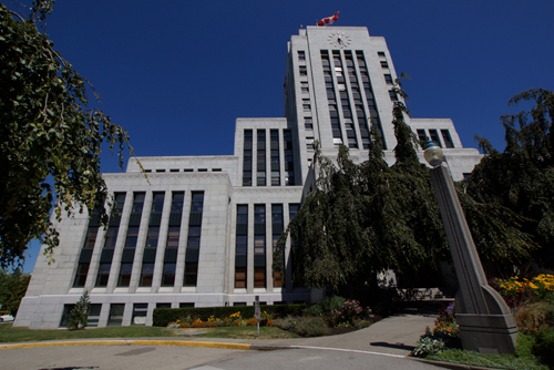
From our motel room we could see a rather elegant Art Deco building on a hill, not far away.

On further investigation it turned out to be the Vancouver City Hall designed by Townley and Matheson and built in 1935-36.

It’s now far removed from the current downtown area of Vancouver, a result of the city spreading towards the waterfront.

We left Mount Pleasant on our last night and walked into Gastown for dinner. This involved trying to avoid Crazytown – the poorest area in Vancouver and all of Canada.

The street people go there because the temperatures only reach 0°C in winter. In the rest of Canada they go far lower.

Vancouver is yet another city that was once criss-crossed with tram lines. And, once again, backward thinking forefathers pulled them up.

At least they have been partially replaced and now the city has an efficient public transport system. Part of which is the the Vancouver Skytrain, the longest fully automated metro system in North America.

The car is still the main form of transport for the residents of Vancouver, resulting in a very congested downtown area. Another reason why they are only ‘The World’s Second Most Livable City’.

Vancouver has been called the ‘city of neighbourhoods’ with each one having a distinctly different feel and ethnic mix.

Without really knowing this we stumbled into Mount Pleasant and got a real taste of Vancouver’s suburban life.

Seattle, Tech City of the Pacific Northwest.
(July 2015)

November 16th, 2015

DSC06570

On the flight from Los Angeles to Seattle I read an article in Sky, the Delta inflight magazine.

Titled “Keeping the global skies open” it was a rant, by the Delta CEO, Richard Anderson.

What has got his back up is the growth of Qatar, Etihad and Emirates and the subsequent loss of market share by the US carriers.

He points out that these Gulf airlines are heavily subsidised by their governments. But what he fails to mention is that those subsidies go to provide better, roomier aircraft and a level of service that the US carriers have forgotten about, or never even had.

We have flown with a number of American Airlines and I don’t blame the public for deserting them in order to get a far better flying experience.

It’s a pity that the Gulf airlines don’t fly on a few more routes – especially in the US.

To quote Richard. “Fair and open competition internationally is in the best interests of airlines, their customers and their employees.”

I am sure that it’s in the best interests of the airlines, however not their customers and to claim their staff benefit might be dubious.

While many of the cabin crew on US carriers act like little more than high altitude wait staff, Emirates people are polite, attentive and well educated. They have badges on their uniforms informing you what language, other than English, that they speak – some have  a lot of badges.

I am sure that there is a direct relationship between happy customers and contented and fulfilled staff.

We were in Seattle to get a new car. In the US you can only have a rental car for 30 days before you have to return it. This is ostensibly for service and maintenance but it’s also so they can keep an eye on their vehicles.

We originally intended to have one car for 62 days but we were told this wasn’t possible.

Having done a loop out of LA we decided to return the car there and then fly to Seattle and pick up another one.

This was a bad move.

We had booked online with rentalcars.com for the entire time and paid for it in advance.

When we returned the car in LA, Dollar, the rental company, unbeknown to us, closed our booking. To make things worse, when we arrived in Seattle we were told that the Dollar company there was only a franchise and we couldn’t take the vehicle out of Washington State. We were then pointed in the direction of Thrifty, the parent company of Dollar and a national network.

That’s when we found out our contract had been cancelled.

We were about to make another call to rentalcars.com when the guy behind the desk, obviously feeling sorry for us, decided to take the issue to his manager.

She was a ‘can do’ person and resolved to help us out.

She did, and with the aid of the night manager, two hours later we walked out of Thrifty with an upgraded car and a waver of the remote delivery charge.

We had made arrangements to have brunch with Tim, a university friend of Hayden. It was at a funky restaurant in the downtown area of Seattle. The decor was ‘Industrial Grunge’ and the menu, as ever, was complicated, offering items that needed Tim’s translation.

After our rather substantial meal Tim kindly showed us some of the city sites.

Our fist stop was to gawk at the world’s first Starbucks. Yes, unfortunately for Seattle this is where it all began.

Having had a great cup of coffee at breakfast we weren’t tempted inside to have another one.

We wandered through the Pike Palace Market, which was more for the tourists than the locals. I was amazed by the Googie inspired neon signs that were everywhere. The market was opened in 1907 and is one of the oldest, continually operated markets in the US.

Under the market and near the Market Theatre box office is the Market Theatre Gum Wall*. It’s a strange tourist attraction with thousand of locals and visitors depositing their used chewing gum there every year.

We took the Monorail to the Space Needle, which dominates the Seattle skyline, and walked through the Seattle Center. Both the Space Needle and Seattle Centre, along with the International Fountain, were built for the 1962 World’s Fair. We then took an Uber taxi up to Kerry Park. From there you can get a great view of the city and the surrounding areas. Unfortunately the clouds were gathering and the visibility was diminishing.

Then it started to rain.

We left Tim to the rest of his Sunday and returned to the car. The remainder of our Seattle site seeing would have to be done from there.

Seattle is the largest city in the Pacific Northwest and fastest growing major city in the US. Its growth is driven, in the main, by tech companies and start-ups. Google, Facebook, Apple, ebay, Dropbox, Uber, Twitter, Amazon and Microsoft all have offices there.

*On November 10, 2015, the Gum Wall was cleaned for the first time in 20 years. This apparently was necessary as the gum was eroding the bricks in the wall. After the cleaning people will be free to stick new chewy up again.

The Pacific Highway part 2: Napa Valley
to Los Angeles. (July 2015)

November 10th, 2015

DSC06969

From Highway 1 we travelled inland to Napa, the Napa Valley and San Francisco, before returning back to Los Angeles.

We had visited so many craft breweries and brewhouses that we felt Thea deserved a little bit of wine culture.

The Napa Valley is regarded by many as the home of fine wine in the USA. The first commercial winery was opened near the outskirts of Napa by John Patchett in 1859. However around 1836 there was a private vineyard, built by George C Yount. This was before California became part of the United States.

When we arrived in Napa we wondered why there were so many buildings being renovated.

We then discovered that there was a magnitude 6 earthquake on August 21, 2014. One person died, 200 were injured, with an estimated damage bill of 1 billion dollars.

Twelve months on there was still a lot of evidence of the earthquake. The brick buildings seemed to be the ones most effected.

It’s little wonder that most of the houses in Napa are timber.

The next day we headed for the Napa Valley wine region.

Our first stop was the Robert Mondavi Vineyards. It was Robert Gerald Mondavi (1913-2008) with his technical and marketing skills that brought fame to the Napa Valley. He introduced the practice of naming wines by their variety and not generically.

This has since become the standard for New World wines.

Just down the road was Hall Wines, a contemporary concern with a wonderful mixture of wine, art and architecture. The vineyard contained some whimsical sculptures, the frolicking rabbit and grazing sheep were the standouts.

To complement their trendy approach, Hall Wines are certified organic.

Beringer is the oldest, continually operating, winery in the Napa Valley. They managed to survive the prohibition years 1929-1933, by making sacramental wine and selling it to churches.

It has been owned by Nestlé, the Foster’s Group and now the Melbourne based Treasury Wine Estates.

There are some elegant old homes on the Beringer Estate, such as Rhine House and Hudson House. The Rhine House was built by Frederick Beringer in 1884 and is a classic example of ornate Victorian architecture.

In a way prohibition still exists in the US, however this one is inflicted by Ford, GMC and Chrysler. The large auto makers in Detroit were strong proponents of the idea of decentralisation, making people reliant of the car.

The cities and even small towns are so spread out that you need to drive everywhere. You daren’t drink and drive as the laws are strict; and the public transport system so poor, again thanks to Detroit, that you have no alternative but to use your vehicle.

The automobile has also been blamed for social isolation, urban sprawl, urban decay and the rise of obesity.

As a general rule people in the USA don’t walk.

I am in no way religious, in fact I believe that religion, or the blind following of a faith, has caused more problems than it’s solved.

However when I see a good line, I can’t help admire it – no matter what cause it is promoting.

This line was outside a church on Highway 1, in California.

“You don’t have a hope in hell without God”

We spent a short time in Napa before driving to San Francisco. This was mainly an opportunity to get some snaps of this sleepy valley town.

As soon as we sighted the Golden Gate Bridge the sky changed from blue to grey as the San Francisco mist rolled in.

About the worst view of the bridge, in all of San Francisco, is ironically at Vista Point.

We therefore decided to walk over the bridge to the south side. There was a much better view from just near the Round House Cafe.

The Golden Gate Bridge was designed by Irving Morrow, Joseph Strauss and Charles Ellis in the Art Deco style.

It was opened in 1937 and connects San Francisco with the San Francisco Peninsula, bridging US Route 101 with State Route 1. It was an essential link in opening up the northern Pacific coast.

At the time of its construction it was a feat of modern engineering, with each tower held together by over a million rivets and the 93cm wide suspension cables containing 27,572 wires. It is famously painted in International Orange, which was originally the colour of the sealant. The US Navy wanted it to be painted with black and yellow stripes to make it more visible in the infamous San Francisco fog.

Not far from the bridge exit on the city side, is the Palace of Fine Arts. This was designed by Bernard Maybec and built for the 1915 Panama-International Exposition. It’s a rather strange structure, based on a Roman ruin that looks very out if place in a modern city. It was rebuilt in 1965 with renovation of the lagoon being undertaken in 2009.

The ‘New World’ seems to have a fascination with antiquity with a lot of architecture inspired by ancient Greece and Rome.

Capitol Hill in Washington is a prime example.

Armed with our US guide book we spent three days site seeing around the ‘Frisco’ area.

The Painted Ladies near Alamo Square are a number of beautiful Victorian and Edwardian houses. These have been lovingly detailed, in soft pastel colours, to enhance their architectural features.

We walked down to Fisherman’s Wharf and then took a ride into Union Square on the cable car. The iconic San Francisco cable car  is the world’s last manually operated system. There were originally twenty three lines, now only three remain with the vast majority of the seven million passengers being tourists.

In total disregard for OH&S you can cling to the outside of the cable cars as you ascend and descend the famous San Francisco hills.

Just like in the movies.

After our essential cable car ride we spent the rest of the day walking, which is a test of knees and thighs, given the terrain.

San Francisco is a truly international destination, full of tourists from around the world.

We spent a lot of time playing ‘Pick the Accent’.

The one we heard more than any other was English. They probably came to California for the summer weather. So how disappointed they must have felt when there was nothing but mist, low temperatures and cold winds.

You can tell the tourists in San Francisco, they’re the ones with shorts, T-shirts and bewildered looks.

The locals know better.

We passed the Chinatown gate, the ferry building clock tower and terminal and even got to see the Bay Bridge from near Pier 14.

Not far from our hotel was Lombard Street which is regarded as the world’s ‘crookedest’ street – it has eight hairpin turns in a one block section.

Another very popular tourist attraction is Pier 39, which is at the edge of Fisherman’s Wharf and close to North Beach and Chinatown.

After a very pleasant but energetic time in San Francisco, we continued or trip south on Highway 1 to San Simeon. This small seaside coastal village isn’t far from the Hurst Castle and is approximately half way between San Francisco and Los Angeles. Hurst’s monument to his wealth is about the only attraction in or near San Simeon.

Our morning coffee stop was at Santa Cruz, a much larger and more impressive beach resort than San Simeon.

A lot of the the time Highway 1 travelled inland but when it did hit the coast the views were spectacular. However, to my mind, the best part of the coast was still north of San Francisco.

After overnighting in San Simeon we drove the final stretch into Los Angeles.

Our coffee stop this time was at the Old West Cinnamon Roll coffee shop in Pismo Beach. The coffee was dreadful. Which isn’t surprising as most people were consuming large quantities of the cinnamon rolls and not there for a caffeine hit.

Our motel in LA was a strange place indeed. It was situated in a very dodgy part of the LA but it was close to the airport – this was it’s only attraction.

We have found that you can judge the socioeconomics of an district by the number of fast food restaurants.

We were surrounded by them.

Just to indicate the tone of the Crenshaw Inn Motel, there was a sign in reception indicating that no prostitution was permitted on the premises.

It did have some standards.

We were also surrounded by churches. I guess they were there to save the poor souls at the Crenshaw Inn Motel.

As we had to drop off the car, which was the only reason to stay where we did, we drove to LAX. Knowing that there were no suitable places to eat near the motel we took the hotel shuttle to the Sheraton, and in total contrast to the Crenshaw Inn, we dined at the Paparazzi, the Sheraton’s restaurant.

What we saved on the motel we paid for in the restaurant.

The Crenshaw Motel was probably the worst place we stayed at on our entire trip. In the morning I awoke to discover that Thea wasn’t my only sleeping companion.

The place was riddle with fleas and as I am a magnet to anything that bites, I had been mauled during the night.

I now understand exactly what people mean when they describe a place as a ‘Flea-Pit’.