Archive for the ‘Photography’ Category

Part 3: Eastern Europe – Poland, Lithuania, Latvia and Estonia. (July/August 2017)

Saturday, June 16th, 2018

P7212700

July 21, 2017. Poprad-Spišská, Slovakia to Krakáu, Poland.

The task for today was simple – drive the 149 kilometres from Poprad-Spišská, Slovakia to Krakau in Poland. This was one of our shortest drives but it turned out to be one of the slowest. 

If Slovakia was ‘slow-quick’, Poland was ‘slow-slower’. 

We added nearly an hour and a half to the estimated time. The traffic density was twice what it had been in Slovakia and they were building a huge freeway along most of the route. 

This new road was certainly needed. 

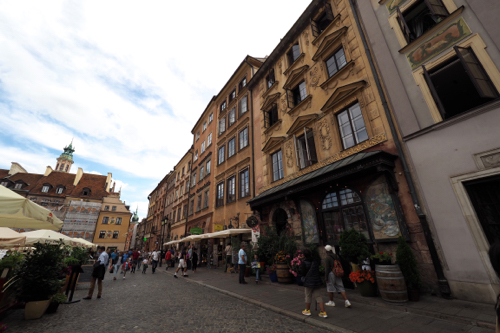
As soon as we got to Krakáu, we found the tourists – in their thousands. 

Unlike where we had been over the last days in Slovakia, Poland was a tourist destination and Krakau was a tourist city.

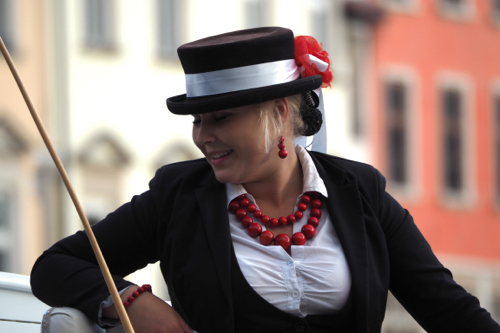
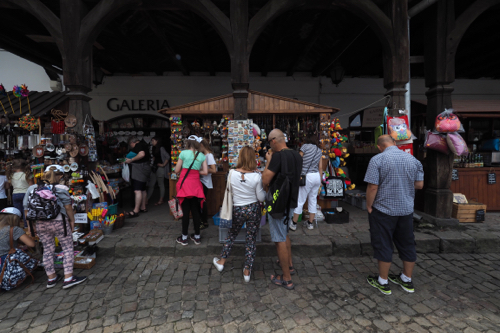
Multiple languages, including English were being spoken on the streets, in the hotels and in the restaurants. Touts, hawkers and buskers were trying to relieve you of your money and souvenirs stands were on every corner. There was also Segways and horse-drawn carriages, ready to show you around.

Prices were also back to their usual inflated value and this meant that there were ATMs everywhere, just in case we ran our of cash.

I think I like places with fewer tourists.


P7222725

July 22, 2017. Krakáu, Poland.

We were in Krakáu to try and get an understanding of the horrors of the Holocaust and the Nazi  occupation of Poland.

Krakáu has a rich heritage, having grown from a stone age settlement to become Poland’s second most important city. In 1364 Casimir III founded the University of Krakáu and today it still remains a centre of academic excellence.

The 15th and 16th centuries were known as the Golden Age for the city. This was the time of the Polish Renaissance when architecture and art flourished. The High Synagogue, built in either 1407 or 1492 (scholars differ), was then rebuilt in 1570 and is regarded as one of the best examples of a Fortress Synagogue in Europe. The Jewish population played an important role in the growth of the city but even as far back as 1495 they were being persecuted. King John I Albert expelled them from the city wall and they were relocated to Kazimierz.

In 1939 Nazi Germany invaded Poland and Krakáu became part of the General Government. This was a separate administrative region of the Third Reich.

The Nazis wanted Krakáu to become a Germanised city which involved removing all the Jews and Poles – one way or another. They confined the Jews to a ghetto, where many died from starvation or illness. Later those in the ghetto were either murdered or sent to concentration camps.

After working in the morning, we headed out to discover the city. Our first stop was in Kazimierz, the old Jewish quarter and then the High Synagogue.

Having seen Steven Spielberg’s 1993 movie, Schindler’s List, we were interested to visit the factory where Oskar Schindler (1908-1974) saved the lives of over a thousand Polish Jews. Based on the Thomas Keneally book, Schindler’s Arch, most of the movie was shot in Krakáu.

The factory was built in 1936, by a  group of Jewish business men, for the Record Metal Goods Company. The business went broke at the start of the war and it was then rented by Oskar between 1939 and 1944.

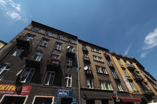
The Schindler’s Enamel Factory is situated in the district of Zabłocie. In recent years the area has been redeveloped and is now a trendy new suburb, full of apartments, coffee shops and restaurants.

The exhibition, although in the Schindler factory, wasn’t about Oskar.  It was all about the German occupation of Krakáu between 1939 and 1945.

The Krakáu Ghetto was established in 1941 in the Podgórze district. This area originally housed 3,000 people but ultimately there were 15,000 crammed into its walled space. From 1942 the Nazis began deporting the Polish Jews to surrounding concentration camps.

In March 1943 the Nazis undertook the final ‘liquidation’ of the Ghetto. Eight thousand, who were deemed able to work, were sent to the Plazów labour camp while 2,000 were killed in the streets of the Ghetto. The remaining survivors were sent to Auschwitz.

The Poles have had it tough and the exhibition was a stark demonstration of that. 

They gained their independence from the Austro Hungarian Empire in 1918. Then in 1939 they lost if again, this time to the German’s. Only to lose it again in 1945, this time to the Russians. 


P7232801

July 23, 2017. Krakáu and Auschwitz – Birkenau, Poland.

We had booked an Auschwitz-Birkenau Full-Day Guided Tour from Krakáu. 

This wasn’t our intended way to see the Nazi concentration and extermination camps but it was the only option available. 

All the tours, for individuals, were booked out weeks in advance. 

It appears that the tour companies buy up all the tickets, so you are forced to use them. 

It took us just over an hour to drive to Auschwitz. 

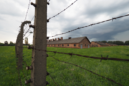
Auschwitz I was the original concentration camp, constructed in 1940  it was primarily to hold Polish political prisoners. Then Auschwitz II – Birkenau went on to become a major site of the Nazis’ Final Solution

Auschwitz II – Birkenau was the largest Nazi German Concentration and Death Camp. 

Between 1942 and 1944 over 1.3 million people were sent to the camp. 

1.1 million people died in Auschwitz, 90% were Jews.

Just as we were about to finish our tour of the death camps the rain came down.

It was a fitting end to a very sobering experience.

Later in the afternoon we went in search of something a bit more uplifting and walked around Krakáu Old Town. This area was listed as a UNESCO World Heritage site in 1978.

We visited the The Cloth Hall, a beautiful late 15th century Renaissance building in the main market square.

We also stopped at the Town Hall Tower (1316), St. Florian’s Gate (1307) and the Barbican Gate (1498).

July 24, 2017. Krakáu to Kazimierz Dolny, Poland.

I worked again in the morning and then we drove to Kazimierz Dolny for a one night stand.

On the road we stopped at Ilźa for a break. This meant finding an ice cream for Thea and a coffee for me. The ice cream wasn’t a problem, as there were at least four places selling them, even though the town was tiny. 

Too tiny for a coffee as it turned out. 

We drove into Kazimierz Dolny and had a walk around the quaint Renaissance town.

That night it rained again.


P7252859

July 25, 2017. Kazimierz Dolny to Warsaw, Poland.

After I worked in the morning we then checked out of the hotel and walked into town. 

Along the way, beside the Vistula River, there’s a sculpture hanging over a wharf. It’s of a tightrope walking young boy with a kite. 

It’s by Jerzy Marian Kędzioraa, a Polish artist, born in 1947. He is famously known as the creator of the ‘Balancing Sculpture’ genre and has installations throughout Poland.

It was Market Day in Kazimierz Dolny. 

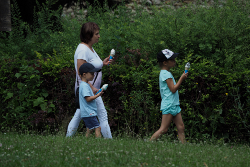
Ice Cream Day as well, as everyone seemed to be licking one. 

Apart from the Parish church and two restored town houses, Under St Nicolas and Under St Christopher, built in1615, there wasn’t much else.

We then continued on to Warsaw.


P7262922

July 26, 2017. Warsaw, Poland.

I worked yet again in the morning and then we walked into the Old Town, which was a lot further away than we thought it would be. From what we read on booking.com, our apartment should have been much closer. Warsaw’s Old Town appears to have grown, a bit like Brighton, and seemed to be a much larger in area than we remembered.

The last time we were in Warsaw was in 2007 and we were staying in the Bristol Hotel which was right next to the Old Town. 

Back then all the roads around the hotel were under repair, now everything was much more ordered. 

It’s not very often that coffee leaves a bad taste in your mouth. 

It did this day in Warsaw, when we found out that we were paying $13 for two double shot espressos. And to add insult to injury the service was non existent and they got grumpy when we didn’t leave a tip.

Warsaw’s Old Town has been almost entirely rebuilt following the Second Word War.

As a reprisal to the Polish resistance of the Nazi invasion, 85% of the city was destroyed. The German’s aim was to obliterate the centuries-old tradition of Polish statehood.

The rebuilding of the city included the reconstruction of the urban plan, which included the Old Market and the surrounding town houses, the city walls and the Royal Castle.

We spent the rest of the afternoon wandering around the city.

We were lucky enough to see the changing of the guard ceremony at the Tomb of the Unknown Soldier. This  took about one minute, compared to the one at Arlington, in Washington DC, that took twenty.

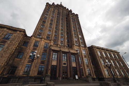
The Palace of Culture and Science is a Soviet era building that dominated the city skyline and we were interested to get a closer look. Built between 1952 and 1955, in the Socialist Realism style, it has become a modern landmark in the Polish capital.

It is the tallest building in Poland and the eighth tallest in the European Union. It is 237 meters high, which includes the 43 meter spire.

It was originally known as the Joseph Stalin Palace. but after ‘Destalinisation’ its name was changed to the rather boring ‘Palace of Culture and Science’

Some less common names include ‘Stalin’s Syringe’ and ‘Stalin’s Dick’.


P7273009

July 27, 2017. Warsaw to Augustów, Poland.

After breakfast in the apartment we walk around the corner and got a coffee. 

12 Zloty (A$4) for both – a far cry from the 37 Zloty (A$13) the day before. And there was service with a smile. 

We then headed to Augustów, which is about 240 kilometres north of Warsaw. 

This is a seaside resort on the Augustów Lakes. 

We had booked another apartment which was in one of three old Soviet apartment blocks. 

It was small, very small, with three rooms and a bathroom. And it was painted in ‘Soviet Green’, like so much of that era. 

Soviet Green is like a Spring green but dulled down. 

After we had checked in we went for a walk into Augustów and then along the Netta River.

We only spent one night at the apartment in Augustów, which was a very Soviet experience, but well worth it.


P7283024

July 28, 2017. Augustów, Poland to Vilnius, via Trakai Castle, Lithuania

I have become very efficient at reverse parking onto footpaths. In a lot of places there is more room there than than on the road.

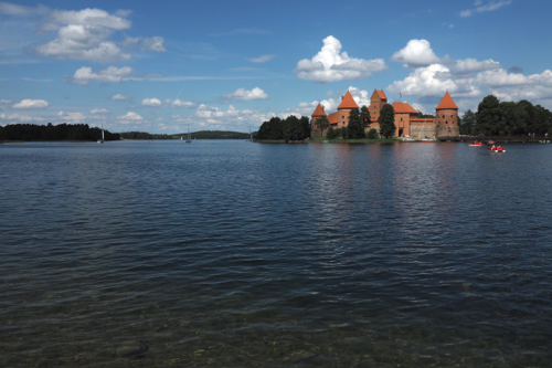
On the way to Vilnius we stopped off at Trakai Island Castle, which is on Lake Galve. 

And so did all the tour busses. 

The stone castle was started by Kęstutis in the 14th century and completed by his son, Vytautas the Great, in 1408.

Over the centuries the castle fell into disrepair and was then partially restored, but it wasn’t until after the Second World War, in 1948, that it was renovated to its current 15th century style.

The castle museum, founded in 1948, holds about 300,000 artefacts. 

There was an entire room dedicated to decorative pipes. 

Trakai is a major tourist attraction and regarded as a true Lithuanian heritage castle.


DSC05087

July 29, 2017. Vilnius, Lithuania.

Our hotel was in a casino, but we were separate from it. 

Except for breakfast. 

This was in one of the casino’s restaurants and we had to be escorted through the casino, past the tables, to get there. Our escort was a big, burly casino security guy. 

In the casino there were people on the tables and at the bar – it was 9:30am. 

A family of three also turned up for breakfast and they were as confused as we were.  

This was Saturday and we were told that breakfast wasn’t available on Sunday. 

Why, we didn’t know, but in a way we were relieved, as we felt uncomfortable being minded by muscle that early in the morning.

We had a long walk around the city and visited Gediminas Castle Tower. The first brick tower was built in 1409 by Gediminas, Grand Duke of Lithuania. The tower is an important part of Lithuanian history and featured on the national currency, the Litas.

Within the tower was a temporary exhibition titled ‘The Baltic Way’.

On August 23rd 1989 more than 2 million Latvians, Lithuanians and Estonians made a living chain from Tompea Castle in Tallin, Estonia to Gediminas Tower in Vilnius, Lithuania. This was in protest of the USSR’s occupation of the Baltic States in 1939. This resulted from the Molotov – Ribbentrop Pact between the Soviets and the Nazis.

After the war the Soviets denied existence of the pact and claimed that the Baltic States joined the USSR voluntarily.

Vilnius is a city to see in the morning, because in the afternoon, everything is back-lit. 

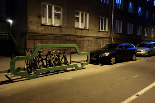
After dinner we discover the Vilnius bike racks. Each rack held ten push bikes and very graphically demonstrated that each rack could take just one car or ten bikes.


P7303128

July 30, 2017. Vilnius, Lithuania to Ludza, Latvia.

It was about 300 kilometres from Vilnius to Ludza in Latvia. 

Given our experiences of the last few days I thought we would be in for a very long trip. 

This wasn’t the case. 

Being a Sunday the roads were very quiet and there were very few trucks and not a lot of of roadworks.

That’s until we got into Latvia. 

The roads were better than Lithuania but that was because they were repairing them. 

It was still a pleasant trip that took about six hours, including stops for coffee and delays due to the roadworks. 

Ludza is the oldest town in Latvia and first mentioned in history in 1173. 

It has a stone built, Livonian Order, crusader castle constructed in 1399. The castle, as usual, is on top of a hill that overlooks the Lielā Ezerkrasta iela (lake)

It is located on the main Riga to Moscow road and only 30 km from the Russian border. 

The town is relatively small so it didn’t take much time to walk around. 

Diner was at the Hotel Ludza, as there weren’t many options in the town. The hotel was a Soviet era building and again there were the green walls that we had seen in our apartment in Augustów.

There was a constant babble in the rooms adjoining the restaurant. As it turned out there was a birthday party in progress. 

I got chatting to a few of the guests when I went outside to take some snaps of the hotel. The group were very Russian in their look and their attitude and were intrigued as to why two Australians could possible end up in Ludza. 


DSC05097

July 31, 2017. Ludza, Latvia to Tartu, Estonia.

It looked like being another longish drive into Estonia, up past the Russian border. 

Surprisingly the roads were free of repair gangs and there was very little traffic. 

There were virtually no trucks as well. 

Which is understandable, as the SatNav took us on a very back-roads route. This did give us some great scenery. Forests, lakes and quaint little villages were our companions for most of the drive. 

Estonia is regarded as one of the most digitally advanced countries in the world. 

Fast free internet is everywhere. 

Our hotel was right next to the Emajögi River and was within an easy walk of the old town square. 

In the afternoon we wandered along the river and into town, then ended up at the botanical gardens. Established in 1803, they are small and built on a hilly site. This made for an interesting and varied landscape, and a good stroll. 


P8013233

August 1, 2017. Tartu, Estonia.

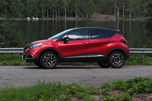
The Captur had done over 4,000 kilometres, so it was due for a wash. 

The roadkill was encrusted onto the front of the poor little Renault. And after the unmade roads of the previous day, it was looking rather shabby. 

The hotel directed to a local hand car wash. 

It was €20 (almost A$30) for a wash only. That’s a lot more than I pay at Clearwater in Brighton. 

Tartu was first mentioned 1030 and is the second largest city in Estonia, next to Tallinn.

Tartu Domed Cathedral has been partly restored and is now used as the University of Tartu History Museum. 

The University buildings have been beautifully restored and there is even an old elevator that still works.

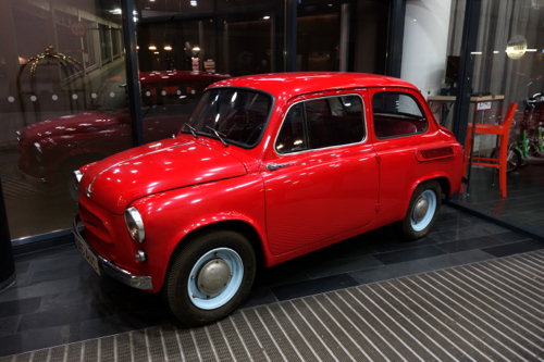
In these eastern block countries there is a constant reminder of their Soviet past. In the foyer of the Hotel Dorpat, was a shiny red, rear engined, Soviet ZAZ-965. Produced in the ZAZ factory in Soviet Ukraine between 1960-1969, they were described as ‘Superminis.’


P8023238

August 2, 2017. Tartu to Vihula, Estonia.

After breakfast at the hotel we went over the road to the Taska Mall to get a coffee. 

Estonia is a very different part of Eastern Europe. The technology, culture, fashion and language all seem to be more Nordic. 

English is very widely spoken, not just in the tourist related establishments but all types of businesses. 

I had a haircut and they spoke English and in the car wash, again, English. 

We had been on the move since we left Berlin and decided to have a few days off in the country. 

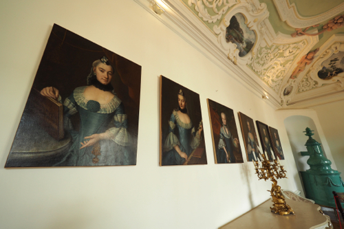
The Vihula Manor Country Club and Spa was in a large old Estonian estate set within the Lahemaa National Park. 

It was spread over acres, with ponds, bridges, walkways and accommodation set within beautifully manicured gardens. 

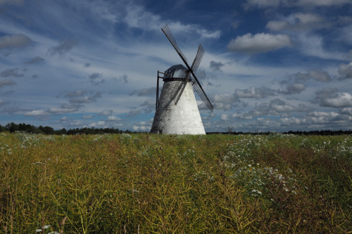
They even have an old Dutch stone windmill at the front gates. 

Visual Vyoll, as it was then known, was first mentioned in history in 1501.

There is nothing left of that era as it was destroyed in the Great Nordic War of 1700 to 1721.

The structures that are there today date from the late 1800s.

During the Russian Revolution the Red Army Guards devastated the manor and then it was nationalised between the wars.

From 1941 to 1944 it was an Intelligence School for the German Abwehr. Then under Soviet rule it became part of the Ubja State Farm and from 1951 to 1980 it was a senior citizens asylum.

The park is set on a coastline that encompasses four peninsulas that jut out into the the Gulf of Finland. 

Lahemaa is one of Europe’s most important forest conservation areas, where many large mammals live. Apparently the area is home to moose, wild boars, brown bears, lynxes and foxes. 

We hope to see them, not meet them. 

Within Vihula Manor there is a car museum, with a small collection from the Soviet era. 

Volga (gAZ-21) 1959, Chaika (1970), Pobeda (1953) and a French Berliet (1927) and German Opel (1936). 


P8033274

August 3, 2017. Vihula, Estonia.

There are two nature trails around Vihula Manor, one is 3 kilometres and the other is 1.5. 

The longer of the two takes you through part of the forest, along the Vihula River and across the hay fields that are within the property. 

The property area of Vihula Manor is large, with the buildings occupying over 8,000 square meters, all set within 50 hectares of parkland.

In the afternoon we drove to the small fishing village of Altja on Vérgi Bay. We then drove further west to the much larger town of Vösu. 

There was a sandy beach and a very strong wind.

Windsurfers and sailboarders were taking advantage of the wind, while the sun bakers were hiding behind the long grass on the foreshore.

There were a couple of brave bathers actually in the Straits of Finland. 

In the evening we decided to go to the ‘swish’ restaurant. 

We were advised to book in advance. 

When we arrived there was only one other table occupied, and by the end of the evening there was only one more. 

At breakfast the place seemed full. So where are they eating?

My guess is, in their rooms. 

We have seen this a lot throughout Eastern Europe. The cities and sites seem busy, but the tourists retreat at the end of the day. 

We often see travellers, loaded down with plastic bags full of groceries, heading into their hotels. 

August 4, 2017. Vihula, Estonia.

We woke to the sound of rain pouring down the drainpipe, just outside our window.

Luckily we did our exploring the previous day, when the weather was fine.

Estonia has a vibrant craft beer industry. I don’t know how much is draught but there is certainly a lot of bottled beer on offer. 

At the Vihula Manor tavern there were 13 bottled craft beers on the bar blackboard. They were from three different breweries, Vihula, the local brew, Ollenaut and Purtse. 

They covered a wide variety of styles, including IPA, American Pale Ale, Pilsner, Brown Ale, Stouts and Porters. 

Over the last few weeks we have seen many storks and their nests. They are usually high up on a man made, purpose built, stork nest platform. 

We wondered why. 

Thea did a bit of digging and came up with a possible answer. 

Superstition. 

Apparently German peasant farmers believed that it was good luck to have a stork nest in your property. So they build places for them to do just that. 

The were originally cart wheels placed on top of chimneys, now they are metal frames on top of a specially erected pole. 

With the migration of Germans to all parts of Eastern Europe, this tradition has been maintained and stork nests are everywhere. They don’t just set up home on the man made locations but also on power poles and very occasionally in the tops of trees. 


DSC05112

August 5, 2017. Vihula to Tallinn, Estonia.

We had our final breakfast at Vihula Manor. It wasn’t as crowded as the previous two days so the staff had a chance to be even more polite than usual. 

Then as we were leaving the hotel it dawned on me. The staff had obviously been trained in the You’re Welcome School of Hospitality. 

Wherever we went in the hotel we were greeted with “Have a nice day” and the phrase, “You’re welcome” was so overused that some of the staff actually said it before they served you. 

The weather has been very erratic over the last few weeks and suddenly it had taken a turn for the worse. 

On the drive from Vihula to Tallinn we were constantly buffeted by brief storms. We would have a few minutes of torrential rain, followed by bright blue sky. Then it would happen all over again a few kilometres down the road. 

The same pattern continued when we arrived in Tallinn. 

Our apartment was close to the old city and crowded with tour groups. 

They blanketed the road and it took me an age to wend my way through the narrow streets and alleys. 

After finding our apartment, we parked the car and went for a walk. 

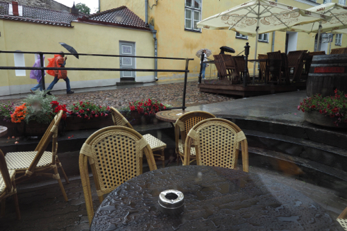
Then the rain started again. 

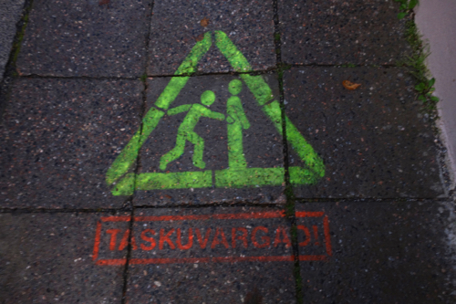
While we were dodging the showers I noticed a graphic stencilled on the pavement. It was warning people about pick-pockets.

Well, Tallinn is a large city and there are lots of tourists.


P8063338

August 6, 2017. Tallinn, Estonia.

In the morning the rain was still pelting down and we were forced to stay inside. 

It persisted, so we made the executive decision to have a long lunch.

After all it was Sunday. 

By mid afternoon the skies were a little clearer so we set out to explore the city. 

Tallinn is the oldest capital in Northern Europe with a history dating back to 1154. 

The Old Town is one of Europe’s best preserved, walled, Medieval cities and a UNESCO World Heritage Site. 

It’s also only 80 kilometres to Helsinki in Finland, as the ferry flies. 

Because of its location Tallinn became an important trading centre from the 14th to the 16th centuries. As a result there are a number of wealthy merchant houses in the Old City. 

Tallinn wears its history proudly with well restored buildings and lots of tourist signs pointing to its colourful past. A large number of the old houses have been turned into museums. In fact there seems to be a museum for just about every topic. 

Just next door to our apartment was the Tallinn Museum of Estonian Drinking Culture. I think it was really a front for a bottle shop and bar. 

Tallinn a very popular destination with Russian tourists, as it’s a lot cheaper than Scandinavia and Western Europe. 

We had got a good feel for Tallinn in the time we were there but weren’t too concerned that we hadn’t done it justice, as we were due to return after visiting Finland. 


Part 2: Eastern Europe – Slovakia. (July 2017)

Sunday, June 10th, 2018

P7081782

July 8, 2017. Brno, Czech Republic to Bratislava, Slovakia.

After breakfast and a coffee with Kate and Mark we parted ways. They still had more touring to do in the Czech Republic and we were heading to Bratislava in Slovakia. 

On the way we stopped in Mikulov, which is very close to the Austrian border. This small town is known for its architecture, with many buildings having Italian features.

Sitting above the town is Mikulov Castle. This reconstruction, built over the site of a 13th century castle, was built between 1719 and 1730 – it dominates the skyline.

Again weddings were everywhere. It was certainly a photogenic town and a great background for wedding snaps. 

This is in the heart of the Moravian wine district and there were hundreds of locals, on push bikes, doing wine tours. 

Just after we crossed into Slovakia we were forced to use the motorway, which was a toll road. 

However just before the toll station there was an office where you could buy an electronic toll pass. 

It was simple, relatively fast and saved all the hassle of having to find change at toll gates. 

In fact there are no toll gates, so you have to have buy a pass. 

We arrived in Bratislava mid afternoon, about the same time as the rain. 

Our accommodation in Bratislava was at the Film Hotel. It was, as you might expect, about all things ‘film’. 

There were human sized Oscars in the reception area, while the walls were covered in black and white photos of film stars, old and new. 

Each room was named after an actor or actress, we were in room 9, Leonardo de Caprio. 

We have been travelling for almost two months and this is our first new country on the itinerary. 


P7091826

July 9, 2017. Bratislava, Slovakia.

Bratislava is the only national capital that borders two sovereign states, Austria and Hungary. 

It sits on the banks of the Danube and Morava Rivers. With a population of just over 450,000 it’s one of Europe’s smallest capital cities.

Bratislava was first mentioned in written history in 903. It became the capital of Slovakia, after the dissolution of Czechoslovakia, in 1993. Then, with the help of foreign investment, the economy took off.

In 2017 Bratislava was ranked as the third richest region in the European Union. It was certainly evident in the art, architecture, lifestyle and the people. 

Street art is everywhere within the city centre. The one that got a lot of attention was a bronze sculpture of a worker emerging from a manhole.

In the afternoon we spent a few hours wandering around Bratislava Castle. This massive fortification stands above the city, overlooking the Danube River, on the Little Carpathians.

It dominates the city and has done so for centuries.

On a clear day you can actually see Austria and get a glimpse of Hungary. It wasn’t a clear day when we visited.

It was progressively built between the 9th and 18th centuries and rebuilt between 1956 and 1964, following a catastrophic fire in 1811.

Because of its location, within the centre of Europe, the site has been inhabited for thousands of years. First by the Celts and Romans and then by successive European dynasties.

The architectural style is a rich mixture of Gothic, Renaissance and Baroque. There is even an English park.

There was a glassware exhibition within the castle, celebrating 125 years of Rona in Bratislava. Rona was established in Ledniké Rovne, Slovakia, in 1892 and is famous for its unleaded drinking glasses. 

Craft beer isn’t just in Germany and the Czech Republic, it’s crossed the border, and is well and truly established in Bratislava, Slovakia.

Over two days we found two craft brewpubs serving excellent craft beers. Both Zil Verne and Klubovña had a selection of imported craft beer, as well as their own brews. 

However I don’t think they were serving their beer in Rona glassware.


P7101919

July 10, 2017. Bratislava, Slovakia.

Bratislava was an interesting city, as was the Film Hotel, so we decided to stay an extra night. 

Rather than moving on we made a day trip clockwise around the Bratislava area. 

The main purpose, and highlight, was a side trip to the Red Stone Castle, which is between Píla and Častá. 

Červený Kameň or Red Stone Castle was originally constructed around 1230 as a border castle between the Bohemian and Hungarian Kingdoms. 

It has been home to many noble families, the last being Pálffy who were there from 1583 to 1945. 

The beautifully crafted ceiling frescos in the living area were a feature. 

Being designed as a fortress, the castle cellars were very impressive. The largest being 70 meters long, 7 meters wide and 9 meters high. The cellars are unique and the largest of their type in Europe, there’s even a 110 meter deep well.

Weather in this area is reliably unpredictable.

One moment there’s a blue sky, with patchy clouds. Then suddenly, all the clouds gang-up on you, and there’s a thunderstorm. After being here for a few days we realised that this is a regular afternoon occurrence. 

No sooner had we arrived back at the Film Hotel than the thunder started to rumble. Which, by now, was to be expected. 

On our last night in Bratislava we found yet another brewpub. Výčap U Ernöho is on a corner, just outside the city gates. 

Just in front of the pub was a small square, which was well used by the pub patrons. They were chilling out in all styles of chairs and there was even a fountain and water spray to help cool the warm evening breeze. 

They do know how to relax and they don’t have to pay a fortune for it. 

A round of drinks (a large beer and wine) was €4.20 (A$6.50). We would be paying $20 in Hobsons. 


P7111984

July 11, 2017. Bratislava to Čičmany, Slovakia.

We made one stop on our way out of Bratislava and that was to see the Church of St Elizabeth. 

Built in the Hungarian Art Nouveau style between, 1909 and 1913, this church is number six on the top ten sites of the city. 

And it’s blue – very blue. 

The exterior is covered in mosaics, much of them glass. 

The vast majority of the drive to Čičmany was on a motorway. Then we got into the ‘slow-fast’ driving of the country roads. Slow through the villages, where the speed limit is 50 km/h and then a little faster through the countryside in between. 

There were lots of villages so the going was slow, then occasionally fast. 

We reached Čičmany in the early afternoon and were able to check into the hotel. 

It was then off to explore the village. 

Čičmany dates back to 1272 and is famous for its painted wooden houses. Which are much younger.

The houses date from the early part of the 20th century. The white motives painted on the black walls are inspired by the local embroidery. 

Off to the side of the village, behind a group of trees, sits the the Baroque Church of the Elevation of the Holy Cross.  

It didn’t take us long to explore Čičmany so we were glad we had only booked one night. 

Our accommodation was at the Kaštieľ Čičmany. This was a traditional old house that had been completely renovated. It retained the old exterior but the inside had been made contemporary. 

And all the furnishings came from Ikea, which was a refreshing change from all the ‘old world charm’ we had been experiencing. 

The little village is surrounded by ski runs. So when it’s not hosting tourists in the summer, it’s full of skiers in the winter. 

Not much is in English in Čičmany, so it is really catering to the local tourist trade. 

It was obviously low season there as most places, that were open, shut early. 

We found an ‘interesting’ local bar and restaurant down the road from our hotel. Come 9pm we were the only ones left in the place. 


P7122005

July 12, 2017. Čičmany to Banská Štiavnica, Slovakia.

On the way we stopped stopped at Bojnice Castle. This was first mentioned in history in 1013, when it was originally a wooden fort.

The most famous owner of the castle was János Ferenc Pálffy (1829-1908). He was a man who loved art, more than anything else. After a failed love affair he devoted his time, energy and money to the castle. He was one of the greatest collectors of antiques, tapestries, drawings, paintings and sculpture of his time.

The last independent owner was Ján Bata of Bata Shoes.

Ironically the Bata family were never mentioned in our guided tour. Which is surprising as the Bata Shoe story is a very interesting one. Maybe not the noblest of families but certainly one of the most industrious.

Founded over 122 years ago in the Czech Republic by Tomáš Bata, Bata Shoes have over 5,200 retail stores in more that 70 countries with production facilities in 18.

The family were originally cobblers, and to overcome a serious debt developed a new style of shoe made out of canvas.

They were one of the first shoe companies in Europe to industrialise, by installing steam-driven machines. They later introduced mass production techniques from America.

The Bata’s were the Henry Ford of shoes.

They received military orders during World War 1 but they fell into decline during the depression years that followed.

Rather than put off staff, the company reduced the price of their shoes and put their staff on a reduced salary. They also provided subsidies for their food and clothing.

They then gave their staff share options in the company, giving them added incentive to work hard and remain loyal.

This radical approach saw Bata Shoes actually increase market share during the depression and helped them to survive.

Many others went under.

The Family may not have collected art or built magnificent castles but they were certainly a family of great resolve and ingenuity.

Just as many Slovakian are early to bed, they are also late to rise. Well if our hotels in Čičmany and Banská Štiavnica were anything to go by. 

The one in Čičmany didn’t start breakfast until 9am, while the Hotel Salamander, in Banská Štiavnica, didn’t start till 8am – how very civilised. 

The Slovakian national summer pastime is eating ice cream. Everyone does it and they seem to do it with great regularity. I was so impressed with their ice-cream eating that I devoted an entire post to it.

Parking is always an issue in Europe but when you get into the small towns it gets worse. 

In Banská Štiavnica we were staying in the Hotel Salamander.

They boasted parking. 

When we arrived all but one of the five spots were taken. Apparently that was ours and it was partially on the street. So if any of the four cars in front of us needed to move, we would have to move, in order to let them out. 

The solution was simple – just leave your keys at reception.


P7132119

July 13, 2017. Banská Štiavnica, Slovakia.

We took the ‘Tourist Train’ around Banská Štiavnica. Unfortunately the commentary wasn’t in English as English speaking tourists don’t seem to have discovered this part of Europe. In fact most of the travellers seem to be either local or from bordering countries, such as Hungary, Poland, Austria and the Czech Republic.

Banská Štiavnica is a UNESCO World Heritage Site that’s built in a caldera.

It was first mentioned in history in 1157 and has been the centre of mining, especially during the Hapsburg Monarchy of the 18th century.

The oldest mining school in the Hungarian Kingdom was set up there in 1735 and in 1846 it joined with the Forest Academy which was founded in 1808. University and college buildings are dotted all over the city.

With its many attractions and relatively few tourists this area of Slovenia might just become a new ‘Hot Spot’ destination.

The Calvary of Banská Štiavnica was built in 1774, on the plug of the extinct volcano, which is in the centre of the caldera. It was under renovation, but its 23 monuments are worth the walk from town and the climb to get to the top.

The New Castle and the Old Castle are also worth a visit. The New castle has an interesting exhibition of Turkish artefacts and documents the history of the war with the Ottoman Empire. 

It was built as a defence against Turkish invasion. 

In the evening we found yet another brewpub, ERB. Edward Rada Breweries brew on the premises and also in an old synagogue, that’s just over the road. 

The Synagogue was built in 1893 and was used as a place of worship until 1941.

It has been used for a number of business over the years, such as a sheet metal workshop and a driving school.

It has been a National Heritage site since 1955.


DSC05077

July 14, 2017. Banská Štiavnica to Košice, Slovakia.

This was the longest drive we had done for a few days. 

And made even longer by us going down a new motorway, the wrong way, for quite a few kilometres.

The motorway was in the middle of nowhere and there were no turn-offs.

Arriving in Košice and finding our hotel wasn’t without its difficulties. The usual road works and one way streets hindered our way. 

This is always going to be an issue when we chose hotels in the centre of the old town, which is usually pedestrian only streets.

The Hotel Zlaty Dukat is in one of the oldest buildings in Košice and built over the foundations of the old city wall. There is a staircase that descends to the basement, where there is a small wine bar built among the ruins. 

After checking in we spent an hour or so just wandering. 

Košice is the second largest city in Slovakia. The old town is concentrated along Hlavná (Street). This is a long walking area that’s dominated by St Elisabeth Cathedral, one of the largest Gothic churches in Europe. 

There is a green area between the two walking streets. This is occupied with parents and children playing, two fountains, a glockenspiel and wedding photographers with their victims.

Restaurants line both sides but it’s hard to find one where people are eating an evening meal. 

Most main meals seem to be taken at lunchtime, with pizza and cake being the staple in the summer twilight. 

Maybe we should consider lunch as an option. 

Košice was originally mentioned in history in the year 1230 and was the first settlement in Europe to be granted its own coat-of-arms in 1369.


P7152214

July 15, 2017. Košice, Slovakia.

After a bit of housekeeping, AKA ‘washing’, we headed back into the old town. 

The weather had threatened to be horrible but then turned out to be fine. Which meant the light was in the right position for most of the historic buildings. 

We paid the ridiculously low price of €1, that was for both of us, and ventured below, into the old city fortifications. 

They were from the 13th, 14th, 15th and 16th centuries, and 3 metres below the current city streets. Where we entered was the site of the original Lower or Southern Gate. 

Later in the afternoon we climbed to the top of St Elisabeth’s Cathedral Tower to get a better view of the city.

The city sprawls off in all directions from the old section. Out in the ‘burbs the architecture was very 70s, Soviet high rise and not very interesting.

It did start to rain late in the afternoon but by that time we had seen all there was to see in Košice.


P7162269

July 16, 2017. Košice to Viničky, Slovakia. (With a side trip into Hungary)

It was a day of ups and downs – literally. 

The drive from Košice to Viničky was very short so we arrive very early and then headed out to explore the Tokaj wine region. We were at the very top of the wine trail as most of the region is in Hungary.

We managed, even at an early hour, to check into Pension Zlatá Putňa, so we had most of the day left to explore.

Most of the vineyards are tiny plots of land huddled around small villages. 

There are the large commercial wineries but these are outnumbered by the small ones.

Out first stop was at the Tokaj Viewing Platform – our first up for the day.

The platform has been developed, with the help of some Swiss Francs, as a tourist attraction.

It’s 12 meters high and shaped like a wine barrel. It is certainly an interesting piece of architecture and was awarded so in 2015.

We then decided to make a side trip into Hungary. From the viewing platform we had sighted a cable car, and having nothing better to do, decided to try and find it.

One problem was that Hungary doesn’t use Euros, they have the Forint.

We managed to purchase tickets with our Visa card on the Nagas-hegyi Chair Lift and had our second up and down for the day.

We were in the Sátoraljaújhely area, which is an adventure playground for the locals, and they were there in their hundreds.

Apart from the chair lift there was a zip-line, cable car, stock car track and a strange style of toboggan run that was on rails.

We seemed to have been driving for kilometres but when we reached the top of the chair lift we could see Viničky, our village.

It was only about 8 kilometres away.

On our way back we stopped in Borsi to look at the castle. There wasn’t really much to see, as it was only a shell.

It seems its only claim to fame was that Ferenc Rákóczi II was born and lived there. Born in 1676 Ferenc Rákóczi is regarded as the hero of Hungary, leading the Hungarian uprising against the Hapsburgs between 1703 and 1711.

Our hotel was on the main road in Viničky and there wasn’t much else in the town.

Luckily the hotel had a restaurant. 

We seemed to be the only people staying in the Penzión Zlatá Putňa but there were certainly a number of drop-ins, all local. 

Thea had made enquiries about where we could have a local wine tasting. 

The receptionist arranged for the chef to do a tasting with dinner, which all sounded very swish. 

However it didn’t eventuate – apparently he was too busy. 


P7172374

July 17, 2017. Viničky to Prešov, Slovakia.

The next morning we didn’t seem to be expected for breakfast but it all happened, despite the confusion. 

We were also told, by some guy we had never seen before, but seemed to carry some weight, that we could go into town and have a wine tastings there.

Apparently the family owned a cellar in Viničky and his uncle, Attila, would show us around. 

It all seemed rather loose. 

After breakfast we headed into Viničky for our cellar tour and tasting. 

When we arrived at Zlatý Strapec, the wine cellar, nothing was open. After trying various doors, two women emerged from the adjoining building.

There seemed to be confusion as to why we were there. 

We had a taste of the wine we had the previous night and we decided to buy two 500 ml bottles. 

What else were we to do. We then headed back to our car. 

Suddenly a guy turns up and tells us to come with him, to do the cellar tour. This turned out to be Attila, the uncle of they guy at the hotel. 

Attila’s English was a little better than our Slovakian but he managed to communicate very well – especially with the help of Google Translate. 

After our very weird but confusing cellar tour we went to the Zemplinska Śirava or Slovak Sea, as it is sometimes called. The reservoir dam was built between 1961 and 1965 and covers an area of 33 square kilometres.

This is a recreational area and there was a café, resort and a sandy beach. There were also a number of rather impressive sand sculptures just near the beach.

When we arrived in Prešov the hotel felt empty, in fact the entire town seemed to be empty. We were starting to wonder if the tourist season hasn’t even started yet.


P7182399

July 18, 2017. Prešov to Poprad, via Spiš Castle and Spišsja Kaputula, Slovakia.

At breakfast there was only one other table – the hotel, like the town, was empty. 

We were getting the feeling that the tourist season hadn’t really started yet in Eastern Slovakia. 

When we got to Spiš Castle we found out where all the tourists were. 

The place was overrun. 

The car park was full and the overflow was lining the steep road leading up to the castle. 

And when we purchased our entry tickets we were told that they had run out of Audio Guides. 

Spiš Castle along with Calvery at Spišsja Kaputula are UNESCO World Heritage sites.

It is one of the largest castle sites in Europe with an area of 41,426 square metres.

This Medieval Castle was first mentioned in history in 1249 and then destroyed by fire in 1780.

From that point forward it fell into ruin.

There isn’t much left today, although there was an attempt at a partial reconstruction before 1993.

There are still remains left of those works that were done just after the break up of the Soviet Union.

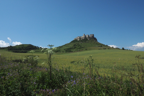
The best views of the castle are from below, looking up. However it does have a small museum and chapel in the reconstructed castle tower.

We arrived at Poprad, at the foot of the High Tatra Mountains, at 3:30pm. 

The weather was being its usual cantankerous self and the dark clouds were building. 


P7192494

July 19, 2017. Poprad-Spišská, with a side trip to Dobšinská Ice Caves, Slovakia.

The main destination for the day was to the Dobšinská Ice Caves, which was 33 kilometres south of Poprad.

We again discovered where all the tourists were – they visit castles and caves.

At the ice caves we had to pay for everything. Parking was €3, the tickets were €7 (with seniors discount) and the toilets €0.50. 

However the most outrageous cost was €10 to take photos.

This UNESCO World Heritage site is part of the Caves of the Aggtelek Karst and Slovak Karst site.

They were discovered in 1850 by Eugen Ruffinyi, a mining engineer. Although they have been known by shepherds and hunters since time immemorial.

They were known as Studená Diera or Cold Hole.

They are regarded as one of the most important cave systems in the world and have been in existence for an estimated 250,000 years.

Once you have parked your car, and paid the fee, there’s about a 20 minute hike up to the entrance. The temperature was in the mid 20s for the climb up, but plummeted to zero once we got inside the caves. It certainly was a cold hole.

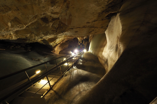
There was no English speaking guided tour so we joined in on the end of a Slovak one. We didn’t understand a word, which gave me the opportunity to hang back and take photos. At €10 each we decided to buy only one ticket to take snaps.

Apparently there has to be a minimum of 30 people to have a specific language guided tour.

Thea and I were the only English speakers, so we didn’t count as a group.

The caves are only open four and a half months of the year from May 15 to September 30. So I guess they have to make their money while they can.

The rest of the day was spent driving through the mountains.

By mistake, or good fortune, we ended up staying in Poprad-Spišská, not Poprad. 

This was about 1.5 kilometres away from the downtown area of the main city. 

It was built around a long, tree lined, square. There was a church at one end and old historic homes on either side. 

There was also a surprising number of restaurants in this small area. 

We booked three nights in the Boutique Hotel Fortuna and this gave us the opportunity to do two day trips. 

One to the Dobšinská Ice Caves and another to the High Tatras. 


P7202599

July 20, 2017. Poprad-Spišská, with a trip to the High Tatra Mountains, Slovakia.

We initially headed to Vysoké Tatry for our Hight Tatra experience but it was far too crowded and the parking scalpers were everywhere. 

We then drove down the road to Tatranká Lominica, where parking was free and the cable cars and chair lifts were open. We went as far up Mt Ve’ká Lomnická veža as we could, which was about 2,200 metres. 

We would have liked to go to Lomnickŷ Štit, which is at 2,558 metres, but that cable car was completely booked out. 

It was crowded but a very pleasant climb along the ridge that runs from the end of the chair lift. 

After our walking in the mountains, we went driving in them as well. 

First to Štrbské Pleso, then to Tatranká Štrba and finally back to Poprad-Spišská. 

It was a very pleasant day in the fresh air, without a church in sight. 

Part 1: Eastern Europe – The Czech Republic.
(June/July 2017)

Monday, May 28th, 2018

P6291228

June 29, 2017. Kreuzwertheim, Germany to Pilsen, Czech Republic.

The windscreen wipers on the Opel Mokka didn’t stop for the entire trip from Kreuzwertheim in Germany to Pilsen in the Czech Republic. The first stop on our adventure to Eastern Europe.

The hold-ups, due to roadworks, were almost as relentless as the rain along the 340 km route. 

In the late afternoon we walked around Pilsen, the birthplace of Pilsner Urquell, the Czech Republic’s  distinctive, bottom-fermented lager. It’s regarded as one of the best beers in the world and having it in it’s unfiltered form, they might be right.  

Dinner was at U Salzmannū, established in 1637, it’s the world’s oldest Pilsen Beer House. 

Not to be outdone by the beer, the wine we had at dinner came from the Habánské Vineyard, Morava, which was established in 1614. 

Prices were also from another era. Our dinner at U Salzmannū only cost us A$45. I’ve not had a meal that cheap since the 80s’. 


P6301315

June 30, 2017. Pilsen, Czech Republic.

Pilsen, apart from beer, has a long history dating back to 1295 when it was established by ‘Good’ King Wenceslas II. 

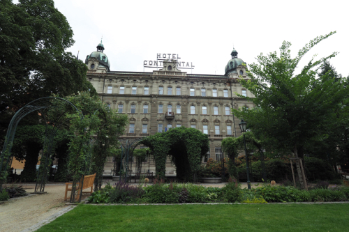
Our hotel, the Continental, was metres from the main town square, so everything was accessible. 

School had recessed for the Summer and kids were everywhere. There was even a small fun-fair in the square. 

We had lunch at Švejk, a chain of Czech restaurants. 

The character featured on the restaurant livery is inspired by an unfinished, dark and satirical comedy (The Good Soldier Švejk) by Jaroslav Hašek. In the 1920s the character was carved, as a puppet, by Gustav Nosek, manipulated by Ludva Novák, voiced by Josef Skupa and performed in the puppet theatre of Pilsen. 

Now this weird, distorted face is everywhere in the restaurant. 

Menus, signage, crockery, even the base of the chairs features Švejk. 

In the afternoon we visited the Puppet Museum, which is at one end of the town square. 

Puppets, like ventriloquist dolls, are to my mind spooky, out-of-this-world beings. 

The Puppet Museum in Pilsen contains hundreds of them.

They ranged in size from miniature decorations, for your beer stein, to larger than life giants of the small stage. 

In the evening, after the children had gone home, the big kids came out to play. 

There must have been a football match on somewhere locally or on TV. 

The police were patrolling the streets as were the young men in their sports cars. 

The vehicles ranged from old Mustangs to new Mercedes, with a lot of ‘try-hards’ in between. 

Apart from the famous Pilsner Urquell and Gambrinus Breweries, there are at least four craft breweries in the Pilsen area. 

Unfortunately you have to go to them to have a tasting and we just didn’t have enough time.


P7011319

July 1, 2017. Pilsen to Český Krumlov, Czech Republic.

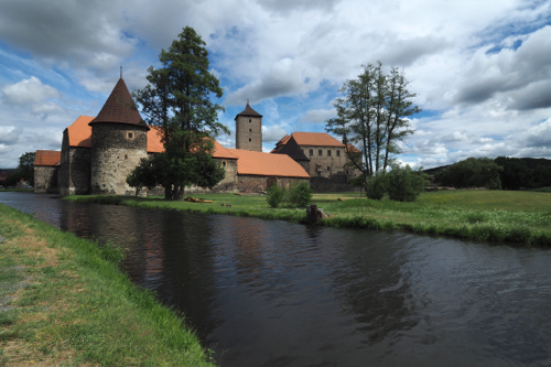
On the drive to Český Krumlov we made a stop at Švihov Castle. A crumbling edifice with a moat on two sides.

This Medieval castle was built between 1480 and 1510 and was the seat of the Lords of Rýžemberk.

Our next stop was at Klatovy. We arrived around midday and the wedding parties were lined up at the town hall waiting to be ‘processed’. 

The weddings were preceded by a procession of cars, honking their horns as they drove around the town square before stopping at the registry office. 

One couple even did a circuit, in a large blue Mercedes Benz prime mover, after their ceremony. 

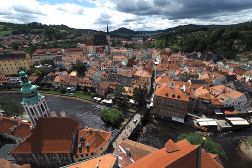
We arrived in Český Krumlov mid afternoon, on Saturday, and finding our accommodation wasn’t without its difficulties. The centre of town was predominantly a pedestrian area, so we had to negotiate the crowds of tourists, winding unmarked streets and the fact that our Pension didn’t have any signage. 

Český Krumlov is built on several bends of the Vltava River, making it difficult to get your bearings. 

It is certainly popular with tourists, both local and international. 

Many of the international visitors vanished in the evening as they had only been in the town on a day trip from Prague, Vienna or Salzburg. 


P7021356

July 2, 2017. Český Krumlov, Czech Republic.

Český Krumlo is regarded as one of the most beautiful historic towns in Europe.

The settlement was built below the castle which was erected around 1240. The Castle was first mentioned in history as Chrumbenowe in 1253. This means ‘Crooked meadow’ in Middle High German, after a bend in the Vltava River. 

Český Krumlov was made a UNESCO World Heritage site in 1992 and is best known for the castle. The castle has Gothic, Renaissance and Baroque elements and literally towers over the township.

We visited the Castle Museum, which chronicled the daily life of the the families that lived in the castle. 

One interesting fact was that the lady of the house had complete control of its running. She even attended a school to learn how to cope with the very demanding task of its day-to-day management.

A far cry from the British aristocracy. 

Another surprising fact was that some noble families were given the right to mint their own coins. Many of these were on display. These became the common means of payment from the 15th to the 18th centuries

The Rosenbergs, Eggenbergs and Scwarzenbergs, of Český Krumlov, had that privilege. 

We had dinner at Two Mary’s, a traditional Bohemian restaurant. There were lots of grains, millet and potatoes. It was certainly one of the most interesting meals we have had – so far. 

We then had a night cap at Hospoda Na Louži Hotel, a very local local. This Renaissance building first popped up in the history books in 1459.

The patrons were singing, but not much better than Thea and me. However they were incredibly enthusiastic and everyone had song books, plus they all knew the words. 

It was a great atmosphere, a lot like you used to find in English working class pubs of the 1970s’.

Much to my delight the walls were covered with old tin advertising posters from the 40s and 50s. 

July 3, 2017. Český Krumlov to Kutná Hora, Czech Republic.

We broke the journey to Kutná Hora with a stop in Telč, another UNESCO World Heritage Site. 

The town was built around a group of small lakes and originally inhabited in the 13th century. 

It’s main attraction is the huge, Zachariáš of Hradec Town Square.

It is surrounded by heavily decorated Renaissance buildings, painted in pastel colours. 

Despite its grand romantic history there is even a Švejk restaurant just off the square. 

The man is omnipotent. 

We had about a 45 minute hold up on route. It turned to be nothing more than a set of traffic lights. 

In the evening we had a walk around town of Kutná Hora, and then gravitated to the main square for dinner. 

There were many nationalities there but one guy stood out – he had a baseball cap on. 

Yes, he was American. 

Ten minutes later a group of five arrived at the restaurant. Two of the women were seriously obese. 

Yes, they were Americans.


P7041547

July 4, 2017. Kutná Hora, Czech Republic.

This is the day that we were ‘reliably informed’, we should get our Renault Eurodrive vehicle. 

That didn’t happen. 

A driver was sent from Paris to Frankfurt, on the train, to pick up our car and drive it to us. 

When he got to Frankfurt he found that the number plates still hadn’t arrived, so he had to return to Paris, again on the train. 

We were then told that we would get the car the next day in Olomouc. 

Considering the distance between Frankfurt and Olomouc is approximately 750km and he wasn’t leaving Frankfurt until 2pm, we weren’t holding our breath. 

Kutná Hora is described as the ‘Town of Two Cathedrals’. 

The Cathedral of Assumption of Our Lady and Saint John the Baptist at Sedlec, founded in 1142 and the Cathedral of Saint Barbara are both UNESCO World Heritage Sites. 

Saint Barbara Cathedral was a fine example Late Gothic architecture, with magnificent flying buttresses supporting a lofty interior, 30m high. Construction started in 1388 but wasn’t finally completed until 1905. 

Construction was interrupted for 60 years by the Hussite Wars. However the main hinderance to the building program, and its final size, was the wavering prosperity of the town’s silver mines.

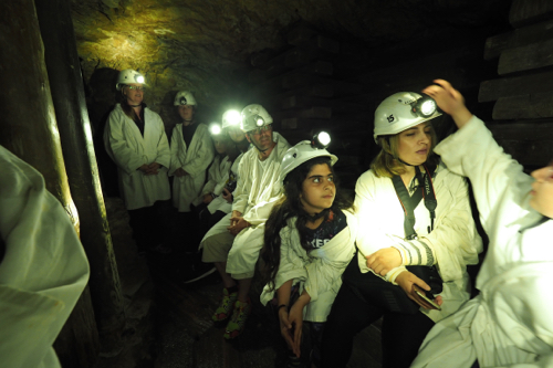
As mining was such an important part of Kutná Hora we visited the Saint George Mine at the Hrádek Museum. This was an excellent display showing construction and renovation from 1388 to present day. 

Silver mining in Kutná Hora took place between the 13th and 16th centuries. It’s primary purpose was to mint silver and copper coins. Within that time 2,500 tonnes of silver and 20,000 tonnes of copper were extracted from the mine. 

After dinner at a local restaurant, that specialised in Bohemian cuisine, we walk down to the cathedral viewing point. This overlooks the Vrchlice River valley. 

Both Saint Barbara Cathedral and the Jesuit College were illuminated and stood out magnificently against the stormy night sky. 


P7051603

July 5, 2017. Kutná Hora to Olomouc, Czech Republic.

We had purchased a combined ticket to see the three main UNESCO sites in Kutná Hora, so on our way to Olomouc we visited the other two. 

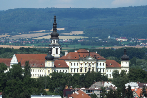
The Cathedral of Assumption of Our Lady and Saint John the Baptist and the Cemetery Church of All Saints with the Ossuary. 

Built in 1142, this is the site of first Cistercian abbey in Czechoslovakia. 

The Scwarzenbergs, who had a lot of influence in Český Krumlov Castle, also played a big part in the restoration and expansion of the Cathedral of Assumption of Our Lady and Saint John the Baptist. 

Our next stop was the Cemetery Church of All Saints with the Ossuary is also known as the ‘The Bone Church’

Skeletal remains hang from the walls and ceiling as well as in the chapel niches. 

It was not surprising, given the macabre nature of the place, that it was far more crowded than the cathedral, just up the road.

There is even a skull and crossbones adorning the church spire.

The church was built in the 14th century and legend has it that a local abbot brought in soil from Jerusalem and by scattering around the cemetery made the place a ‘holy field’.

After the plague of 1318 around 30,000 bodies were buried there and a further 10,000 were also interned as a result of the Hussite wars.

In the 15th century the bones were exhumed and placed inside the church.

The current bone arrangements dates from 1870 and done by a Czech woodcarver, Franttišek Rint.

I had complete forgotten about paying to use the toilet, until we got into the Czech Republic.

I guess 30 cents is a small price to pay for a clean, well maintained, WC. 

And, unlike the USA, there are plenty of them. 

I would have thought that the idea of a ‘Washroom’ that you pay for would appeal to the American ideal of enterprise. 

Our travels took us from Bohemia to Olomouc in Moravia and again we found a restaurant serving the local cuisine.

We were hoping to sit outside on Moravská’s heated terrace, but that was full.

It was excellent food and great service and we found ourselves the last to leave – again.

People do seem to eat early.

When we left the streets were deserted, which was strange considering it was a public holiday.


P7061689

July 6, 2017. Olomouc, Czech Republic.

Again we were told that the Renault would be arriving. 

We were a little more hopeful as this information was coming from the driver, who was on the road from Frankfurt.

We were still in the Czech Republic and staying in the centre of Olomouc an old, historic town.

There was a lot to see but until we had the car we didn’t want to move too far from the hotel.

At 12:30 pm the Renault finally arrived.

It was only then, when we were doing the handover of the Opel Mokka, that we discovered it didn’t have a spare wheel.

We wished Jeanne good luck as he started the long drive back to Frankfurt.

We just hoped that he didn’t get a flat tyre. 

Now that we had our hands on the Renault we went about exploring Olomouc – on foot. 

The town was a work in progress, with construction and road closures at almost every turn. 

We found this out when we arrived

It is believed that Olomouc was originally built over a Roman fort from the late 2nd century.

The city is known for its six Baroque fountains, many featuring gods from Greek mythology, and its columns. The most important is the 35 meters high Holy Trinity Column, which is a UNESCO site and situated in the largest town square, Horní Námēstí.

Unlike other European cities, who removed their fountains after building water supply piping, Olomouc kept theirs as reservoirs in case of fire.

Tipping in the Czech Republic is a strange system. 

The locals don’t tip. But the tourists can be tricked into giving a tip by those waiters that understand the silly US system. 

If you speak English, you must be an American, seems to be the approach.

I really liked the unfiltered Pilsner Urquell Pilsen but the Chomout Pivo in Olomouc was better.

Chomout, a family run craft brewery, was started in 2014 and has a brewpub right next door to the brewery. There are always six beers on tap, Destíka, Pale larger, Ležál Amber Larger, two American style ales and two seasonal beers.

I had the Režná Bára, a full bodied IPA made from American hops. This beer had recently been voted as the best IPA in the Czech Republic.

I agreed with the judges.


DSC05058

July 7, 2017. Olomouc to Brno, Czech Republic.

It was meant to be a short drive to Brno to catch up with Kate and Mark for a night. 

Due to interminable road works it turned out to be longer than anticipated. 

The rather round about way gave me an opportunity to ‘test drive’ the Renault. 

It was lunchtime when we reached Brno, so after a coffee for me and a quick bite for the others we set out to explore the town.

There’s the castle and cathedral but not a huge amount more, so we managed to do a superficial tour in a few hours. 

Kate and Mark had booked a restaurant for dinner and also found a couple of brewpubs for a pre dinner beer, and a wine of course. Nejepši Pub v ČR was a trendy bar with great beer and wine.

After all Moravia is the heart of the Czech wine growing region. 

To my mind the Nejepši Pub v ČR had one of the great brewpub logos. A guy with a beer baby belly and a graphic of a foaming pint mug superimposed over the top.


A brief stay in Germany before heading east.
(June 2017)

Sunday, May 13th, 2018

June 24, 2017. Berlin, Germany.

Arriving in Zurich we had 20 minutes to make our connection to Berlin. 

This involved a change of terminal. We made it with a few minutes to spare, but then had to wait an hour, as there was a discrepancy in the passenger list. 

It was a Saturday so Hayden and Andrea picked us up from the airport and took us back to their apartment. We immediately went round the corner for a coffee, which was served to us by an Australian. 

In the afternoon we went for a walk in Volkspark Friedrichshain. There were hundreds of Berliners enjoying the large green spaces. There are two ‘hills’ in the park that were once bunkers but are now covered in trees and vegetation. 

These are the only relief from what is a rather flat landscape in the Berlin area. 

Volkspark Friedrichshain is the oldest park in Berlin and at 52 hectares, the fourth largest. The oldest parts of the park were planted between 1846 and 1848, over the site a former vineyard.

After the Second World War the park was in the Soviet Sector.


P6251176

June 25, 2017. Berlin, Germany.

On our first ‘awake’ day in Berlin we did the touristy thing and went on a ‘Berlin from Below’ tour. 

This one was ‘Subways and Bunkers in the Cold War’. There are five tours that explore the city from a subterranean perspective. 

This was the story of how the Western Berliners used old subway tunnels from the 30s’ and new ones from the 80s’ to developed a series of civil defence shelters.

This was the time of the Cold War and both the East and the West were on high alert. They were ever mindful that a nuclear holocaust was just around the corner.

The underlying theme, of the presentation, was a sceptical one. Sceptical in that all the money that was spent on these precautions was really just part of a placebo effect.

It may have made the people of Berlin feel safe, but in effect it was useless.

Only 1% of the inhabitants could be housed in these bunkers. Compare this to the Swiss system of civil defence, where 120% of their population could be saved.

Unfortunately no photos were allowed on the tour – I wonder if there is thought of using these bunkers again.

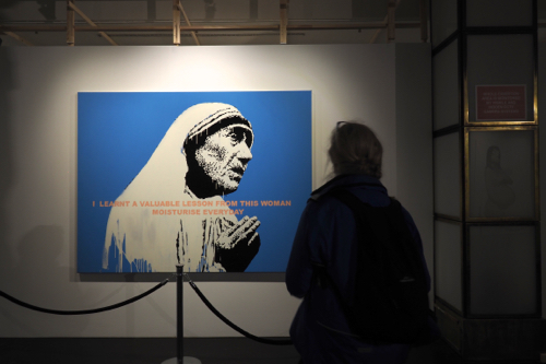
In the afternoon we went to ‘The Art of Banksy’ exhibition.

This exhibition of Banksy’s work was totally unauthorised, created by his former agent, Steve Lazarides.

They have been estranged for over eight years.

Lazarides didn’t believe that he needed to get permission from the famous street artist, because he knew he wouldn’t get it anyway.

None of the work is ‘off the street’ but rather a collection of work that Banksy made for sale. Lazarides was more than likely the agent who sold the work in the first place.

There was a wide variety of work from screen printing, test images, oil paintings and even sculpture.

The exhibition has already been shown in a number of cities, including Melbourne.

It was not without controversy there, as it was ‘visually attacked’ by Melbourne street artist, Matt ‘Adnate’, two days before the opening.

Rats have always featured in Banksy’s work. When asked by Timeout Magazine in 2010, about his fascination with the rodents, he gave this typically self effacing answer:

“They exist without permission. They are hated, hunted and persecuted. They live in quiet desperation amongst the filth. And yet they are capable of bringing entire civilisations to their knees. If you are dirty, insignificant and unloved, then rats are the ultimate role model. I’d been painting rats for three years before someone said: ‘That’s clever it’s an anagram of art’. And I had to pretend I’d known that all along.”

The irony is, that there is a gift shop at the end of the exhibition. 

This goes against everything Banksy stands for. 

Late in the day we had a coffee at Oslo Coffee Bar, which is just around the corner from where Hayden works. The coffee is great but what stands out at this cafe is their re-usable, dishwasher safe, coffee cups made from recycled coffee beans.

Created by the product designer Julian Lechner, these unique coffee cups took three years to develop. They were first launched in 2015 and are made from Kaffeeform. This is an entirely new material, that recycles coffee grounds, combines them with a renewable raw material, which is then moulded into espresso, cappuccino and take-away coffee cups.

(To find out more visit: kaffeeform.com)


P6261207

June 26, 2017. Berlin, Germany.

It was another day devoted to exploring more of Berlin.

Our first stop was at the site of the Führerbunker (Hitler’s Bunker). There is nothing there except a car park. It is certainly not a memorial and everything is done to play down its significance. 

The Führerbunker was an air-raid shelter near the Reich Chancellery. Built in two stages, 1936 and 1944, it was designed by Albert Spier and Karl Piepenburg.

Hitler spent the last few weeks of the war here, marrying Evan Braun, shortly before they both committed suicide.

Then, on a more sobering note we visited the Memorial to the Murdered Jews of Europe, which is also known as the Holocaust Memorial.

Inaugurated in 2005, it was designed by architect Peter Eisenman and engineered by Buro Happold. The 19,000 square metre site is covered with 2,711 grey concrete slabs or stelae. 

There is believed to be no exact interpretation of the design but I felt the stelae had an erie resemblance to coffins.

It certainly makes you think and it is to be hoped that this thinking and reflection will continue in Germany for an eternity.

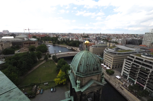
We walked from the Jewish Memorial down to the Berlin Cathedral or Evangelical Supreme Parish and Collegiate Church in Berlin. 

There has been a church on the site since 1608. The current cathedral was built between 1894 and 1905 during the reign of Kaiser Wilhelm II. It was designed by Julius Raschdorff in the High Renaissance style. 

It was extensively damaged during World War II and rebuilt between 1975 and 1993, when it was rededicated. The restoration work wasn’t finally completed until 2002. 

To my mind the Berliner Dom is yet another opulent church that’s had far too much money spent on glorifying clergy and monarchs, rather than helping the people of the parish. 


P6271220

June 27, 2017. Berlin, Germany.

There is so much recent history in Berlin – WWII and the rise of the Nazi state, the ‘Final Solution’ resulting in the Holocaust and the DDR rule of Berlin’s Eastern Sector.

We had decided to cover a bit of it all.

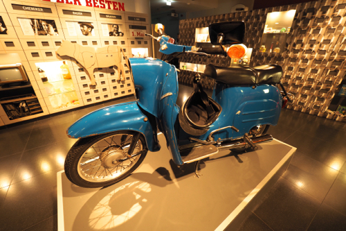
The  DDR Museum is located on the Spree River, opposite the Berlin Cathedral.

It’s small, crowded and very hands-on, giving the visitor a chance to look at and experience life in the DDR (Deutsche Demokratische Republik)

There are three themed areas. Public Life, State and Ideology and Life in a Tower Block.

The museum was opened in 2006 and was initially privately funded. This was regarded by the public museums as a threat to their funding. 

One of the exhibits that caught my attention was of an East German Trabi. This quaint and very basic people mover was produced by VEB Sachsenring Automobilwerke Zwickau from 1957 to 1990.

It was the laughing stock of the big West German auto manufacturers and the butt of many jokes.

One being: How do you double the value of a Trabi? Fill up the tank. 

The Trabi wasn’t entirely a dud as it had a plastic body on a monocoque chassis, front wheel drive and independent suspension. 

All unusual and contemporary features for a car at that time.

Hayden and Andrea understand my love of craft beer and took us to the BrewDog Craft Brewery.

They had thirty beers on tap, with great names such as Punk IPA, Dead Pony Club, Hop Fiction and at 0.5% Alcohol by Volume, my favourite, Nanny State.

BrewDog have a very alternative view on marketing, they have open-sourced their beer recipes, making them a form of Free Beer.

You won’t find the big brewers doing that.

Despite their punk approach, BrewDog, based in Ellon, Scotland, are an international brewery. They opened in 2007 and now produce bottled and keg beer for local consumption and export. They have bars throughout the UK and also in Stockholm and Gothenburg in Sweden, Helsinki in Finland, Florence in Italy, São Paulo in Brazil and of course Berlin in Germany.

BrewDog also has plans to open a brewery in Brisbane. This means that some of their excellent draught and bottled beers might end up down in Melbourne.

June 28, 2017. Berlin to Frankfurt and Kreuzwertheim, Germany.

The day didn’t go as well as we had planned. 

Firstly our plane from Berlin to Frankfurt was an hour late. Then when we went to pick up our Renault Eurodrive lease car – it didn’t have any number plates. They hadn’t come with the car when it was shipped from France. 

After many discussions between Michael, the Renault Eurodrive representative and Renault in France, we were taken back to the airport to get an Avis hire car. 

This was only after Renault Roadside Assist couldn’t get a car in down-town Frankfurt, as they were all booked out. 

They were reluctant to go to the airport depot as they charge a 21.5% surcharge, which wasn’t our concern as they were paying.

At the end of the day we found ourselves driving an Opel Mokka rather than a Renault Captur. 

Renault had booked the rental car for ten days. The big question was how quickly could they get our Captur, with number plates, delivered to us. 

After all we were heading into Eastern Europe, and moving further and further away from France.  


Part 2: New York and the eastern states.
(June 2017)

Monday, April 30th, 2018

Mabry Mill, 1910

June 5, 2017. Roanoke, Virginia to Winston-Salem, North Carolina.

The sky was dark and foreboding on the morning we left Roanoke and the rain had returned. Our plan was to drive along the Blue Ridge Parkway, continuing our journey in the eastern states.

We stuck to the plan but didn’t get out of the car as the weather was too foul.

One stop we did make was at Mabry Mill. Built in 1910 this was a multipurpose mill that not only ground corn but was also a sawmill and a woodworking shop. 

We continued our drive into Winston-Salem.

The further south we moved, the better the weather became and by the time we reached the hotel the rain had stopped completely.

There were still some very dark clouds clinging to the horizon.

Winston-Salem has a population of nearly a quarter of a million people, so it’s a lot larger than we have been used to.

It is a ‘Twin City’ due to its duel heritage. It is also know as ‘Camel City’ because of the locally based tobacco company RJ Reynolds.

Salem is the older part of the two cities, first being settled in 1753 by Bishop August Spangenber and his followers on behalf of the Moravian Church.

In 1849 the Salem congregation sold some land to the north, this then became Winston in 1851.

Winston was a sleepy country town until Pleasant Henderson Hanes, his brother John Wesley Hanes and Richard Joshua Reynolds built their tobacco factories there in the 1870s. By the 1880s there were almost 40 tobacco factories in the town of Winston.

The Hanes brothers and Reynolds were fierce competitors for the next 25 years until in 1900  when Pleasant Henderson and John Wesley Hanes sold out to Reynolds. They then built a second life in textiles.

This became the famous Hanes underwear and hosiery company. 

That evening we caught an Uber up to the Foothills Brewing Company for dinner.

The rain had started again so walking was out of the question, even though it was very close to our hotel.

The food, wine and beer were excellent. There was also a great display of their ‘Retro’ posters on the walls around the dining area.

This was a brewpub in the old tradition. The waitstaff grovelled for tips, unlike their counterparts in the west and north central parts of the US.

After some discussion with the wait staff we discovered that they get paid $2.30 per hour.

Why would anybody work for that?

The simple answer is – they have no choice. There are no unions, to push for better conditions and pay, and the owners are so heavily taxed that they are not making that much money.

Well that was the story we were told.


OLYMPUS DIGITAL CAMERA

June 6, 2017. Winston-Salem, North Carolina.

‘Reynolda House Museum of American Art’ is the description that is now given to the RJ Reynolds family home in Winston-Salem.

It was the passion and brainchild of Katharine Smith Reynolds, wife of RJ Reynolds.

The house was the centre piece of a 1,067 acre (4.32 square kilometres) estate just outside of the city centre.

Today the house has one of the finest collections of American paintings spanning three centuries.

It was designed by Charles Barton Keen (1868-1931), with construction starting in 1912 and completed in 1917.

Due to it’s low profile and wide verandas it was described by Katherine Reynolds as a ‘Bungalow’

It is far from any bungalow that we know, especially the Californian style.

The Reynolda House Estate was run on the style of an English estate in the 18th and 19th century. Think Downton Abbey.

Apart from the main house there was a self-sufficient estate that was run by Katharine Smith Reynolds. This consisted of gardens, facilities for recreation, a school, church, model farm and housing for the estate workers.

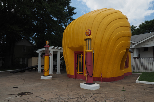
A short drive from the centre of town was the shell shaped service (gas) station. This single story Shell station, in the shape of a giant scallop shell, was built by R.H. Burton and his son, Ralph, in 1930. It is located at the corner of Sprague and Peachtree Streets in Winston-Salem. The owners decided to attract customers through a series of shell-shaped service stations.

A very good example of how literal 1920s and ‘30s advertising was.


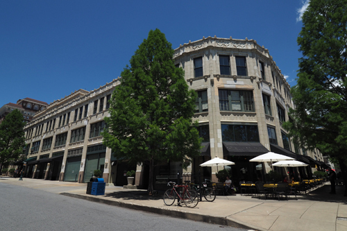
Grove Arcade 1929

June 7, 2017. Winston-Salem to Asheville, North Carolina.

There was a lot to see and do in Asheville, so we just took the Interstate and made the trip as simple as possible. 

We had been told how great Asheville was by the owner of a wine store in NYC. 

She seemed to know her wines and craft beers and gave the city a great wrap, especially in regards to its off-beat culture. 

We found the Visitor’s Centre and they didn’t hesitate in sending us on the ‘Asheville Urban Trail’. 

This was a three hour, self-guided, walking tour of downtown. 

Apart from it’s vibrant arts culture Asheville has some of the best Art Deco buildings in the US. 

When most cities in the country were demolishing their ‘old’ buildings during the 60s Asheville was in a financial slump and had no plans for redevelopment. 

This saved the city and preserved its heritage. 

It is now one of the fastest growing regions in the country. 

Asheville was incorporated in 1797 and named after Governor Samuel Ashe. 

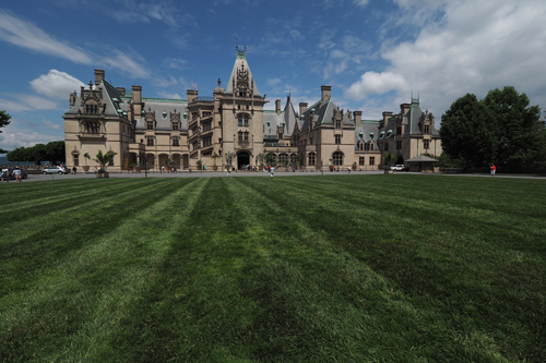
It also boasts the Basilica of St Lawrence and the Biltmore Estate.  

The dome of the basilica has a span of 58 by 82 feet (18 by 25 m) and is reputed to be the largest, freestanding, elliptical dome in North America.

While we were at the Visitor’s Centre we purchased, rather expensively, tickets to the Biltmore Estate. 

That was tomorrow’s adventure. 


Biltmore Estate 1895

June 8, 2017. Asheville, North Carolina.

America’s largest, privately owned home, Biltmore Estate, was built by George Washington Vanderbilt in 1895. 

The work began on the house in 1895 and it took 1,000 workers to complete the project. Vanderbilt not only used local labourers but international artists such as Viennese sculpture Karl Bitter and Spanish architect Rafael Guastavio..

It was modelled on the French Renaissance chateau style, with characteristically steeply pitched roofs, towers, turrets, and extensive sculptural ornamentation.

It contains 255 rooms, and 43 bathrooms, which is surprising considering that George Vanderbilt was a bachelor at the time of its construction.

The name Biltmore derives from ‘Bildt’, Vanderbilt’s ancestors’ place of origin in Holland, and ‘more’, Anglo-Saxon for open, rolling land.

Vanderbilt engaged Richard Morris Hunt to design Biltmore and Frederick Law Olmsted to landscape the 8,000 acre estate. 

This was Downton Abbey, but on a grander scale. 

George Vanderbilt and his wife Edith were Europhiles. They met and married in Paris in 1898. 

George Vanderbilt was an extensive traveller, visiting over 25 countries and crossing the Atlantic Ocean a total of 60 times in his life. 

He was an intellect, speaking three languages and having a love of art, music and science. 

Biltmore Estate is a huge drawcard for the Biltmore Foundation with 1.4 million visitors in 2016 alone.


OLYMPUS DIGITAL CAMERA

June 9, 2017. Asheville to Cherokee, North Carolina.

The main reason for going to Cherokee was to learn a little about the local Native Americans.

What made it even more rewarding was that we travelled on the Blue Ridge Parkway to get there. 

This was our third time on this scenic drive and to my mind the best yet. 

Due to the higher altitude, the wild flowers were still in bloom. 

At the Richland Balsam Overlook, which is the highest point on the Blue Ridge Parkway we reached 6,947 feet (2,117 metres).

Blue Ridge Parkway is Americas’ longest linear park. It runs for 469 miles (755 kilometres) through Virginia and North Carolina. 

Construction was started during the presidency of Franklin D. Roosevelt in 1935 – that man did so much.

Museum of the Cherokee Indians was in the centre of the the town of Cherokee.

It was an interesting display that covered the aboriginals of the region through many periods, not just the Cherokee.

It showed the development of weapons from spears and throwing sticks to bow and arrow through the Paleo, Archaic, Woodland and Mississippian Periods.

One very interesting artefact was the Atlatl or throwing stick  – very similar to the Woomera.

Sequoyah was part Cherokee and in 1821 developed a written language for his people. He became know as ‘The man who made the leaves talk’

Another interesting character was the Anglo-American army officer, journalist and cartographer, Henry Timberlake (1730 or 1735 to 1765)

His memoirs published in 1765 had detailed descriptions of villages, houses, weapons and tools. All vital for anthropologists and historians when they uncovered archeological sites in the southern Appalachian region.

In May 1762 Timberlake returned to England with three Cherokee chiefs, who had expressed a desire to meet the king of England. They met King George III and had their portraits painted by Sir Joshua Reynolds.

There are copies of these in the Cherokee Museum.

Unfortunately the Museum lacked academic rigour. There weren’t the usual facts, figures, dates and timelines that normally accompany the displays.


Cades Cove Loop Road

June 10, 2017. Cherokee, North Carolina to Knoxville, Tennessee.

We found, yet another, good coffee house in Bryson City, at Mountain Perks. The best coffee seems to be had at the places that roast their own beans.

If they roast they seem to care about the quality of their coffee.

Again getting to our destination was the purpose of the drive.

We took the Great Smoky Mountain National Park road from Cherokee. This was after consulting the staff at the Visitor’s Centre.

Unfortunately we had to do a little backtracking, as we were sent down a road that turned out to be closed. 

I blame the woman at the Visitor’s Centre, and the TomTom. 

They both should have known better. 

The road was surrounded on either side by stunning views, however it was, in parts, excruciatingly slow.

The mere glimpse of a bear or deer, however distant they were, caused the traffic to stop. 

The advice we received at the Visitor’s Centre was that this trip could take between two and four hours.

They were wrong about that as well, as it took more like five hours. It was worth it as the scenery was stunning.

The Great Smoky Mountains get their name from Cherokee tradition.

They are known as ’schaconage’ or ‘blue, like smoke’ because of their natural bluish haze.

In the evening we walked into Market Square in the heart of downtown Knoxville for dinner and discovered a small slice of ‘Euroamerica’. 

Market Square is a block long and surrounded by cafés, bars and restaurants – all with outdoor seating facing the square. 

There are buskers, musicians and lots of weird people, just as you would find in Barcelona, Paris or Berlin.

Being settled in 1786, Knoxville was the first capital of Tennessee.

It was bitterly divided during the Civil War and was occupied by both the Confederate and Union armies.

During the 1920s the economy stagnated, but in 1982 the city hosted the World’s Fair which helped to rejuvenate it.

The Sunsphere Tower, erected for the World’s fair, dominates the city skyline.

It is a 266’ (81 metres) tall hexagonal steel truss structure with a 75’ (23 metres) gold glass sphere on top.

It’s so disco and so 80s.


World's Fair Park and the Sunsphere Tower

June 11, 2017. Knoxville and Oak Ridge, Tennessee.

Continuing with the Euroamerican theme in Knoxville we had breakfast at the French Market Crêperie, near Market Square. 

The croissant, crêpes and coffee were very French, however everything was served on disposable plates and cups – very American. 

After breakfast we wandered around Knoxville, it was Sunday and very quiet. I think we were the only tourists in town.

Like so many of the small towns and cities we have see, Knoxville has a mixture of 19th century and early 20th century architecture.

Some of the Art Deco buildings are fantastic and many are now being restored.

Modern architecture is hard to find. There are some contemporary office blocks, but no domestic buildings.

All houses, motels and hotels seem to hark back to the 17th, 18th and 19th century for their designs. Most are in timber and have a gabled roof.

It’s easy to see why Frank Lloyd Wright is so revered. 

I discovered a website that was devoted to domestic American architecture. It was titled, American Home Styles, 1600 to Today.

It covered the following styles:

American Colonial House Styles 1600s – 1800

Neoclassical House Styles 1780 – 1860

Victorian House Styles 1840 – 1900

The Gilded Age 1880 – 1929

Frank Lloyd Wright Styles 1901 – 1955

Bungalow Styles 1905 – 1930

Early 20th Century House Styles 1905 – 1930

Mid-20th Century House Styles 1930 – 1965

Modernist Houses 1930 – Present

‘Neo’ House Styles 1965 – Present

Spanish and Mediterranean 1600s – Present

French Styles 1700s – Present

Prefab Houses 1906 – Present

Dome Homes 1954 – Present

Frontier Houses 1600s – Present

Native American House Styles Prehistoric – Present

Two things caught my interest in this article.

One, Frank Lloyd Wright had his own section and two, a number of styles, that were started in colonial times, are still used today.

This is very evident when you travel around the US. There is so much of the older style of architecture that is still being built and so little contemporary designs.

It seems that there is an unwritten rule that forbids people designing or building modern homes.

In the afternoon we visited the American Museum of Science and Energy in Oak Ridge. This is a 30 minute car trip from Knoxville.

The feature exhibition is all about the part that the town played in the Manhattan Project.

Both Thea and I had an interest in the story of the atomic bomb, as we had both read ‘Brighter than a Thousand Suns’ by Robert Jungk. This was the first account of the Manhattan Project and the German atomic bomb project.

Subsequently the book has been discredited, especially by the military head of the project, General Leslie Groves, who said:

“I wouldn’t place any reliance on anything in that book Brighter than the Suns. For example, he gave quotes attributed to me that were the direct opposite of what I had given him. He did that with everybody he talked to. I’d say that he was thoroughly discredited in the eyes of everybody who knew him.”

The Manhattan Project was a highly secretive US research undertaking, designed to develop the atomic bomb during the Second World War.

It took place between 1942 and 1945, culminating in the building of the bombs that destroyed Hiroshima and Nagasaki in Japan.

The line that has always been pushed by the US, is that by dropping the bomb they shortened the war and saved thousands, if not millions, of lives.

In 1942 President Franklin D Roosevelt was convinced by a group of US and foreign scientists that Germany, under Hitler, was capable of producing the bomb.

Albert Einstein authored a letter to Roosevelt imploring him to act quickly in the national interest.

Three sites were used in the Manhattan Project. Hanford in Washington, Los Alamos in New Mexico and Oak Ridge in Tennessee.

The Oak Ridge facility was the biggest and at its peak housed 75,000 people, becoming the fifth largest city in Tennessee.

The layout of the exhibition was far too messy with an over abundance of conflicting information, both spoken and graphic. 

After three hours spent in the museum we felt that we had done the ‘book ends’ regarding the atomic bomb.

We had seen the destruction and misery it caused in Hiroshima, when we were in Japan in 2013. And then on this trip, where we saw how it was created.

Both the Japanese and the Americans put their own spin on the bomb, so we have seen both sides to this momentous part of 20th century history.

Apart from the Manhattan Project display, there were other exhibits covering nuclear fusion, oil and natural gas, plus a huge display on coal. 

Not surprisingly, very little was mentioned about renewable energy. 

We went back into Knoxville for dinner, this time to Gay Street. 

As we were walking in we kept seeing people carrying folded chairs. We thought that they were coming from a day at the river, as the temperature had skyrocketed over the last 24 hours. 

How wrong were we. 

After dinner we walked back into Market Square and there were about 600 people sitting, on ‘folded chairs’, watching a game of ice hockey on a big screen. 

They were there to watch their local team, which was from Nashville, a time zone away. 

The game was between the Nashville Predators and the Pittsburgh Penguins. 

This was part of the Stanley Cup final. 

Obviously a very important game, judging by the enthusiastic crowd. 

We left before the end, but later discovered that the Penguins beat the Predators, 2-0, winning the Stanley Cup. 

Fortunately we weren’t around to witness the crowd’s disappointment. 


June 12, 2017. Knoxville, Tennessee to Columbia, South Carolina.

Today was a longish drive to Columbia, our halfway stop before heading on to Wilmington and the coast. 

Again we went over the Great Smokey Mountains, but this time on the Interstate, not through the State Park.  

Apart from the erratic driving by some road users, both in cars and trucks, the roads are relatively easy to drive on. Once we were back in South Carolina, we could also cruise along at 70mph (112kph).

Just over the road from our hotel was the Carolina Ale House. 

The beer was excellent, the wine and food ok but the service was chaotic. 

The 13% tip seemed excessive.


Front Street Brewery posters

June 13, 2017. Columbia, South Carolina to Wilmington, North Carolina.

We drove into downtown Columbia and found the Wired Goat Cafe for a coffee, then started towards Wilmington on the coast. 

The temperate was much warmer now, so a few days by the sea would be welcome. 

All of our accommodation, apart from NYC with Ev and Steph, has been in hotels and motels. In Wilmington we decided to try an Airbnb and found one near the river. 

We had a bedroom, kitchen, dining room, sitting room and laundry on the top floor of  ‘Schubert Hall’ which was built in 1836.

It was great to be able to spread out for a few days.  

Wilmington is a port city, first incorporated in 1739/40 and named after Spencer Compton, 1st Earl of Wilmington. 

We were staying in the downtown, Historic District which seemed to be set up for visitors. 

There were 11 breweries in town and one on the waterfront, just to the east. 

In fact, there seems to be a brewery or coffee shop on every corner. 

Which was very unfortunate as we only had three nights there. 

There was even a craft brewery just opposite our Airbnb. 

On our first night in Wilmington we walked back into town and had dinner at the Front Street Brewery. This is the oldest brewery in the area and by far the busiest. 

Most other places were empty, while there it was packed. 

They had five ‘Flagship’ draught beers and another five ‘Seasonals’, also on tap. 

I had the Port City IPA, it was the best India Pale Ale I had tried so far on the trip. 

This was also one of the first gastro breweries we had been to, on this trip, that actually had tanks on display. 

I believe that this adds a certain authenticity to the place. 

Each brew had its own poster on a rather impressive wall display. 

The graphics were great. 


Venus Fly Trap

June 14, 2017. Wilmington, North Carolina.

The Stanley Rehder Carnivorous Plant Garden was created by George Stanley Rehder Sr. who was known locally as ‘The Fly Trap Man’.

Stanley spent 25 years transplanting and cultivating fly traps pitcher plants and sundews.

The garden is tiny, only three quarters of an acre (3035.14 square metres) but full of flesh eating plants.

The Venus Fly Trap can only be found within a 75-100 mile radius of Wilmington. They can’t be found in the wild, anywhere else in the world. 

Being so rare, it’s understandable that there is a black market in these plants. In 2013 a thousand plants were stolen from the park. 

Valued at over US$20,000, this was not an isolated incident. 

Since then state law has made it a felony to nick Venus Fly Traps. 

In the afternoon we drove east to Wrightsville Beach and had a coffee at The Workshop. 

According to their business card they specialise in Sandwiches, Espresso and Fossils. 

The fossils were sharks teeth and there was also a large collection of shark’s teeth Jewellry for sale. 

The North Carolina number plates have the line: ‘First in Flight’. We wondered what on earth that meant, until we discovered that Orville and Wilber Wright made their first flight, in a heavier than air, fixed wing aircraft, in North Carolina in 1903. This was near Kitty Hawk, which is just up the coast from Wilmington.


Bellamy Mansion Museum, children’s stage

June 15, 2017. Wilmington, North Carolina.

Time to get a haircut. 

After a bit of searching I found the Beale Street Barber Shop, which wasn’t actually in Beale Street but Castle Street. 

It’s named after the famous Beale Street in Memphis, Tennessee. 

This is a 1.8 mile (2.9 kilometre) strip that is significant in the history of the ‘Blues’

It was created in 1841 after a forgotten military hero and originally name Beale Avenue.

In 1903 Mayor Thornton of Memphis was looking for a music teacher for his band, the Knights of Pythias. He talked to his friend Booker T. Washington who recommended trumpet player, W. C. Handy. Thornton contacted Handy and Memphis became the home of the musician who created the ‘Blues on Beale Street’

Not surprising the Beale Street Barber Shop in Wilmington was a shrine to the Blues. There was also a lot of Rock and Country Music photos, records and memorabilia covering the walls.

Johnny Cash and Elvis were heavily featured.

There was even an old black and white TV playing video clips and a stage where bands perform on Friday nights.

We decided to make another trip to the coast this time to Fort Fisher at the mouth of the Cape Fear River.

No sooner did we reach the resort area of Carolina Beach than it started to rain. 

Then the rain got harder and harder. We have never experienced a downpour like it.

So much for our beach excursion.

Because we had a kitchen and the wherewithal to cook a meal, we decided to do just that.

The owner of the Airbnb had very kindly left us bacon and eggs. These were obviously intended for breakfast but we thought that they could be the start of a Spaghetti Carbonara.

As our beach trip was cut short we found a supermarket and got the rest of the ingredients we needed to make or ‘spag cab’.

Looking for something to fill in the rest of the afternoon we went to the Bellamy Mansion Museum.

It was built between 1859 and 1861, in a mixture of Neoclassical architectural styles, for Dr John D Bellamy.

The facade features a full colonnade of six Corinthian columns and is crowned with a belvedere, to allow the summer heat to escape from the lower levels.

Dr Bellamy and his wife Eliza had been married twenty years before they moved into the house. By that stage they had nine children and Eliza was pregnant with their tenth when they moved in.

No wonder they needed twenty two rooms.

Designed by architect James Frost, both enslaved and free workers were used in the construction. 

The house was taken over by federal troops during the American Civil War. It survived a fire, said to have been ignited by opponents of the Confederacy, in 1972.

It’s lucky to be still standing. 

Many of the rich, southern, plantation owners of the 19th century, were not only brutal to their slave workers but completely self possessed about their wealth. 

It was regarded as the ‘Gilded Age’. 

A phrase that was coined by Mark Twain, referring to a period that was glittering on the surface, yet corrupt beneath. 

It was a time of corruption, capitalism and conspicuous consumption. 

I have often wondered why most of the houses, especially the ones owned by wealthy people, were made of timber and not brick.

Our Bellamy Mansion guide said that timber was the main export in the area and it was more expensive than brick, especially if you used the best timber. 

Again they were being ostentatious.

This pales into insignificance when you consider that the Vanderbilt family imported marble from Italy to build their stately home.  

Before we cooked dinner, we walked over the road to Flytrap Brewing. Yet another craft brewery. 

It was literally, in a parking lot. 

They don’t serve food at the bar but there is a food truck, in the car park. 

Most of the seating is outside. Which was good as there was a live act playing, that was far too loud for the area. 

The rain held off – just. 

It was a true local, with people actually walking to get there, with their dogs. 


June 16, 2017. Wilmington, North Carolina to Washington, District of Columbia.

It was a long day on the road, from Wilmington to Washington DC. 

The search for a wake up espresso was also long, ending at Morning Addiction in Rocky Mount, North Carolina. 

How very apt. 

Later in the afternoon, I needed, and Thea found, another coffee shop in Richmond, Virginia, called Brewer’s Café.

It was owned by AJ Brewer – I guess he was born to be a barista. 

We were meeting Ev and Steph in Washington and spending the weekend with them discovering DC. 

It was also their second wedding anniversary, another great reason to catch up. 


Capitol Building

June 17, 2017. Washington, District of Columbia.

DC means the District of Columbia.  We found this out the hard way, trying to locate our Airbnb on the SatNav. 

Washington DC is the compact capital of the USA and situated on the Potomac River, bordered by Maryland and Virginia. 

It houses the three branches of government: the Capital, White House and Supreme Court. 

Occasionally ‘The Donald’ lives there but it was the weekend and we suspected that he might be somewhere that treats him more favourably, like Mar-a-Lago. 

We found out later that he was ‘slumming it’ at Camp David.

His first visit since taking office. 

Our day was spent sightseeing. 

We started at the Capital Building and the Library of Congress. We then walked along the National Mall, detouring to the White House before ending up at the Lincoln Memorial. 

That evening we went to the Right Proper Brewing Company’s, Shaw Brew Pub for dinner

Apart from great beer, cheese was their specialty.

But they didn’t food match the beer with either the main course or the cheese, which was a pity. However Ev and I did discover that the Porter went very well with the Stilton.


Portraits of the American Presidents

June 18, 2017. Washington, District of Columbia.

In the morning we went to the Smithsonian American Art Museum for some culture.

One of the main exhibitions was ‘Down these Mean Streets’ (Community and place in urban photography). The display examines how Latino photographers depicted America’s urban streets as the concept of inner cities started to emerge.

The American Presidents portrait gallery was undergoing renovation but there was still good representation of the presidential portraits.

Missing was the planned interactive part of the display.

I am sure that this would have helped the poor Aussies who have not really studied American history that closely.

Another interesting exhibition was ‘The Gilded Age: Treasures from the Smithsonian American Art Museum’. It featured works that had been created during the very opulent period from the 1870s to the 1920s.

The Gilded Age was a showcase for art and architecture that was funded by the enormous wealth that some American land owners and industrialists amassed during the time of slavery and industrialisation.

These families built their wealth through industry, shipping, railroads and real estate.

They built castles and filled them with the best art and artefacts that money could buy.

In the afternoon, after we dropped Ev and Steph off to get their bus back to NYC, we drove to Arlington National Cemetery.

This is where many of the dead from American conflicts have been buried.

The cemetery was established during the Civil War in 1864 and built on land that was owned by the wife of the Confederate Army commander, Robert E. Lee.

After wandering around we visited the Tombs of JFK and the Unknown Soldier.

There was a crowd building up around the tomb of the Unknown Soldier so we waited to see what it was all about.

It was the changing of the guard and it took nearly half an hour of pomp, ceremony, barking commands, clicking of heels and presenting of arms.


June 19, 2017. Washington, District of Columbia to New York City, New York State.

The drive into NYC was relatively easy – a lot easier than the drive into DC on the Friday afternoon. 

We drove along the Baltimore Parkway, an efficient freeway that runs through a tall, green, lush forest. 

After a coffee break in Baltimore we headed to NYC. We couldn’t avoid toll roads so got onto the New Jersey Turnpike. 

This was an experience.

Truckies or Truckers as they are known in the US are an ill disciplined group.

They believe they own the road and the road rules don’t apply to them. Fortunately the operators of the New Jersey Turnpike realise this and have segregated the trucks from the cars.

This makes for a much better driving experience.

After dropping off our bags at Ev and Steph’s apartment, we took the car back to Hertz.

We had covered 3,753 miles (6,040 km) in 32 days. 

All in all it was a relatively stress free drive, of less than 200 kilometres per day. 

The temperature was in the 90s F (30s C) for most of the day, that’s until a thunderstorm and the resulting deluge rammed into the city in the late afternoon.

Then the temperature dropped.


Grand Central Station

June 20, 2017. New York City, New York State.

Still doing the tourist thing, but without a panic to get all the sights ‘done’ we had a wander through NYC.

Grand Central Terminal, or Station as most people know it, was built in 1903 in the Beaux-Arts style.

While the facade is imposing it’s the interior concourse that is it’s main feature.

It measures 275 feet (84 metres) long by 120 feet (38 metres) wide. There is a four-faced brass clock that sits on top of the information booth and a large American flag hangs at one end. Put there just days after the September 11 attacks.

At one end is an Apple store complete with hangers-on availing themselves of the free WiFi.

Next was the Chrysler Building, the New York home of Dancer Fitzgerald Sample, when I worked on Toyota in the 80s.

DFS had three floors of this classic 1930 New York skyscraper and was the largest agency in the city at the time.

Built for the auto giant Chrysler and designed by William van Alen, in the Art deco style, it was for about twelve months the world’s tallest building. Then the Empire State building came along.

The design of the decorative top of the tower was said to be inspired by the wheel caps of the 1920s Chrysler models.

The interior foyer area is equally inspiring with the decorative lift (elevator) doors and wall panels depicting 20th century transport.

New York Public Library was next on the list.

Completed in 1911 in the Beaux-Arts style, it is public in the fact that the public get to use it but it is financed privately.

Like most public places in the US, everything is privately paid for.

The main benefactor of the New York Public Library was Samuel J. Tilden (1814-1886). He left the bulk of his fortune, about $2,4000,000 to build the library.

As stated in his will, he wanted to, “establish and maintain a free library and reading room in the city of New York.”

Like so many public buildings, a competition was held to find a suitable design – New York architects lined up to get in on the action.

The eventual winner was the firm of Carrier and Hastings. The corner stone was laid in 1902 and it was finally completed nine years later.

The response to the new library by the people of New York was astounding with between 30,000 and 50,000 visiting on the first day it was opened.

One of the most unusual exhibits in the library is ‘The Real Winnie-the-Poo and friends’.

These are the five dolls, Poo, Kanga, Piglet, Eeyore and Tigger, that were given to Christopher Robin in the 1920s. They inspired the characters of A.A. Milne’s Winnie-the-Poo books.

Why they are in America and not England is still a mystery to me.


Yankee Stadium (New York Yankees playing the Los Angeles Angels)

June 21, 2017. New York City, New York State.

We went to the Frank Lloyd Wright exhibition at MoMA.

This was titled, Frank Lloyd Wright at 150: Unpacking the Archive. It was a celebration marking the 150th anniversary of the American architect’s birth.

There were 450 examples of his designs, drawing, ideas, models, furniture and even publicity, covering his work from the 1880s through to the 1950s.

In his lifetime Wright designed over 1,000 buildings and realised about 500 of them. His work spans the era of optimism in the late 1800s through the Great depression of the 1930 and the post war boom period of the 1950s.

The exhibition reflected this and showed how his ideas developed and adapted to the rapidly changing society in the US.

As I have mentioned before, Wright was an architectural hero in the US. Even today he is regarded as a god, so much so that it would be hard for any architect to ever surpass him.

That evening we visited Yankee Stadium to see the New York Yankees playing the Los Angeles Angels.

Compared to cricket, there was little use of video technology. No spidercam or pitching (bowling) analytics.

I found it hard to concentrate on the game – I wasn’t alone. Most people fidgeted, talked and generally moved about during each innings. 

Yankee Stadium is in the Bronx and not the original ball park made famous in movies and TV shows.

This one was completed in 2009 and replaces the old park that is now known as Heritage Field, a public park. 

The current spectator capacity is for 47,422 fans.

I must admit that even through I played softball as a kid I have little knowledge of Major League Baseball and found the game hard to follow.

The evening ended with Frank Sinatra singing New York, New York.

I guess that was to be expected.


Coney Island

June 22, 2017. New York City, New York State.

This was our last full day in NYC so we did the very touristy thing and went to Coney Island.

Situated in the borough of Brooklyn, Coney Island is known for its amusement parks, seaside resorts and hot dogs.

Fittingly, both Thea and Stephanie had a ‘dog’ for lunch from Feltman’s. They boast at being the creators of the original hot dog, which dates back to 1867.

Coney Island’s glory years were in the 1830s. Holiday hotels and fun parks for New Yorkers became the vogue.

Later in the afternoon we walk again through Greenwich Village, had a coffee in Blue Stone Lane, then went down to the Hudson River.

it was a casual day in NYC, but a lot of fun.

That evening we went to the Smoke Jazz and Supper Club on the Upper West Side. It was founded in 1999 by Paul Stache and Frank Christopher and is regarded as a very influential New York jazz club.

The concept is that you book dinner and a show which lasts about 90 minutes – then you are out the door as new customers are waiting to come in.

That night Stephen Kroon’s Latin Jazz Sextuplet were playing. It was a great venue with excellent music, I just wished that it could have lasted longer.


June 23, 2017. New York City, New York State to Berlin, Germany. 

The morning was spent on boring things like backing-up computers and packing, before a final coffee at Mason Harlem. 

We had been there often enough that we were almost ‘locals’. 

Then it was the long Metro ride to JFK for our flight to Berlin. 

We had one final drink at Flyzone, one of the JFK’s airport bars. Again the beer was great.

I will miss American craft beers and the great bars that, no matter where they are, seem to be able to create an atmosphere. 

But I do wonder and worry about where America is heading under Trump,

As Hayden described the US. “It’s the bastard child of Europe.”

However this bastard now has an even bigger identity crisis.


Part 1: New York and the eastern states.
(May/June 2017)

Wednesday, April 4th, 2018

01_May 15, 2017_Tarrytown

May 11-18, 2017. New York City and Tarrytown, New York State.

After a very long flight from Melbourne, via Sydney and Los Angeles, we arrived in the Big Apple.

This was the first leg in another adventure – discovering new places and chasing our family around the world.

We are planning on being away for about ten months and the first part was all about family.

Over two years ago Evan and his wife Stephanie came to NYC. Steph had been offered a place, in the Masters program, at Columbia University.

We were in New York for her graduation and from there we were going to explore some of the eastern states.

Columbia University was first established in 1754 and was formerly known as King’s College. It was established by a royal charter from George II and was renamed as Columbia College in 1784, following the American Revolutionary war.

I wondered why a crown was on the crest of Columbia – the answer was in its history.

We arrived on a Thursday, just in time for Mother’s Day on the Sunday.

Jenny and Neil, Steph’s parents, were also in New York for the graduation and Ev and Steph had planned a Sunday lunch.

Where we were going and how we were to get there was a well kept secret.

A Mother’s Day mystery tour.

After a bus ride and a train trip we ended up in Tarrytown, about 40 kilometres north of Manhattan, on the Hudson River.

It was a wonderful surprise for everyone, especially the mums.

After an excellent lunch we had a stroll up and down Main Street in Tarrytown.

We even visited the local fire department and chatted with one of the local fireman, a huge 17 year old volunteer.

Then it poured down.

There was plenty of shelter, so we managed to get back to the station and New York without getting soaked.

The next few days were taken up with the graduation which is the subject of a separate post.
 

80 Church Lane, Bridgehampton

May 19, 2017. The Hamptons, New York State.

On our final day in NYC we picked up a Hertz rental near the Washington Bridge and made a very slow escape from the city.

The car was a white Nissan Sentra with cavernous boot space, so our bags and packs fitted in easily.

After our slow start we got onto Long Island and the speed increased as we hit the rural areas.

The Hamptons are the ‘escape’ towns for New Yorkers. They are quiet during autumn and winter but turn feral in the summer months.

We had arranged to spend time with our old friends, Cathie and Earl Gandel. They have had a house in Bridgehampton for over 40 years. It’s been both their principal residence and holiday home during that time.

The weather was very hot as we left New York and the Nissan’s air conditioner worked overtime. By the time we reached Bridgehampton it had dropped to a very pleasant 25°C.

The next day the New York weather had reached us and the temperature had risen to 35°C again.

In the morning Earl and Cathie drove us around the Hamptons and we caught a glimpse of some of the vast hedged estates that are home to rich and famous New Yorkers.

We stopped for lunch and had one of the notorious lobster rolls, a local specialty we were told.

Two serves were enough for the four of us.

We were back in the States and the servings were huge.

How quickly you forget.

Earl and Cathie had just sold the Bridgehampton house and were planning to move back to LA.

We spent two nights and a full day with Earl and Cathie.

I met Earl at Dancer Fitzgerald Sample in 1982.

The agency was a partnership between Schofield Sherbon Baker in Sydney and Dancer Fitzgerald Sample (DFS) from New York.

The founding and primary reason for the creation of DFS was the servicing of the Toyota business in Australia.

Commercial vehicles were handled out of the Sydney office and passenger cars from Melbourne.

Earl was sent to Melbourne as General Manager and chief authority on all things Toyota.

Earl still has a love of cars and owns two beautiful vintage British sports cars – a 1949 Triumph and a 1950s’ MG.

Earl is retired but still holds honorary positions with the local fire station and historical society. While Cathie still works as a free-lance journalist.


Sterling Library, Yale University, New Haven

May 20, 2017. Bridgehampton, New York State to West Haven, Connecticut. 

It took three ferry trips to get from Bridgehampton, in New York State, to West Haven in Connecticut.

Two short and one long.

The longer journey was from Orient Point to New London. This is the only one we needed to book in advance.

We broke our trip at Greenpoint, with a good cup of coffee at Aldo’s, followed by a short walk.

It was a pleasant 80 minute boat ride, marred briefly by the beeping of a car alarm coming from a black BMW.

Our ferry was the New London, operated by Cross Sound Ferries.

We stopped in New Haven, the home of Yale University to explore the campus.

A strange feature of the city landscape, especially around the campus, were the ‘Personal emergency stations’. These were freestanding poles, with a blue light mounted on top and down below, an emergency button.

I can only surmise that students on the campus are at risk of muggings or other attacks. The poles were everywhere and placed at 50 metre intervals.

Wandering around the campus we also discovered the Women’s Table, a sculptural piece by the artist Maya Lin.

Maya Lin was a student at Yale and in 1993 designed the piece to celebrate the growing number of female students that have and will attend the university.

There were women at the university right from its very start in 1701. They were what was called ‘silent listeners’ and could only sit in on classes and not participate.

The first female students on record registered in 1837.

The hotel/motel prices in New Haven were over the top. Probably due to graduation season in Yale.

We therefore stayed out of the main centre in West Haven, at a small and rather run down motel.

Our evening meal was at Cask Republic, a brewpub with 43 beers and ciders on tap.

Again we were rewarded with a good meal, at reasonable prices, with excellent local craft beers and wines.

Thea has decided on a new strategy for accommodation. By staying out of the main town or city centres we can save on accommodation costs. That saving can then be spent on using an Uber to travel to where the action is.

So far it has worked well.

May 21, 2017. New Haven, Connecticut to Kingston, New York State.

We headed back into New York State, on our way to Kingston and the Catskills. This was via Scenic Byway 58 into Bethel.

Here we had a cup of coffee at Molten Java – the write-up and reviews were better than the coffee.

The drive into Kingston was again on a Scenic Byway. The countryside was verdant green with spring growth.

Kingston is a strange town as there is no apparent centre or commercial area. In fact there is very little accommodation at all in the town, with most of it being centred near the Hudson Valley Mall.

Luckily this was where we were staying.

Surprisingly I took no snaps this day.
 

OLYMPUS DIGITAL CAMERA

May 22, 2017. Kingston and the Catskills, New York State.

This was a day of country and culture.

Firstly we found a good coffee at Coffee Beanery. The guy was very anxious to find out how we discovered his café. He seemed surprised that we had Googled ‘good coffee close by’ and his name popped up.

We then headed into the Catskills for a drive.

The weather had turned cold and cloudy and rain was constantly threatening.

Part of our country drive took us along Railroad Avenue where we came across an old dilapidated hotel. It was a huge, rambling structure that was literally collapsing in on itself.

On the way to the Vanderbilt Mansion we discovered Kaaterskill Falls. This has been a tourist destination since the 1820s and is one of the highest waterfalls in New York State.

There are two stages to Kaaterskill Falls. The total height is 79m and the longest drop is 55m.

It was quite a hike up to the viewing platform but the views were worth it.

Even if everything was shrouded in mist.

In November 2016 a 30 year old hiker fell to his death. However it was winter and the ground was slippery with ice.

It took us almost two hours for the return trip and as soon as we arrived back at the car park, it started to rain.

We didn’t get to the Vanderbilt Mansion until late in the afternoon and the main building was shut. It was a little disappointing but we had enjoyed a great walk in the morning and you can’t do everything.

To add to it all, the mansion was undergoing major renovations and scaffolding adorned all sides of the Neo Classical construction.

The 54 room Vanderbilt Mansion in Hyde Park was designed by the architectural firm of McKim, Mead and White and built between 1896 and 1899. It all sits on 85 hectares of formal gardens, woodlands and auxiliary buildings.

The estate originally dates back to 1764 when it was then used as agricultural land.

The Vanderbilt family were of Dutch origin and prominent during the ‘Gilded Age’ from about 1870 to 1900. They made their money through shipping and railroads. Two generations of the Vanderbilt’s were the richest family in America from the late 1800’s to the middle of the 20th century.

As with so many families that achieve great wealth, the Vanderbilt’s legacy only lasted three generations. It was described to us as ‘Shirt sleeves to shirt sleeves’ with the first generation building an empire from nothing and the last generation loosing it all.
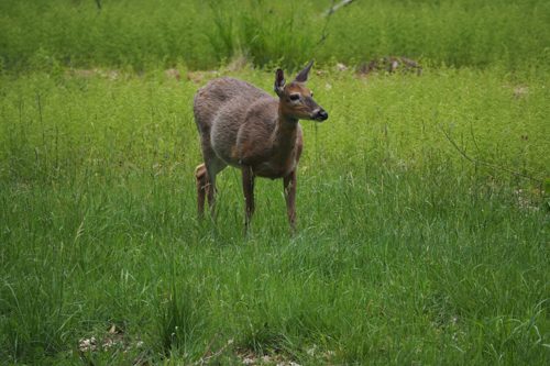
 

Deer at Ashokan Reservoir

May 23, 2017. Kingston to Ithaca, New York State. 

On the way to Ithaca and the Finger Lakes we stopped at the Ashokan Reservoir. The temperature was still fresh but it promised to warm up in the afternoon.

Construction on the reservoir was started in the early 1900s, with the first drinking water pumped to New York City in 1915.

It was a monumental project that used over 3,000 workers, all of whom were housed near the construction site.

It was ground breaking in that the authority offered food, housing, doctors, recreation and a broad education to the children of the workforce, as well as English classes to the immigrant families.

In the 1880s’ New York’s water supply was being stretched and the new Ashokan Reservoir promised to deliver 600 million gallons (2,271,247 litres) per day into the city.

The project displaced many locals from their farms and homes.

Once completed the system included four reservoirs and over 127 miles (204 kilometres) of aqueducts and tunnels.

The cost then was $177 million, today it would be over $4 Billion.

On the way to Ithaca we had a scare – there was a screeching of alarms in the Nissan.

Initially we thought it was a warning from the car, but nothing seemed to show up.

No lights or any indications.

Then we realised it was coming from our iPhones.

The alarm was from an alert, that had been put out by police, in regards to an abduction.

The offence had taken place hundreds of kilometres from where we were.

We still kept an eye out for the red Ford Pick-up truck.

In Ithaca we were staying out of town again and planned on getting an Uber to go to dinner.

There were no Ubers in Ithaca.

So we were back to the old, dated and extremely ineffective taxi system.

We were told that the taxi would be 20 minutes, it only took 10. We were also told it would cost $12, it only cost $10.

Maybe they are starting to learn.
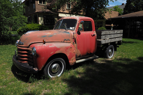
 

1950 Chevrolet Pick-up Truck, Montour

May 24, 2017. Ithaca and the Finger Lakes, New York State. 

We found yet another excellent coffee at Montour House in Montour Falls.

The Montour or Sch-qua-ga Falls are a looming backdrop to this quaint little village – they seem to cascade right into the main street.

From there we drove to Geneva, along Seneca Lake, one of the many long narrow lakes in the Finger Lakes region.

Geneva it at the very top of Seneca lake and boasts a number of beautifully restored buildings from the turn of last century.

My favourite was the Romanesque revival YMCA building (1898) with its beautiful Art Nouveau typography on the facade.

From Geneva, on the shores of Seneca lake we then drove to Seneca Falls which is very close to Cayuga Lake.

The US women’s rights movement started in Seneca Falls in 1848. However it wasn’t until 1920 when women, across the US, actually got the vote.

The Seneca Falls Convention ran over two days, July 19-20 and attracted widespread attention. The convention’s Declaration of Sentiments became the single most important factor in spreading the news of the women’s rights movement around the US.

There is a life sized statue on the Seneca River, not far from the falls that depicts three women. This was the meeting between Elizabeth Cady Stanton and Susan B Anthony, introduced by a mutual friend, Amelia Bloomer.

This chance meeting is said to have been the start of the suffragette movement in the US. This ultimately led to the Nineteenth Amendment to the American Constitution – the right for women to vote.


WWI Poster exhibition, Johnston Museum of Art, Cornell University

May 25, 2017. Ithaca, New York State.

Ithaca is the home of Cornell University.

Cornell, like Columbia and Yale, is another Ivy League, private University. It was established in 1865 by Ezra Cornell and Andrew Dickson White.

Its charter was to make contributions in all fields of knowledge. From the classics to the sciences – from theoretical to the applied.

It has always been co-educational and non-sectarian. Ideals that were unconventional for the time.

As of 2017 Cornell claims amongst its 245,000 living alumni to have, 34 Marshall Scholars, 30 Rhodes Scholars, 29 Truman Scholars, 7 Gates Scholars, 56 Nobel Laureates and 14 living billionaires.

The currents students also like to drink.

We were in Ithaca just before the Commencements, or Graduation Ceremonies (This depends on whether your are starting or ending your academic year) and there were a lot of very ‘merry’ graduates.

They were harmless and who could blame them for letting off a bit of ‘academic or practical ‘ steam.

Ithaca, named after the Greek island, was founded in 1740 and incorporated in 1888.

Due to its large student population the voters are more liberal than upstate New York.

Ithaca hasn’t always been liberal leading. In the late 1800s, it was home to the Ithaca Gun Company, manufactures of high quality shot guns.

The company became the icon of the hunting and shooting world. The famous trick-shooter, Annie Oakley favoured, and promoted, Ithaca guns.

On our last day in Ithaca the weather turned foul so we visited the Johnston Museum of Art at Cornell University.

There was an interesting poster exhibition, immediately we entered the museum.

During WWI, posters went from artistically advertising products, to aggressively promoting propaganda for the war effort.

The exhibition was all about that transformation.

This was followed by an interesting retrospective of printmaking with artists such as Albrecht Dürer, William Hogarth, Claude Lorrain, Giovanni Batista Tiepolo, Antonio Canaletto and Rembrandt Harmensz van Rijn.

Installations and diverse collections were also in the museum.

Thea even donated her old red iPhone case to an exhibition of Abandoned Red Objects.

It’s all about the art.

There was even an Andy Warhol Campbell’s Soup collection from 1969.

The entire collection was very eclectic, in that there were a small number exhibits from many periods.

This is probably due to the fact that almost everything was from a bequest or donated.

In the afternoon the weather hadn’t got much better so we went in search of a mall to replace Thea’s iPhone cover.

We then had a short drive and a quick walk to Ithaca Falls, which is almost in the centre of town.

This is the site of the infamous Ithaca Gun Company.

Much of the area has been fenced off, as it was polluted with lead from the factory.

Rehabilitation is still taking place.
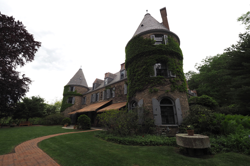
 

Grey Towers near Milford

May 26, 2017. Ithaca, New York State to Milford, Pennsylvania.

We drove out of Ithaca and eventually got onto the NY 97, a scenic drive that took us down the Delaware River.

This is the border between New York State and Pennsylvania.

Near the junction of the Delaware and Lackawaxen Rivers we found the John A Roebling’s Delaware Aqueduct that was built in 1847-1848 and opened in 1849. It is also known as the Roebling Bridge and was originally designed as an aqueduct that connected two parts of the Delaware and Hudson canal.

It has now been converted to carry vehicles and pedestrians.

We also found a public toilet, which is rather rare in the US.

The construction of the canal and the subsequent building of the Erie Railroad in 1848 help development in the Upper Delaware region.

Late in the afternoon we made our way to Grey Towers, a stately mansion on the outskirts of Milford.

Grey Towers was designed by Richard Morris Hunt and built by the philanthropist and businessman James Pinchot in 1886.

The Pinchot family originally came from France and the mansion reflected their French heritage.

James Pinchot was deeply disturbed by the deforestation, caused by over logging in the US, and convinced his eldest son, Gifford Pinchot to consider a career in forestry.

After studying abroad, because no forestry schools existed in the US, Gifford went on to become the first Chief Forester. This was in the the newly created United States Forest Service, formed by President Theodore Roosevelt.

During his tenure, national forests more than tripled in size to over 170 million acres.

Gifford went on to serve two terms as Governor of Pennsylvania.

In 1963 Gifford Bryce Pinchot, son of Gifford, donated the property to the United States Department of Agriculture, Forest Service.

On September 24, 1963, President John F Kennedy dedicated the site to the American public in the hope of further promoting the ideals of conservation.

There is a monument to the Forest Service in the forecourt of Grey Towers.


Washington's headquarters, Valley Forge

May 27, 2017. Milford to Philadelphia, Pennsylvania.

Our morning started with breakfast at the Village Diner, which was next to our motel.

Bad move.

It’s only saving grace was that their menu had been designed in the Googie style (1950s’ space age design genre)

The service was lazy and the food was poor.

Dissatisfied we headed to Philadelphia, via Valley Forge.

This was an interesting side trip as Valley Forge is regarded as one of the seminal locations in US history.

Valley Forge was the site of General Washington’s headquarters during the winter encampment of 1777-78. This was the third year of what was the eight year War of Independence.

No battles were ever fought at Valley Forge.

The area became famous as the place where, though extreme hardship, the Continental Army survived a brutal winter and went on to eventually triumph over the British.

This is seen as the defining moment in the US – the time when the American spirit was established.

It’s a bit like our ANZAC Day.

Late in the afternoon we discovered the King of Prussia Mall. This has the dubious honour of being the largest, by rentable space, mall in the US.

To their credit they have a Bluestone Lane coffee shop. This is a part of an Australian chain, that now has 7 outlets in the eastern US.

They serve great coffee and much to Thea’s delight, Lamingtons.

That night we stayed in the university district of Philadelphia and discovered the White Dog Restaurant for dinner.

This proudly boasts being the first Philadelphia establishment to source all their ingredients locally.

True or not, their food was fantastic.

The restaurant’s design followed the ‘canine’ theme with dog busts on the walls. As well, cushions and art were all incorporated into the decor.
 

White Dog Restaurant, Philadelphia

May 28, 2017. Philadelphia, Pennsylvania.

We were in Philadelphia for the Memorial Day holiday weekend.

This is the day that Americans remember those who died serving in the American Armed Forces.

It is held on the last Monday in May.

It was about 5 km into the old part of Philadelphia, so we decided to walk, having been stuck in the car for the last few days.

Stupidly we stood in line to see the famous Liberty Bell, only to discover that our view was through a window.

Once we found the real queue it took 45 minutes to get inside.

Well the Liberty Bell is one of the patriotic touchstones in the US and this was the Memorial Day long weekend.

The Liberty Bell was commissioned in 1752 by the Pennsylvania Provincial Assembly and was originally placed in the Pennsylvania State House.

While it is closely associated with the Declaration of Independence, there is no account of it actually being rung on July 4, 1776. However most historians agree that it probably was one of the bells rung on July 8, to mark the reading of the declaration.

The bell fell into obscurity until the 1830s’ when it was adopted as a symbol by the abolitionist societies who called it the ‘Liberty Bell.’

The bell has been recast twice, due to cracking and there is a large crack in the one on display. Since being retired it has made many road trips across the US.

We then continued on a few more kilometres down to Penn’s Landing on the Delaware River.

There is a big Irish influence in Philadelphia. This is mainly due to the influx of Irish immigrants following the potato famine of 1847.

There is a large memorial to the Irish near Penn’s Landing  and many Irish pubs and bars in the city area.

We discovered The Plough and the Stars, a lively pub that was bursting at the seams with weekend revellers.

We managed to get an outside table. I think the locals knew something that we didn’t, as it wasn’t long before the rain came.
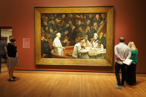
 

Portrait of Dr Hayes Agnew (The Agnew Clinic) Thomas Eakins 1889

May 29, 2017. Philadelphia, Pennsylvania.

The rain held off and we again walked. This time to the Philadelphia Museum of Art, which was just over the Schuylkill River from where we were staying.

The steps leading up to the Museum were made famous in the Rocky movies, staring Sylvester Stallone. There is even a ‘Rocky’ statue out the front, and tourists line up to have their photo taken with him.

We spent three hours in the gallery, mainly concentrating on the America art that spanned the 18th, 19th and 20th centuries.

The exhibit that caught my attention was Marcel Duchamp’s ‘Fountain’.

One hundred years ago this piece turned the art world upside down with its uniqueness and sheer audacity.

Duchamp created the concept of ‘readymades’ by taking mass produced items, and presenting them as art.

The ‘Fountain’ was a urinal that he purchased from the New York showroom of J. L. Mott Iron Works. He then signed it ‘R. Mutt’ and submitted it to an exhibition of the Society of Independent Artists.

It was rejected.

Today the debate still continues as to whether it is object or art.

After our cultural experience in the gallery we went in search of more basic needs.

A good glass of wine and a local craft beer.

The 2nd Story Brewing Company, on Chestnut Street, fitted the bill.

Just next door is the Han Dynasty, a Chinese restaurant with a difference.

Despite the food descriptions being foreign to us the meal was great.

Fresh ingredients, manageable portions and full of flavour.

It was in an old bank and the lofty ceilings and timber features made it all the more impressive.

There was even a row of large clocks with world times displayed.

Unfortunately they didn’t work.


Eshleman's Covered Bridge, built 1845, rebuilt 1883

May 30, 2017. Philadelphia to Gettysburg, Pennsylvania.

The morning we left Philadelphia was overcast and drizzling.

It didn’t improve.

It wasn’t so bad as we planned to spend the day driving in search of covered bridges and the Amish folk. There are a number of covered bridges around Lancaster and we had been to the Tourist Information centre to get a map.

We did stop in Lancaster for a coffee and visited the market. Built in 1730, it’s one of the oldest covered markets in the US.

There were once as many as 12,000 covered bridges in the US, today there are fewer than 1,500.

There is a romanticism associated with these quaint old structures, but they are entirely practical.

Their timber truss design allowed for a greater span and they were covered to give them greater longevity.

We drove around the area for about 20 miles (32 Km) and visited four of the bridges, each one was different.

Being in Amish Country we wanted to see if we could spot these traditional Christians. They have been made famous by their simple living, plain dress and a reluctance to adopt modern ways.

The Amish began with a schism in Switzerland between a group Swiss and Alsatian Anabaptists, led by Jakob Andaman in 1693. Many in this group emigrated to Pennsylvania in the early 18th century.

We did see many in farm yards and in their traditional horse drawn buggies. But what was surprising was a lot were also driving their John Deere tractors.

Obviously not all the Amish have rejected technology.

Historically we were travelling in the right direction.

Philadelphia and the surrounding areas, especially Valley Forge were the site of Washington’s winter encampment of 1777-78. These were the touchstones of the American’s strive for independence.

Now we were in Gettysburg, founded by Samuel Getty in 1761.

This is where the Civil War was won.

This war wasn’t about sovereignty but more about states’ rights and slavery.

Fought between 1861 and 1865 it was an idealogical battle between the north and the south.

In 1862 seven southern ’slave’ states individually declared secession from the US to form the Confederate States of America.

The Battle of Gettysburg was fought between July 1 and 3, 1863. The battle involved the largest number of casualties in the civil war and was the turning point. After three days of battle in Gettysburg, Robert E Lee’s army, of North Virginia, were defeated in their attempts to invade the north.

This changed the course of history.

Speaking to the locals, they say that if the north had lost then America would never have become ’The United States’ and world history would have been very different.

Given the current politics within the US, I wonder if that would have been such a bad thing.

Our accommodation in Gettysburg was right in the heart of town, at the Inn at Lincoln Square.

This was an historic house, originally built by Joel Buchanan Danner (1804-1885) in 1824. Joel B Danner was born in Liberty Maryland and was a Democratic member of the US House of Representatives between 1850 and 1851. He was probably comfortably retired from politics and running his hardware business when the Civil War broke out in his front yard in 1863.

Apart from a few modifications, the room we stayed in had an authentic 19th century feel.

There’d were even steps to get up into the four poster bed.
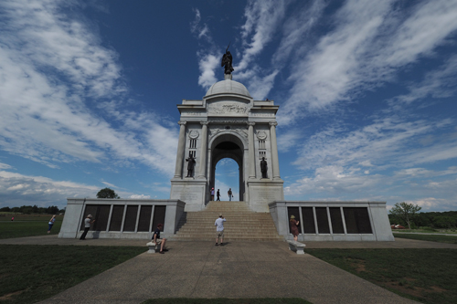
 

The Pennsylvania Memorial, the largest in Gettysburg

May 31, 2017. Gettysburg, Pennsylvania.

The day was spent on the battlefields of Gettysburg.

It was suggested that we hire a guide for a few hours to escort us around the site. The guides were all booked out, so we purchased a CD pack and escorted ourselves.

The itinerary was intended to run for two and a half hours.

We took much longer than that – about five and a half hours.

We had a rough beginning, as we couldn’t find the start of the tour. After that it all went extremely well.

The guided tour was a mix of facts, yarns and dramatisations.

There are over 1,400 monuments dotted around the battlefield area, making it the largest open air gallery in the US.

That’s if you regard monuments as art.

One was of an indian chief, erected for the Tammany Regiment Memorial. The monument is a bronze statue of the Delaware Indian Chief Tammany standing in front of a teepee. Tammany was a friend to colonists in the early days of America and became the symbol for the powerful New York City political hall that raised the regiment.

It sits rather incongruously with the images of white men in uniform.

There were three CDs in the set, one for each day of that battle that was fought from July 1 to 3 in 1863.

Our final stop was at the Soldiers’ National Cemetery. This is set within the Gettysburg battlefield and was consecrated on November 19, 1863.

This is the place where Abraham Lincoln delivered the historic and eloquent ‘Gettysburg Address’

This must go down as one of the most monumental speeches in history.

Surprisingly it is only 272 words long, yet it expressed so much.


Fallingwater by Frank Lloyd Wright, Mill Run

June 1, 2017. Gettysburg to Uniontown, Pennsylvania.

Mowing the lawn takes on a whole new meaning, once you escape the big cities.

Wherever we went, men and occasionally woman, sat astride their ride-on-mowers and ‘cultivated’ their lawns. This seems to be a national pastime at this time of the year. It’s needed, as there are so many blocks of land, about the size of a small European country, that need constant maintenance, especially in spring.

Our primary adventure for the day was a visit to Frank Lloyd Wright’s Fallingwater.

This is regarded by many as the finest piece of domestic architecture in America.

The irony is that he achieved this greatness by ignoring the brief.

Designed and built between 1935 and 1939 for the Kaufmann family of Pittsburgh, Pennsylvania, the house is cantilevered over a 30’ (9.1 metres) waterfall.

The Kaufmann’s owned a large estate at Bear Run and wanted the house to overlook the waterfall.

Wright decided to build the house over the falls instead.

It was part of Wright’s new architectural philosophy of incorporating the surroundings into the design. The stone used to construct the house came from a local quarry, also owned by the Kaufmanns.

Frank Lloyd Wright designed about 1,000 houses in his lifetime, 500 of those were created after Fallingwater, when he was in his 70s.

This is regarded as his best.

Fallingwater is so popular, that at the height of the season, 1,000 visitors file through the house every day.

On the day we were there it processed about 800 tourists.

You can only take pictures outside, as they believe it will hold up the tours if photos are taken inside.

If you want to photograph the interior, you can book one of the Photo Tours, but these only run in the early morning and are booked out weeks in advance.

I did try a grab a few snaps through the windows.

As with most of his designs, Wright also created the furniture, lighting and interior decor. So it’s a pity I couldn’t have captured a few more images.

Fallingwater was designed to be the Kaufmann’s summer house, so cooling was important. Wright, without using a traditional air conditioning system, utilised windows and the draft from the waterfall below to allow cool air to flow through the house.
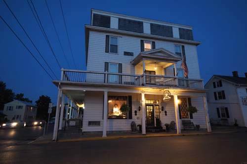
 

The Strasburg Hotel

June 2, 2017. Uniontown, Pennsylvania to Strasburg, Virginia.

Heading south we crossed the Mason-Dixon line again. This is a line that was surveyed by Charles Mason and Jeremiah Dixon, between 1763 and 1767.

The line ultimately became a symbolic and cultural division between the North and the South, especially in regards to slavery.

It is 250 years since Mason and Dixon were commissioned to survey the 4,000 square miles (10,360 square kilometres) of disputed territory.

The survey was a result of a disagreement between Maryland, Pennsylvania and Delaware in Colonial America.

The two British surveyors used the most advanced equipment that was available in the day. The accuracy was so extraordinary, that even today it astounds the scientific world.

The countryside was green and heavily wooded. We went off the main road and had a great drive through the countryside on very narrow, winding roads.

Sergeant Peppers Lonely Hearts Club Band by the Beatles was released on May 26, 1967 in the United Kingdom and June 2, 1967 in the United States.

We were in the US on the 50th anniversary, so dutifully played the album as we were driving through Virginia.

It’s a classic.

We arrived in Strasburg, Virginia in the afternoon and decided to drive around town to see what was happening.

The drive was very short.

Strasburg, founded in 1761, is on the Shenandoah River and is know for pottery, antiques and Civil War history.

However most people would remember the name from the American folk song, ‘Oh Shenandoah’ This was recorded by many artists, including Bob Dylan, Glen Campbell and even Judy Garland.

For a change we were staying in an old colonial pub, the Hotel Strasburg. This was very different to our usual motel/hotel style accommodation.

The building was constructed in 1902, as a private hospital, but then became a lodging house.

It was restored in 1977 to its current state.

Antiques were everywhere and our computers and digital cameras seemed very out of place. Apparently the Hotel Strasburg used to be owned by one of the large antique dealers in the town and everything in the place was available to purchase.
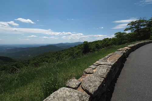
 

Little Devils Stairs Overlook

June 3, 2017. Strasburg to Roanoke, Virginia.

Antiques are still big business in the US, well at least in Pennsylvania and Virginia.

The vast majority of domestic architecture in the eastern US hasn’t changed in the last 100 to 150 years. Modern houses are very hard to find and even the decor in the motels and hotel we have stayed in seem to hark back to an older era.

That combined with the fact that the American War of Independence and the Civil War all loom large in the culture of these towns.

We found a great coffee shop in Front Royal, which is only about a twenty minute drive away from Strasburg.

There we met Bruce.

He lived in Front Royal and loved a chat. He was retired but had been a salesman, worked on the railroads and even in the funeral business.

There was music coming from the town square and Bruce told us that there was a Baptist revival meeting going on.

According to Bruce, another regular Font Royal activity happens on Wednesdays. This is when the Democrats and Republicans face off in the square, yelling and waving placards at each other.

The main part of the day was to be spent driving along the Skyline, a ridge road in the Shenandoah National Park, within the Blue Ridge Mountains

Bruce told us it was well worth it even if it was a little slow.

He wasn’t wrong.

The drive is 105 miles (169km) long with 75 overlooks on both sides of the road. However you are restricted to 35mph (55kph), which makes the trip very long indeed.

We drove from near Front Royal in the north to Waynesboro in the south.

It certainly was a great drive, regarded by many as one of the best mountain roads in the US.

Apart from the day trippers on the road, there were many on bikes and an unknown number walking in the forests.

Every car park, leading to one of the many walking tracks, was full.

On the recommendation of the hotel receptionist we went to Billy’s for dinner. This was in the market area of Roanoke and about a twenty minute walk from the hotel.

From the outside Billy’s looked rather small and very crowned but when we got inside it was much larger than it appeared.

It was a beautiful balmy evening so we opted to eat outside.

The food was great and a change from burgers, sandwiches and over sauced pastas.

Uber is operating in Roanoke, so we booked one to bring us back to the hotel.

That’s when we met Perry, ‘The best Uber driver in the world’. They were Perry’s words not mine.

Apart from his huge ego, Perry did have some interesting innovations. One was a small blue illuminated Uber sign on the top of his car.

It did help us to find him. There was the 59th Annual Sidewalk Art Show in the streets around the market area and Perry was forced to park at the end of the streets, as the road in front of the restaurant was blocked off.

We saw Perry again the next day. His other job was in a hot dog stand.

I wonder if he made the best hot dogs in the world?
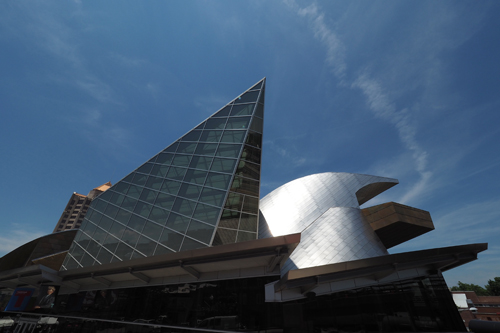
 

Taubman Museum of Art

June 4, 2017. Roanoke, Virginia.

In 1852 the town was known ‘Big Lick’, after a large outcrop of salt that drew wildlife to the site near the Roanoke River.

This name wasn’t well regarded by the locals, so in 1882 it was renamed to Roanoke and became an independent city in 1884.

One of the main attractions in Roanoke is the Taubman Museum of Art. This was designed by Randall Stout, a southern architect originally from Tennessee, and built in 2008.

For seven years Stout worked with Frank Gehry and this is very evident in his design.

The Museum is rather boxed in, with the railway line on one side and a bridge on the other.

This is ironic, considering that there is so much space in this city, most of it taken up by vast carparks

Fortunately the interior was much more spacious.

The collections in the Taubman place an emphasis on South Eastern US art. There was a small, rather diverse offering that ranged from 18th century colonial works to contemporary painting and arts and crafts.

One that I particularly liked was an installation of images projected onto four boxes filled with different foods. Entitled I am not in the business, I am the business it was created by Eva Rocha.

It was surprising how dramatically the images were altered by the background material.

There was also a collection of highly decorative handbags entitled, Earthly Delights by Judith Lieber.

She was born in Hungary in 1921 and after the war, in 1946, married an American GI, Gerson (Gus) Lieber, then moved to the US.

She obtained a traineeship at a handbag company and eventually became the first woman to join the Hungarian Handbag Guild.

In 1963 she founded her own company and became famous for her unique designs that featured animals, fruit, birds and snakes.

Her bags have been carried on the red carpet by the rich and famous, as well as a number of US First Ladies.

Another collection was some beautifully intricate metal work entitled, Metal Delicious by Alison Pack.

It was suggested that we go to the museum inside the visitor’s centre, however it was closed.

There was a small exhibition on Raymond Loewy in the foyer, so we had a wander around there instead.

Raymond Loewy (1893-1986) was a French born American industrial/graphic designer. He designed everything from famous corporate logos like Shell, Exxon and TWA, to Greyhound buses, Studebaker cars and the first Streamliner locomotive for the Missouri Pacific Railroad.

He is regarded by many as the Father of Industrial Design in the US.

Later in the afternoon we walked down to the Virginia Museum of Transportation. This concentrates on cars and trains, with the odd motorcycle and bus thrown in for variety.

A very interesting exhibit, in the train section, was an old mail sorting carriage. Most mail in the US moved on railroads, in Railway Post Offices cars, until the 1960s.

The term ZIP Code means Zone Improvement Plan and was used from 1963.

Who killed the electric car?

This was a question asked on the exhibit sheet from a 1996 General Motors EV1 Electric Car.

The vehicles were produced between 1996 to 1999 and only ever leased, not sold outright.

They were limited to Los Angeles, Phoenix and Tucson but were popular enough to expand to San Francisco and Sacramento.

Then, in 2002 the program was discontinued. The majority of the cars were recalled and crushed. The remainder were given to museums with their power trains deactivated.

One has to ask why?

We then wandered back into downtown Roanoke for dinner.

Then it started to pour down, but it did clear long enough for us to walk back to our hotel.

No Uber that night.
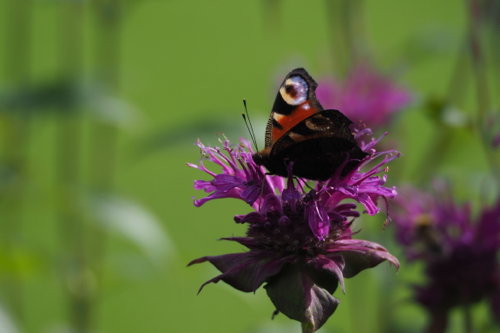
The Slovakian and Polish national summer pastime.

Sunday, July 30th, 2017

P7252885

We have just spent about three weeks in Slovakia and Poland, travelling to both the big cities and out-of-the-way places. (These posts will be available shortly)

One thing that struck us was the amount of ice cream that’s consumed in both these countries.

Eating ice cream is gender and age neutral and seems to happen at anytime of the day or night.

Families do it, teenagers do it, older people, office workers and even tradies do it.

Here are some of the people I snapped – doing it.

Along the Garden Route, Port Elizabeth
to Cape Town, South Africa. (November 2016)

Friday, February 10th, 2017

PB116494

Day 1, November 11: Port Elizabeth to Tsitsikamma National Park.

The weather had certainly changed for the cooler as we commenced our trip west, from Port Elizabeth to Cape Town.

The change wasn’t just in the temperature, as everything else seemed very different to what we had become used to in other parts of Southern and Eastern Africa.

The roads, shopping centres and housing were much more western and white faces much more evident.

And the internet worked.

We drove into Jeffreys Bay, the home of Supertubes, one of the world’s most famous surf breaks. It was made even more notorious when Mick Fanning was nearly taken by a Great White in the opening moments of the 2015 J-Bay Open.

Remarkably he returned to the competition in 2016 and won.

A drive along the shopping strip at Jeffery’s Bay is like being in Torquay, Anglesea or Lorne. There are surf shops, cafes and all forms of associated surf culture.

Brands like Billabong, Rip Curl and Quicksilver were all there.

It’s a pity they’re not Australian any more.

Continuing westward on the N2, past Storms River Gorge, our next stop was Tsitsikamma National Park to see the Grootboom or Big Tree. This massive yellowwood is believed to be around a thousand years old: about the time of the Norman conquest of England.

We spent the entire drive, from Port Elizabeth to Tsitsikamma, listening to Leonard Cohen.

It was November 11, 2016, the day we heard of his passing.

Thea, Hayden, Evan and I were great fans. Leonard’s music was often heard in our house and it played a big part in the soundtrack of our lives.

Our accommodation in Tsitsikamma was within the park and yet again we got given the honeymoon chalet.

What is going on?

The bonus wasn’t the king-size bed or the spa but the spectacular views. The accommodation consists of chalets and camp sites, all of them have sea views. However the ‘honeymoon’ chalet had a particularly good position with 180° views of the Indian Ocean crashing into South Africa.


PB126523

Day 2, November 12: Tsitsikamma National Park to Plettensnerg Bay.

We had planned to do the 3.5 hour Waterfall Walk in Tsitsikamma National Park.

That was cut short by rain.

The rain wasn’t so much the problem, but rather the rocks we had to scramble over to get there, became very slippery.

Tsitsikamma National Park covers about 80 kilometres of coastline and is a popular destination for visitors travelling along the Garden Route.

It was spring in South Africa and the wildflowers were in bloom.

We came across three Giant Green African Grasshoppers mating. Another sure sign that spring was in the air.

As the rain came down, I could hear our raincoats laughing at us from the back seat of the car – stupidly we had decided not to take them.

There was nothing left to do but to return to the visitor’s centre and console ourselves with a cup of coffee.

Then the sun came out.

Plan ‘B’ was to go on the Suspension Bridge Walk. This was very crowded but at least there was a boardwalk for the entire journey and no rocks to worry about.

When we returned to the visitor’s centre there was a group of Hyrax playing on the lawn.

They are very comical animals and seem to love life.


PB136670

Day 3, November 13: Plettenberg Bay.

We were told that very little is open on a Sunday night at Plettenberg Bay, but lunch is always available.

We decided to spend the morning at Birds of Eden free fight sanctuary. This was only a 25 minute drive away, so there would be time to visit before lunch.

It’s the largest single dome, free flight sanctuary in the world, inhabited by African species as well as birds from all over the world.

Many of the birds have been rehabilitated. We even spotted a galah called Rosie who had been rescued – in fact all the parrots in Birds of Eden are ex-pets.

Our lunch was at Equinox, a short walk from Swallow’s Nest, our guest house in Plettenberg Bay.

It was a contemporary restaurant, with great staff and excellent decor.

The food was very good as well.

If you’re a tourist in South Africa, it’s great value for money. We had a four course Sunday lunch for A$15 per head.

The bar prices for wine is also very inexpensive, with the average bottle costing around A$15.

Craft beer is again very reasonable, with a bottle of King’s Blockhouse IPA only costing A$4.

Equinox was right on Plettenberg Bay overlooking a large swell. Late in the afternoon a couple of surfers arrived and attempted to tame the waves. When the surfers left the birds moved in and then the Dolphins.


PB146751

Day 4, November 14: Plettenberg Bay to Knysna.

Unseasonable wet weather in the Western Cape kept us confined to short trips, or indoors.

It wasn’t a long drive from Plettenberg Bay to Knysna, our next stop. We therefore had time to do a bit of housekeeping.

Thea’s nails were in need of major reconstruction and my hair was looking rather scraggy.

The last cut was in Zanzibar.

I was told that the ‘Cutter’ was due in the salon soon.

A hour and a half later he turned up.

It was a Monday morning and I think he had slept in after a hard Sunday night. That’s if the energy drink he was downing was anything to go by.

This part of the drive would continue on The Garden Route, along the famous Route 62, and then onto Stellenbosch and the Winelands.

‘Coffee culture has come to the Western Cape.’ Well that was the theme in one of the many magazine articles I read while waiting for my haircut.

Knysna is on a narrow bay, fed by the Knysna River and surrounded by hills.

We were in Paradise, literally, as this was the name of the suburb we were staying in.

Before checking into Hamilton Manor, our guest house, we did a short circuit around the area.

Noetzie Beach in the Pezula Private Estate is a very weird place.

We had to drive for several kilometres, on dirt roads, to get there and our only access was to Noetzie Beach. The rest of the area was enclosed in electrified fences and large gates covered in razor wire.

The reason for the security are the ‘castles’ dotted throughout the the peninsula.

These are stately holiday homes, designed to look like stone castles, using the local rock and complete with turrets.

The strange thing is, that along the stretch of Noetzie Beach we could get to, they were sitting next to fibro-cement beach houses.

Quite a contrast.

Our next diversion was to Knysna Heads, the narrow opening to Knysna Bay.

On one side of the heads is a viewing area and housing while the other side is the Featherbed Private Nature Reserve.

The Southern Cape coastline is truly spectacular, with rugged rocks and a pounding Indian Ocean.

Parking is a strange affair in South Africa.

There are very few parking metres and the locals seem to control who parks where, for how long and at what cost.

There are official parking people or ‘car guards’ and they have a high-vis vest and identification to prove their authenticity.

Then there are the opportunists, who believe that there is money to be made by ‘pretending’ to be a parking official.

They may have a vest, of sorts, and no identification. They appear from nowhere, as soon as you approach a parking spot, and offer to “Watch your car, boss?”

For two reasons we decided to pay most of the people, official or not.

Firstly, in the hope that our car would be looked after and secondly, and more importantly, to give some money to the locals.

The suggested parking fee is somewhere between 20 and 50 cents Australian, so it wasn’t going to break the bank and it’s cheaper than parking metres.


PB156794

Day 5, November 15: Knysna to Oudtshoorn.

We drove along the N9 and then over the Outeniqua Pass and into Oudtshoorn, the Ostrich capital of the world.

We drove through the pass three times. All the best lookout points are on the right hand side, as you climb up through the pass, heading north from George. They are inaccessible from the left of the road, so we had to double back and then come down. Then of course we had to go through the pass again in order to get to Oudtshoorn.

There were two ostrich feather booms in South Africa, one between 1865 and 1870, the other between 1900 and 1914. The start of WW1 caused of the last boom to collapse. Fashion was the driver behind both booms and the price of the feathers soared. At one point during the first boom the value, per pound, of ostrich feathers equated to that of diamonds.

The town was named after Baron Pieter van Oudtshoorn, who became Governor of the Dutch Cape Colony 1772.

The town is full of grand old colonial homes, called ‘feather palaces’ that were built by the wealthy ostrich farmers, known as ‘feather barons’. There are also some magnificent public buildings such as the 1907 CP Nel Museum building and the NG Moedergemeente (Dutch Reformist Church) completed in 1879.

All signs of Oudtshoorn’s past glory.

There are similarities between cities in Australia such as Adelaide, Ballarat and Bendigo with Oudtshoorn. The difference is that Oudtshoorn made is wealth from feathers, not gold.

Parking was a different experience in Oudtshoorn. We arrived in the town just before lunchtime and decided to visit the museum first.

The temperature was on the rise again and there was no one around so we parked our car right out the front.

After touring the museum we walked a short distance to a cafe so Thea could get some lunch and I could get a coffee. When we returned to the car there were a few very dishevelled looking chaps hanging around the vehicles.

They made no attempt to even look like car guards and still expected me to pay for their protection, even though they had just turned up.

This lot went empty handed.

Craft beer, as well as barista coffee, is becoming very popular along the Garden Route.

I discovered Kango, a local craft brewery making a Larger and an IPA. Both are naturally brewed, the IPA was cloudy and both were very drinkable.

We had dinner at a local Italian/African, fusion restaurant.

The food was good, the wines inexpensive and the bill, so low that you wonder how its possible to make and serve a meal for that price.

What we didn’t know was that November was high season and the restaurants were full. We were told by our host to book in advance if we wanted a good one.

At the current prices I’m not surprised that many people are eating out.


PB166815

Day 6, November 16: Oudtshoorn to Hermanus.

This was going to be the longest drive on our trip.

We left Oudtshoorn at 10am and planned to have a coffee break on the way.

In Barrydale we discovered Diesel and Créme, a very funky cafe and western style bar serving good coffee, craft beer and an interesting menu.

It was in an old motor workshop and decorated with a eclectic selection of memorabilia, much with an automotive theme.

Very fitting being on Route 62.

Our drive to Hermanus took us over the Tradouws Pass on the R324. Again we drove both ways through the pass, as the only vantage points were on the return journey.

Hermanus is the whale centre of the Western cape and everything is geared to whale watching.

We had a drink at Coco, a very pleasant bar overlooking the Hermanus waterfront.

They even had binoculars on the wall, just in case you spotted a Southern Right Whale – we didn’t see any.


PB176909

Day 7, November 17: Hermanus to Stellenbosch.

All our accommodation in South Africa, apart from Stormsriver Mouth in the Tsitsikamma National Park, had been in ‘Guest Houses’. These are a fusion between a boutique hotel and a B&B. Many are built in old homes that have undergone extensive renovations to accomodate tourists. We always had an ensuite and the facilities were first class.

They are similar to the ‘Casa Particulares’ in Cuba.

The first recorded guest house was established in 374 AD by St Basil the Great, in Caesarea, (or Kayseri) Cappadocia, Turkey.

There are many benefits of staying in guest houses, such as personalised attention, quietness, lower cost and the food.

A guest house breakfasts was always a good way to start the travelling day.

The Gumtree Lodge in Oudtshoorn, prided themselves on their local produce. At breakfast there was local cheese, cold meats, chutneys and even single origin African coffee. In the evening the owner, Phil Putzel, even ran a little bar serving wine and craft beer, all locally produced.

Running a guest house isn’t without its problems, as we discovered in Hermanus. As we headed to breakfast at the Potting Shed Lodge, we discovered the owner, David, cleaning out the small pond next to the slightly larger swimming pool.

He was looking for a frog.

Apparently its croaking had kept the guests awake for much of the night and they weren’t happy.

On the way to Stellenbosch we made three diversions. The first was to the Harold Porter National Botanical Gardens at Betty’s Bay, then Stony Point to visit the penguins and finally Pringle Bay for coffee.

The botanical gardens is located between the mountains and the sea, with spectacular vistas of both. Then there’s the plants, a stunning array of indigenous flora that was in full bloom, all set in 10 hectares of cultivated gardens. There are about 1,600 plant species in the area, more diverse per unit area than any place on earth. We even discovered a critically endangered Geometric Tortoise wandering across the lawn.

African Penguins were originally called Jackass Penguin, due to their donkey-like braying.

They are the only penguin that breeds in Africa and can grow to a height of between 60 and 70cm. They have a distinctive pink gland above their eyes which is used for thermoregulation in the wildly changing temperatures of the southern oceans.

On the way back to the car park we came across a group of young Hyrax playing in the rocks.

At any age Hyrax are very cute.

At Pringle Bay the cafe offered Red Espresso. The waiter couldn’t explain what it actually was but I decided to have a double shot anyway.

It wasn’t coffee.

It’s made from ground Rooibos tea and then prepared in an espresso machine.

It has no caffeine.

Worth a try, but only once.


PB186941

Day 8, November 18: Stellenbosch.

In Stellenbosch the Hop-on Hop-off wine bus or Vine Hopper is the best way to visit some of the wineries, taste some wine and not get picked up for drink driving.

When we went to book the Vine Hopper we were told that it was full (remember this was November and the height of the tourist season).

Plan ‘B’ was to drive ourselves.

The company soon put on more buses so it was back to ‘A’ again.

The Vine Hopper offer three routes with seventeen wineries open for visitors. It was Friday and the Friday tour takes in the northern wineries – we visited four of them.

The Stellenbosch wine tours was one of the highlights of our South African adventure.

All the wineries we visited offered a unique experience, not just the wine but the ambience and location as well.

We followed the driver’s advice and had the full wine and cellar tour in Bergkelder, then wine tastings in Beyerskloof and Simonsig, followed by lunch in Delheim.

Like everything else we have come across as tourists in South Africa, generosity and value for money were key.

The tastings were a half serve in a full size wine glass. It was your choice how much you drank.

We soon learnt to pace ourselves.

There was no time limit or pressure to buy at any winery. The cost for five wine tastings averaged A$5 and the Vine Hopper bus was A$60 per person.

The bus gave us plenty of time at each location.

Each of the wineries strived to be individual and their marketing reflected this.

Bergkelder was ‘Following nature’s lead’ while Beyerskloof claimed to be ‘The home of Pinotage’. (Pinotage is a uniquely African variety of grape, being a hybrid of Pinot Noir and Hermitage vine stock). Simonsig, who first produced sparkling wine in South Africa was, ‘The Cuvée experience’ and Delheim, being out of town, was ‘Worth the journey’

Our wine regions in Australia, and possibly others around the world, could benefit from how Stellenbosch market their area.

Like the Yarra Valley and the Mornington Peninsula, Stellenbosch is close to a major city, Cape Town. Yet they offer a unique ‘wine experience’ with restaurants, accommodation and services all catering to the wine lovers.

Most people don’t do a day trip from Cape Town, to visit the wine region, they come and stay for a night or even two.

Apart from wine and tourism Stellenbosch is a university town and therefore has a thriving alternative culture.

After Cape Town, Stellenbosch is the second oldest European settlement in South Africa. It is situated on the Eerste River and is also known as the ‘City of Oaks’ due to the abundance of the trees that were planted by its founder Simon van der Stel in 1679.

Stel named the town after himself and Stellenbosch means ‘(van der) Stel’s Bush’.

The Dutch were excellent hydraulic engineers, which can be seen in Mill Creek, a canal that’s still runs down the main street.


DSC04893

Day 9, November 19: Stellenbosch to Cape Town.

After a bit of gift shopping in Stellenbosch we headed for Cape Town, the final stop in South Africa.

On the way we drove via the other Cape Wineland towns of Franschhoek and Paarl. We then did a brief tour, circling around Table Mountain, before arriving at the Verona Lodge, our guest house in Cape Town.

We walked down to the V&A Waterfront, as we did every night, and got our first view of Table Mountain.

This 3 kilometre level plateau overlooks, and dominates, the city of Cape Town. It also seems to be a barometer to the local weather. When the ‘tablecloth’ rolls over the top, the winds are strong and the temperatures are cooler and when the mountain is clear, then so is the weather. The tablecloth is caused by orographic clouds that are created when wind rolls up the the mountain from the south-east and runs into cooler air causing the moisture to condense.

Contrary to science, there is also the legend that the tablecloth is caused by a smoking contest between the Devil and Van Hunks, a local pirate. Van Hunks was a prodigious smoker and the contest has been repeated yearly since the early 1700s.

Breaking dishes will be a constant reminder of African restaurants. It happened at least once a night in the majority of restaurants we visited.

If it’s not the crashing of plates, then it is the clatter of cutlery.

The staff, on the whole, have been fantastic but they do have a total disregard for the hardware.

We were told by one waiter, after we heard yet another crash in the kitchen, that a glass has a lifespan of about one week.


PB206977

Day 10, November 20: Cape Town.

As we do in many cities, we took the Hop-On Hop-Off bus and explored Cape Town. There were four routes covering the city, coast and wine areas.

First we did the city and then the coastal route. The most memorable part of the city route was a drive through District 6. This is an inner suburb of Cape Town that was laid bare during the sixties and seventies. Over 60,000 residents were forcible removed by the apartheid regime in an attempt to stop racial integration.

The place has become a shrine with little development. All that remains now are vacant blocks of land covered in long grass.

After the bus we went walking around Cape Town. This took us past St George’s Cathedral, the Anglican church made famous by Desmond Tutu and his stance against apartheid. The role this church has played in the fight for democracy and the anti apartheid movement has resulted in it now being known as the ‘people’s cathedral’.

Next was the Company Gardens, started by the East India Company in 1652. The gardens were originally planted to provide fresh vegetables to the Dutch trading ships sailing between the Netherlands and the East.

The first wine produced in South Africa came from grapes grown in the garden.

South Africa is a very multi cultural country. Muslims, Malays, Coloureds, Blacks, Whites, Indians and others all form part of the demographic.

But it’s not very equal.

Wherever we travelled there was little sign of a coloured or black middle-class. Admittedly we might have been in the wrong areas but even in the restaurants and bars of the V&A Waterfront there were very few non-whites.

South Africa is also diverse, with a wide variety of cultures, religions, languages and ethnic groups amongst its 52 million people.

According to the 2011 census, Africans make up the majority with 79.2%, Coloured, 8.9%, Whites 8.9%,  Indian and Asian, 2.5%  and Others, 5%

Cape Town has a population of 3.74 million people with the white folk making up 15.7 %, a lot more than the South African average.

It’s no wonder that there seemed to be a lot more white faces there.

In the afternoon we discovered the South African Jewish Museum in Hatfield Street.

The Jewish story in South Africa is an interesting one.

It makes absolute sense that the Jewish community in South Africa played an important role in the dismantling of the apartheid system.

They know a lot about racial discrimination.

Jewish lawyers were the only whites willing to represent the ANC members charged with crimes against the state.

There was even one lone Jewish voice, in the all white parliament, during the apartheid era. Helen Suzman fought for thirteen years, from 1961 to 1974, to give the Blacks equal rights.


PB217011

Day 11, November 21: Cape Town.

The departure point to Robben Island, at the V&A Waterfront, is known as the Nelson Mandela Gateway – this sums up the tone of the trip.

In many respects it’s all about Mandela.

However the history of Robben Island goes back to the end of the 17th century, when the Dutch used the island as a prison for political prisoners.

The island has also been used as a whaling station, leper colony and quarantine station.

During the Second World War it was fortified and became part of Cape Town’s defences.

Due to wide spread pilfering of artefacts by the tourists, you don’t get much freedom to explore Robben Island. After the 45 minute ferry ride from Cape Town you are met on the Robben Island wharf by an armada of buses. From there you are taken around to the various sites, which you view from your seat on the bus before being taken to the main prison complex.

On the bus the commentary was informative and graphic. So much so that a middle aged African American woman, sitting near us, was reduced to tears after hearing the countless stories of atrocities committed on Robben Island.

The guided tour around the main prison area is given by former prisoners and again they painted a very grim picture of life there.

The highlight for most was seeing Nelson Mandela’s cell – this was his home for 18 years from 1964 to 1982.

This is probably the most photographed site on the island.


PB227030

Day 12, November 22: Cape Town.

On our final day in Cape Town we planned to go to Table Mountain.

And, as it has been for all our time in the city, luck was with us again.

The tablecloth had cleared, the sun was out and the wind had dropped.

The cable car had only just re-opened, after being closed for over a week due to bad weather.

We booked our tickets online and within an hour we were on the mountain. We even got a rare parking spot metres from the front of the cable car station.

Table Mountain is a constant backdrop to Cape Town. It’s only 1,084 metres high but dominates the city.

The views from the top are stunning.

Our host at the guest house, Sean, suggested that we walk to Maclear’s Beacon on the northern side then take the rim track, on the southern edge, back. It was a great suggestion and we had spectacular views in every direction.

Maclear’s Beacon is a large cairn on the highest point of Table Mountain. It was built in 1865 by the Irish born South African astronomer, Sir Thomas Maclear (1794-1879) to assist in measuring the curvature of the earth.

Our luck continued, as the clouds converged just as we neared the end of our walk.

In the afternoon we drove down to the Cape of Good Hope.

So it seemed, did everyone else.

The placed was packed with bus and car loads of tourist racing to get a snap of themselves in front of the sign post for the Cape.

The Cape of Good Hope is the most south western point in Africa. It’s the spot where ships coming, from Europe, start to travel more eastward than southward.

We then drove to the Cape Point Lighthouse and took the funicular to the top.

The wind was so strong that we had to hold onto the hand rails to stop being blown into the Indian Ocean of even the Atlantic.

We were in Cape Town for four nights and each evening we would walk to the V&A Waterfront for dinner.

It was a pleasant 30 minute walk and there was a huge range of bars and restaurants to choose from.

Getting back to our guest house wasn’t as straight forward, as we had to take a taxi.

There were plenty around but they weren’t allowed to stop and pick-up a fare.

Traffic was controlled by security guards, dressed like real police, they were everywhere.

Actual coppers were nowhere to be seen.

On three occasions we managed to be able to corner a cab, negotiate a price and get in before he was forced to move on.

On our final night guards were again controlling the traffic, this time there were more of them and they had bollards. They were only letting taxis in that were pre booked.

We finally found a rogue driver outside of the control zone and flagged him down.

He explained that the security company and the big taxi groups had joined forces to control the price and keep the independent drivers from working the lucrative tourist areas.

The whole thing smelled of corruption – he wasn’t happy.

He told us that they were charging 100 Rand (A$10) to take the tourists back into the down town area.

This was about a five minute ride.

Our trip with him was about seven minutes and we paid 50 Rand (A$5).

The V&A Waterfront has interesting history, in that the ‘A’ in ‘V&A’ doesn’t stand for Albert, as you might expect. It actually stands for Alfred, the second son of Queen Victoria. In 1860, as a 16 year old Midshipman in the Royal Navy, Prince Alfred visited the the Cape Colony and instantly became a hit with the locals. There is even a plaque on the waterfront commemorating the fact that he tipped the first truck of stone for the new waterfront breakwater.

Day 13, November 23 and 24: Cape Town to Melbourne.

It seemed fitting that on the flight from Cape Town to Dubai I watched the David Yates film, The Legend of Tazan. 

It was set in the Congo and nowhere near where we had been, but it was Africa.

Part 3: Namibia, Botswana and Zimbabwe.
Ongava Game Reserve, Namibia to Victoria Falls, Zimbabwe. (October/November 2016)

Wednesday, February 1st, 2017

PA295536

Day 19, October 29: Damaraland to Ongava Game Reserve via Etosha National Park.

We left Toko Lodge mid morning and headed to Ongava Game Reserve.

It was suggested that we not take the sealed road route, but rather go via the Galton Gate, in the west and travel through the Etosha National Park to Andersson’s Gate.

This was our opportunity to ‘self drive’ our own game drive.

It was a great experience.

We stopped at five of the eight waterholes and found each one to have its primary inhabitants. They happened to be the birds or animals who were there when we visited.

This could change very quickly, as a new species came in to take control.

The ‘Elephant’ waterhole or Dolomietpunt was the fist we came across and as the name suggests it was full of elephants cooling off. There were zebras and springbok but they couldn’t get close to the water.

The ‘Vulture’ waterhole or Duineveld had ostriches but was dominated by the vultures. There were also zebras and a lone giraffe waiting patiently in the background.

The ‘Ostrich’ waterhole or Nomab also had vultures – fittingly the surroundings were flat and stark.

Our fourth stop was at the ‘Oryx’ waterhole or Olifantrus. The oryx soon left when two bull elephants arrived and started flinging muddy water around. There were also ostriches, eagles, vultures and zebras, keeping their distance.

Our final destination was the ‘Springbok’ waterhole, or Ozonjuitji m’Bari, there were also elephants, ostrich and zebras.

PA305660

Day 20, October 30: Ongava Game Reserve.

Andersson’s Camp is inside Ongava Private Game Reserve and very close to Andersson’s Gate into Etosha National Park.

Ongava was created in 1991 when four non productive farms were combined. It’s 30,000 hectares and shares a common boundary with Etosha National Park.

We had arranged to do an afternoon game drive in Ongava so we spent most of the very hot day overlooking the waterhole that’s just metres from the hotel lounge.

There had been a few animals there the evening before but there was now a cavalcade of zebras, Black Faced Impalas, oryx, wildebeest and a giraffe.

The giraffe was so cautious approaching the waterhole, that it took over 1.5 hours from when it first arrived, until it spread its long spindly legs to take its first tentative sip.

It was good to have the animals come to us for a change.

Andersson’s Camp was named after Swedish explorer Charles Andersson (1827-1867) who was one of the first Europeans to expose Etosha to the outside world.

Andersson’s spirit for adventure was forged at a very early age, being the illegitimate son of an English bear hunter, Llewellyn Lloyd. (How many letter ‘l’s’ can a name have?)

All the lodges we have stayed in have been unique in their design, Andersson’s Camp was both strange and special.

The walls around the bathroom and toilet area were built from loose rock held together with a web of chicken wire. Inside there was also an additional covering of fly wire – just to stop the nasties from entering.

There was also a wide use of corrugated iron and raw timber.

The shower base was a large tin tub set into the floor and the towel rails were rough cut tree branches.

Yet there was the convenience of hot water, plenty of power outlets and an oscillating fan. There was even a small in-ground swimming pool.

Strangely there were no locks on any doors.

PA315812

Day 21, October 31: Etosha National Park.

We were now back inside Etosha National Park and took the road from Andersson’s Gate, in the west, to the von Lindequist Gate, in the east.

The park was proclaimed a game reserve in 1907 and became a National Park in 1967. Etosha National Park is 22,270 square kilometres in size and gets its name from the Etosha Pan, which is 4,760 square kilometres in area. Etosha means ‘Great White Place’.

We made twelve stops, detouring off the main road, over a seven hour period. Eight of them were at waterholes.

The weirdest stop was at the Etosha Lookout. This was a two kilometre diversion, onto the Etosha Salt Pan itself. The pan is so large that you get the feeling you can see the curvature of the earth. Then there’s the added sensation of seeing water on the horizon, this is only a mirage.

The waterholes were again the best places to view the animals – there was a huge variety. From the more common, like zebras and wildebeests to the exotic, like rhinoceros and even lions.

We also saw ‘White Elephants’. These were actually bush elephants that had been wallowing in the light grey mud of the Springbokfontein Waterhole and had dried off to a very light grey.

The waterholes have wonderful names like Gemsbokvlakte, Olifantsbad, Ondongab and Charitsaub.

I think you need to speak Afrikaans to pronounce them.

Our accommodation was just outside the park at Emanya@Etosha Game Lodge. This, by contrast to the earthiness of Andersson’s Camp, was an Apple Store – a vision of minimalism in white.

But form certainly didn’t follow function at Emanya@Etosha, as everything from the building design to the shower seemed to be at odds with practicality. The bathroom was larger than most bedrooms, yet I even had trouble fitting into the tiny shower cubicle, which was stuck in a corner.

But that didn’t really matter, as there was no hot water anyway.

The the strangest paradox was the offer of a foot spa and massage after you returned from your game drive in Etosha National Park.

You are forbidden from leaving your car in Etosha, so this treatment is totally unnecessary.

I am not usually this critical of hotels – they are what they are.

However Emanya@Etosha Game Lodge claims to be five star. Their brochure proudly boasts: “Explore the warm soul of the African bush from the supreme comfort of your sumptuous accommodation…”

Despite the starkness of the design, we were continually reminded that we were still in Africa. There were ostrich, kudus and even a group of Leopard Tortoises wandering around the grounds. Then there was a very active waterhole close to the hotel pool.

There is always a bright spot in any stay and apart from the animals around the waterhole, they served ice cold draught beer.

PB015859

Day 22, November 1: Etosha to Otavi Mountain Region.

This was our ‘est’ experience in Namibia.

Hoba Meteorite, the larg’est’ known in the world, was discovered by Jacobus Hermanus Brits in 1920.

It weighs approximately 50 ton, is 3 metres long and 1 metre thick. It struck the earth 80,000 years ago.

Having done over 3,500 kilometres on gravel roads it was strange to be back on bitumen.

Tar can be so boring.

Our only two, one night stops were at Emanya@Etosha Game Lodge and Roy’s Rest Camp in the Otavi Mountain Region.

They couldn’t have contrasted more.

Emanya@Etosha strove to be upmarket with a sleekness that verged on sterility. Also everything was impractical in its design.

While Roy’s, like Andersson’s Lodge, was eclectic, rustic and to my mind, far more reflected Africa.

The only thing that seemed to be at odds with the environment was the ‘House’ music playing in the bar.

That didn’t last long.

We arrived at Roy’s mid afternoon and the temperature was in the high thirties.

There was nothing to do but sit by the pool and jump in every now and then to cool off.

Wrecked cars seem to be a feature of the landscape in Namibia.

You see them by the side of the road, decorating the entrances to lodges or farms.

At Roy’s Rest Camp they were part of the architecture and built into the very fabric of the building.

PB025948

Day 23, November 2: Otavi Mountain Region to Okavango Delta.

We were now in the north east of Namibia.

It was no longer dry and hot, but humid and hot.

Our accommodation in the Okavango Delta was at the Ngepi Camp on the Kavango River.

Our room was literally suspended over the water.

There were Hippos in the river, just opposite our treehouse, and elephants, buffalo and warthogs on the far bank.

On our first afternoon in Ngepi Camp a herd of more than 25 elephants came down to drink.

We never saw them again.

The shower and toilet were outside and to get to them, we had to negotiate an open deck.

There was no guard rail, just a three metre plunge into the river if you got it wrong.

We made a pact with each other, that if one of us needed to go to the loo during the night, they would wake the other and let them know.

Apparently there are also Crocodiles in the river, so a midnight swim wasn’t advisable.

PB035991

Day 24, November 3: Okavango Delta.

It was a strange night at Ngepi Camp.

Apart from sleeping above the river, there was the added interest of strong winds and the constant threat of rain.

November is the start of the wet season and there are ever-building thunderheads in the sky. As the sun set in the west, the sky lit up in the east.

Then the thunder started.

All night it seemed to circle us but it never rained.

At some point during the night the thunder stopped, then at dawn the birds started.

It was a weird feeling being able to shower in the morning, while watching the Hippos wallow in the river just opposite.

I wondered how many other pairs of eyes were also looking at me.

Just over the river is the Bwabwata National Park, so it’s not surprising that there’s a lot of animal activity. It’s also an important migration route from Botswana to Angola for the African elephant. I guess the herd of elephants, that we saw the previous day, were on there way to somewhere else.

Ngepi Camp has a sense of humour.

It starts by telling you, as you are wending your way along the long approach, that; ‘You are nearly there.’

There are a variety of other signs, around the camp, that show a real sense of fun.

There’s a toilet block just near the hotel bar. Not unusually it had two entrances, male and female, however once inside it was actually one facility, with two toilets.

The one on the left was in grey with the toilet seat permanently bolted up. While the one on the right was decorated in pink.

My favourite sign was the one in front of the pontoon swimming pool, that’s actually in the river. ‘World’s 1st Hippo and Croc Cage Dive’

PB046012

Day 25, November 4: Okavango Delta to Caprivi Strip.

We took the B8 or Trans Caprivi Highway across the Caprivi Strip to Camp Kwando.

This was through the Bwabwata National Park which was full of signs warning us of Elephants.

We didn’t see one.

Camp Kwando was on the Kwando River, which is the border between Namibia and Botswana.

Our view was of another country and our next destination.

The Caprivi Strip or ‘panhandle’ is the finger of land in north east Namibia that borders Botswana, Angola and Zimbabwe. It’s the only place on earth where four countries intersect.

Variations on the colour khaki are everywhere and on everything in Southern Africa. Tents, furniture, guides uniforms, vehicles and especially tourists. They are all decked out in it.

The French and Germans tour groups love to get into the African experience with a uniform of khaki hats, shorts, T-shirts, shirts, boots and sox.

There’s more khaki than you’d see in Puckapunyal during a graduation day ceremony.

I somehow can’t see them wearing it in Paris or Berlin once they return home.

The layout of Camp Kwando was very simple and it worked.

There were three circular areas, under thatched roofs, that were linked by a boardwalk.

In the centre was reception and a lounge. To the right was the dining area and to the left, the bar.

All this faced the Kwando River.

Large seed pods were continually falling around the lodge area, dislodged either by wind or the Grey Lourie Parrots or ‘Go Away Bird’ that were everywhere.

PB056138

Day 26, November 5: Kwando River on the Caprivi Strip.

We had booked a boat trip on the Kwando River in the afternoon, so the morning was spent sitting on our veranda, watching the river flow past and the seed pods dropping.

This was our last full day in Namibia so it was great to be able to reflect on what we had seen and done.

We had been hoping to take a dugout canoe or mokoro through the backwaters. Unfortunately this wasn’t possible as the drought had reduced the water level so much they weren’t passable.

The bird life around Camp Kwando was relatively active but animals sightings were sparse.

I saw a lone buffalo on the Botswana side but not much after that, until we did the river cruise.

The buffalo was an old bull that had passed his used by date and was now destined to wander the rest of his days alone.

Life in the wild it tough. There’d be no retirement, surrounded by family and friends for him.

Kwando is a river that flows both ways. Like the Tonlé Sap in Cambodia, it’s flow changes direction from the wet to the dry season.

Elephants are destructive, but they need to be.

Much of the deforestation that we had seen is all part of the ecosystem in Southern and Eastern Africa that can be attributed to elephants. They tear down the trees for food, which then allows grass to grow, providing food for grazing mammals.

Our guide for the afternoon river cruise was Hidden (not a typo but his real name). He lived in a local village and told us that many of the backwaters were now too shallow to use, even for the locals.

We bottomed out a number of times, even on the main river. At one point I wondered if it was the river bed we bumped over or a submerged hippo.

There was large amounts of floating reeds in the river, again caused by elephants. And again beneficial, as it helps the plants to proliferate by dispersing them downstream.

Our second night at Camp Kwando was jut as hot and humid as the first.

It was uncomfortably warm in the dining area even though it was outside. The problem was that there was no ventilation in the thatched roof.

There was nowhere for the hot air to go.

Using convection, the Egyptians discovered natural air conditioning, with ‘Windcatchers’, around 1,300 BC. I was beginning to wish that the concept had travelled south.

PB066151

Day 27, November 6: Kwando River on the Caprivi Strip to Chobe River, Botswana.

We took the longer, more scenic, route to Katima Mulilo along the C49. The road had recently been sealed, so the drive was easy.

The border crossing between Namibia and Botswana was painless. The main concern was bringing a foreign registered vehicle into the country.

Fortunately our paperwork was all in order.

We saw so many road signs, warning us of elephants, in Namibia but never sited one.  It was therefore ironic that as soon as we crossed the border into Botswana, we saw elephants by the roadside.

But there were no signs anywhere.

Our accommodation was in the Water Lilly Lodge, an older style hotel in the centre of Kasane and right on the Chobe River.

Kasane has a Spar supermarket and therefore ranks as very sophisticated, according to the office staff at our last stop, Camp Kwando.

Our room looked right onto the pool which was very inviting in the 35°C heat. There was also a 35 meter high pole next to the hotel buildings and I wondered what it was.

Then it struck me, it was a lightning conductor.

A useful feature, considering the thunderstorms we had had over the last few days. And essential, knowing the hotel roof was thatched.

PB076340

Day 28, November 7: Chobe River, Botswana.

Through the hotel we booked a morning game drive in the Chobe National Park. It started at 5:30am as this is the best time to see the animals.

The most interesting part of this drive was that we spent a lot of time on the Chobe River, the border between Botswana and Namibia.

The river backdrop made the photos different to what we had experienced.

Chobe National Park is 11,700 square kilometres in area, which gives the animals plenty of places to hide and avoid the nosy tourists.

We did see lions, elephants, hippos and a rare Sable Antelope.

There were also hundreds of impalas. These are known in Chobe as ‘McDonalds’, as they are fast food for lions.

Young Impalas are born at the same time each year, at the start of the rainy season. They have the amazing ability to be able to control the gestation period and choose when to give birth.

As well as the morning game drive we had also booked an afternoon game cruise.

Our boat contained a mixture of nationalities. Two Spanish girls, a Dutch couple, three from Japan and the two of us.

Of course English was the language of conversation.

The Chobe and the Kwando are in fact the same river, with the direction of the flow influenced by the seasons.

Like the morning drive, the afternoon boat trip offered a very different perspective for game park photography.

Again the river aspect was the focus.

The Chobe River and Chobe National Park are a very important tourist attraction in Botswana.

This means lots of tourists. It was crowded in the park in the morning and just as busy on the river in the afternoon.

Looking over the Chobe River into Namibia we could see plumes of smoke rising into the sky. This was coming from the crop burning, that happens just prior the wet season.

I have always wondered why a shot of a hippo yawning was so special. That afternoon, on the Chobe River, I discovered that the ’yawn’ is actually a bull trying to assert his dominance over the herd.

We started the day with a sunrise and ended it with a sunset.

In Africa both are spectacular.

PB086367

Day 29, November 8: Chobe River, Botswana to Victoria Falls, Zimbabwe.

Our Toyota was ‘repossessed’ by a driver from Autovermietung Savannah CC, who would be taking it back to Windhoek.

He would only take a day to get back.

We then were driven to the Zimbabwe border. Unfortunately a group of French tourists got there just before us.

This border crossing was in stark contrast to the one coming into Botswana.

There twenty people to be processed by two officers who seemed to do everything manually and in triplicate.

Then that paperwork was passed on to another guy who actually put the visas in the passports.

As we intended to walk across Victoria Bridge to Zambia at Victoria Falls we bought ‘double entry’ visas.

This made things even more complicated.

The drive to Victoria Falls was through the Zambezi National Park. There wasn’t much activity, just a few Elephants crossing the road.

It was very hot when we arrived in Victoria Falls, about 36°C. We were staying at Amadeus Gardens, a guest house that was a little too far out of town. Stupidly we walked into Victoria Falls township in the heat, there we found the Shearwater Cafe.

They had an espresso machine and a contemporary menu, which included the obligatory serving of ‘wildlife’.

The Shearwater Group seem to own most of Victoria Falls. Their name wasn’t only on the cafe but on just about every other tourist activity in the area.

At the recommendation of our hotel, we went to the Victoria Falls Safari Lodge for dinner. Even though it was very close to our hotel, it was suggested that we take a taxi there, as most of the backroads in Victoria Falls are closed after dark.

Apparently ‘wild animals’ still wander the streets at night. I wondered what wild animals they were referring to.
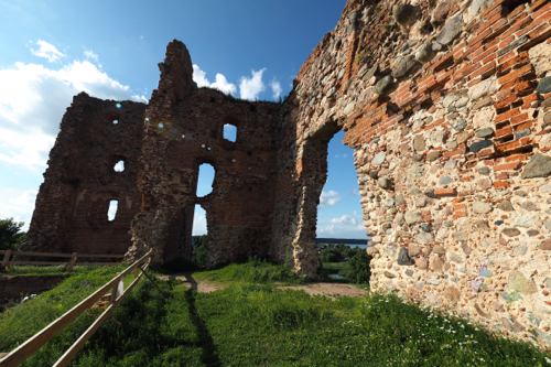
The Victoria Falls Safari Lodge is built on a plateau, overlooking Zambezi National Park. Here you can watch the animals coming down to the waterhole, while you are also having your evening drink.

PB096392

Day 30, November 9: Victoria Falls, Zimbabwe.

Due to hyperinflation in the 1990s, the Zimbabwe government stopped printing their own currency in 2009. They now only use US Dollars.

This has its issues.

One is that the smallest denomination is one dollar – you never get change smaller than that and every bill seems to come to an even dollar.

The next day we walked back into the Victoria Falls township and found a much shorter route. This was good as the temperature was skyrocketing into the high thirties again.

Visiting Victoria Falls was the main objective of our time there, that and having High Tea at the Victoria Falls Hotel.

We had a long walk along the falls, unfortunately many of the attractions were lacking water, due to drought – we were still the dry season

November in Zimbabwe sees the lowest water level and the hottest temperatures.

There are 16 viewing points along the length of the falls and we stopped at them all but didn’t necessarily take snaps.

Victoria Falls or Mosi-oa-Tunya (the indigenous Tonga name meaning ‘The Smoke that Thunders’) is on the Zambezi River and borders Zambia and Zimbabwe.

In 1855 David Livingstone was believed to have been the first European to discover the falls while on his quest to find the source of the Nile River. He named his discovery in honour of Queen Victoria of Great Britain. There is a statue honouring Livingstone’s achievements at the start off the Falls Walk.

Victoria Falls, along with Niagara Falls in the US and Argentina and Brazil’s Iguazu Falls are regarded as the world’s premier waterfalls.

Victoria Falls was designated a UNESCO World Heritage Site in 1989.

The Victoria Falls Bridge is at the end of the 16th viewing point. It crosses over the Zambezi River and is the border post between Zimbabwe and Zambia.
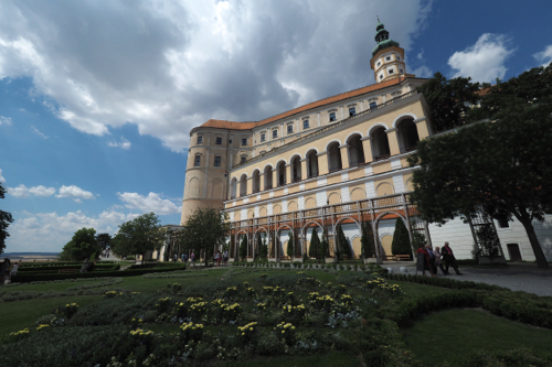
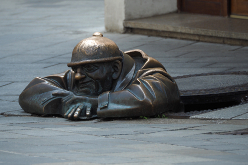
The bridge is designed as a Parabolic arch and completed in 1905, with a total length of 198 meters and a hight of 128 meters.

It was conceived by Cecil Rhodes, who founded the southern African territory of Rhodesia. His dream was to: “…build a bridge across the Zambezi where the trains, as they pass, will catch the spray of the Falls.”

Unfortunately there was no spray that day.

Later that afternoon we walked to the Victoria Falls Hotel for High-Tea on Stanley’s Terrace.

This overlooks the Second Gorge and the Victoria Falls Bridge.

We decided not to have either tea or coffee with our tiered platter of sandwiches, cakes, and Devonshire Tea.

It was far too hot.

I did have a wine and Thea, keeping with British Colonial tradition, had a gin and tonic. After our High Tea we sat on the lawn and watched the warthogs playing on the grass, while security chased away the pesky baboons.

The Victoria Falls Hotel was built by the British in 1904 and was originally designed to house workers from the Cape-to-Cairo railroad. The property is still owned by the National Railways of Zimbabwe but is now a luxury five star hotel.

When we returned to our hotel, which certainly wasn’t five star, there were a group of Americans having a drink around the pool.

I think they were drowning their sorrows, as Donald Trump had just been elected.

We all agreed that we would remember where we were that day. Just as we had when the news broke about the assassination of JFK, Chernobyl and 9/11.

It was another world disaster.

Day 31, November 10 – Victoria Falls, Zimbabwe to Port Elizabeth, South Africa.

Our flights from Victoria Falls to Port Elizabeth, via Johannesburg, was in Business Class.

This wasn’t our choice.

It was the only flight we could get and it cost us more than our Emirates flight from Cape Town back to Melbourne.

Determined to make the most of the expense we went in search of the Business Class lounge, as soon as we checked in at Victoria Falls International.

It was closed.

The lounge in Johannesburg was open and very full.

I allowed myself one beer, as I had to drive, once we got into Port Elizabeth and picked up the rental car.

So much for flying Business Class.

We arrived in Port Elizabeth and the temperature had plummeted 20°C to 16°C, it was also raining.

After getting the hire car we went straight to the Admiral’s Lodge Guest House.

As they didn’t serve dinner we had to quickly find somewhere to eat.

The closest place was a drive away which was a pity because Charlie’s served excellent Craft Beer.

Yet again that day I was restricted to one glass.

Part 2: Namibia, Botswana and Zimbabwe.
Helmeringhausen to Damaraland, Namibia.
(October 2016)

Tuesday, January 24th, 2017

PA204800

Day 10, October 20: Helmeringhausen.

Being located on a working farm there isn’t much to see around the Helmeringhausen Hotel. We therefore, on the suggestion of the hotel proprietor, made a short road trip on our day in the area.

This turned out to be around 250km.

This was a circuit from Helmeringhausen down the C13 to the D707 then clockwise back via the C27.

The countryside was varied, starting with outcrops of boulders along the C13, through red desert along the D707 and then past the Tirasberg Mountains. At the junction with the C27 we headed east again, back to Helmeringhausen.

The mountains certainly influenced the weather as there was a build up of clouds and virga (rain falling but evaporating before reaching the ground) on the higher peaks.

Our constant companion, while driving on the gravel roads, has been a rooster tail of fine dust.

This changes colour according to the material the road is built from.

We have had reds, light grey, dark grey and black.

It gets into everything.

The Helmeringhausen Hotel boasts ‘The best apple cake in Namibia’ and they have T-Shirts, and a sign out the front, promoting their claim. Yet it’s never the dessert that’s part of the evening’s fixed menu.

You have to order it separately, at an extra cost of course.

Don’t you just love marketing.

What’s not promoted and a missed opportunity for the hotel is the ‘Sundowners’ walk. Just behind the hotel is a hill with a well laid out path to the top. There you get great views of the surrounding landscape and, more importantly, the setting sun.

There were six of us up there the night we went, all wishing we had taken a drink to celebrate the sunset.

I am sure the hotel could have provided a bar service, as well as snacks.

After all there was no shortage of chefs.

PA214876

Day 11, October 21: Helmeringhausen to Sossusvlei.

We drove north up the C14 then turned west on the C19 towards Sossusvlei.

Again there was a dispute between the TomTom and MapsME, in regard to the distance we had to travel.

This time the TomTom won.

Sossusvlei is in the Namib Desert, one of the world’s oldest. It stretches for nearly 1,000km along the Atlantic coast.

Sossusvlei is one of the easiest places to access the desert and our hotel, the Sossus Dune Lodge, was surrounded by it.

There was a rocky ridge behind our room and a vast expanse of the Namib Desert in front.

At check-in we received yet another baboon warning, telling us not to leave any windows or doors open. After our experience at the Ngorongoro Crater Conservation Area, everything remained shut.

Why we were booked into the honeymoon suite I have no idea. It was about as far away from the office, restaurant and bar as you could get. Our area was huge and it even had a swinging day bed at one end of the wide veranda.

Being in the heart of the desert the winds ebbed and flowed, gently rocking our day bed. This was a wonderful vantage point to take in the spectacular desert scenery.

In the late afternoon we headed out to explore the famed dunes of the Namib Desert, especially Dune 45.

This is what’s called a ‘star dune’ and gets its name from the fact that it’s 45 kilometres on the road that connects the Sesriem Gate and Sossusvlei. It’s made up of 5 million year old sand that was accumulated by the Orange River and came from the Kalahari Desert, then blown into the Namib Desert.

As the sun sets, one side of the dune is thrown in shadow, while the other side glows bright orange.

I can understand why Dune 45 is the most photographed dune in the world.

As tourists we tread gently.

Whatever country you travel in, it isn’t yours, unless you live there of course, you therefore need to be mindful of offending people.

Some tourists believe it’s their right to demand. It could be what they want to eat, what language they want to speak, or even where they want to sit.

These people are rude.

We witnessed one such couple rearrange a table for four, at a window seat, just to suit themselves.

Everyone in the restaurant looked on in disgust. Especially those who had taken the tables for two, that were not by the window.

Ironically the light vanished within minutes of them sitting down, so they had no view anyway.

As it turned out the couple were celebrating a seventieth birthday and the restaurant staff made a big fuss, giving him a very large birthday cake.

It was so large that they shared it with the other diners in the restaurant.

We felt that our judgement of them may have been a little harsh.

That’s until we bumped into them again the next day – they were just as obnoxious.

Our first impression was the right one.

PA224986

Day 12, October 22:  Sossusvlei.

We ordered a packed breakfast from the hotel and headed out just before dawn.

It was hazier, with more cloud around, so the photos weren’t as striking as we had taken on the previous evening.

When we reached the end of the 60km stretch of paved road, we went for a walk in the dunes.

Despite the fact that the car park was full of people, 4WDs, buses and safari vehicles, the dunes were surprisingly quiet.

The light had improved and there was a real contrast between the orange dunes and the bright blue sky.

Our only companions were three Oryx grazing in the distance and the occasional lizard scurrying over the sand.

Our next move was a mistake.

We took the shuttle down a 4WD track to see more of the dunes.

So did everyone else.

There were hundreds walking and climbing over the dunes and along the dry river bed.

It was like Kurfurstendamm on a warm summer’s evening, complete with the chatter of Deutsch.

Then, when we decided to return to our car again, so did everyone else.

The shuttle bus drivers never stopped at the same spot, to drop-off and pick-up passengers.

This meant that random groups of people gathered where the last bus made a drop-off.

However they never stopped there.

There was a further complication, in that some of the buses went an extra kilometre down the road to the end of the track – so we never knew where they were going to end up.

Again there was no obvious pattern, so we decided to get on any bus we could, and stay on it until we eventually got back to the car park.

This strategy worked and we had the bonus of doing the full circuit and seeing the last of the Sossusvlei Dunes.

With all the confusion I wished I had taken the Toyota and driven myself, that’s until we saw two 4WDs up to their axils in sand.

Our hotel, the Sossus Dune Lodge, was one of the first lodges to be developed by the Namibia Wildlife Resorts in 2007.

It is literally perched above the Namib Desert.

The lodges, walkways, restaurant and even the pool are all built on stilts. The only footprint left by the lodge are the holes in the desert floor.

Just as we arrived back from our drive in the dunes, a tour bus came out of the dust and heading for the Sossus Dune Lodge.

At dinner we found out it was a Chinese tour group.

Now Chinese tourists are very valuable to a hotel, they can also can be very disruptive, as ‘they want it and they want it now.’

There were 24 in the group and they returned to the restaurant at 8pm, after a sunset tour, looking to be fed. It took well over an hour for them to be served, yet they consumed their meals in less than 20 minutes.

There has to be a more efficient way to service their needs.

If the Namibia Wildlife Resorts want the Chinese tourists they’ll have to do better than that.

PA235008

Day 13, October 23: Sossusvlei to Swakopmund.

Continuing on the C19 we now headed north.

About 70km from Sossusvlei is the tiny town of Solitaire.

It was suggested that we stop there as they have a good bakery and an espresso machine.

The cake was better than the coffee.

There was no parking in front of Moose McGregors Desert Bakery, so everyone parked under the two trees that were conveniently out the front.

A much better option, considering the temperature was now around 34°C.

It was a rather long, 375km, drive from Solitaire to Swakopmund and the terrain became flatter and dryer with little vegetation.

We hit the Atlantic at Walvis Bay and drove to the Walvis Bay Lagoon to see the flamingos.

There were a lot.

They were the Lesser Flamingo and not surprisingly, smaller in size to the Greater Flamingo.

When we got out of the car to take some snaps, we found that the temperature had plunged about 20°C.

Walvis Bay plays an important role in the oil and gas industry as well as being a vital port for Namibia. It is also growing in tourism and is the second most important coastal resort town next to Swakopmund.

When we arrived in Swakopmund it was as quiet as a church mouse on a Sunday. About the only thing that was slower was the internet in our hotel.

After wandering around the town and finding nothing open we returned to the hotel.

Not surprisingly it was very busy, as everything else was shut.

The Anchor Point Restaurant, within the Swakopmund Beach Hotel, has an interesting history.

It’s named after three rather ornate brick structures that are just outside the hotel. These were anchor points for an 86 meters high communications tower that was used by the Germans during WW1. This transmitter was a vital radio link to Lüderitzbucht, Windhoek and Berlin. In 1914, when war broke out in South West Africa, the local German military destroyed the tower, fearing it would fall into enemy hands.

PA245061

Day 14, October 24: Swakopmund.

Our hotel was right on the junction of the Atlantic Ocean and the Swakop River.

The river was the boundary between the town and the desert.

On our first morning we couldn’t see much as the fog had rolled in and visibility was down to a few hundred metres. This is caused by the hot desert air running headlong into the sea breezes from the cold, moist Atlantic.

Swakopmund is the second largest town in Namibia and the resort capital. It remains cool when the rest of inland Namibia boils.

There is 1,570 kilometres of coastline in the west, stretching from the Kunene River in the north to the Orange River in the south. The coastline north of Walvis Bay is referred to as the Skeleton Coast and most of it is desert. The entire Namibian coastline has been designated as a national park. In fact the Namibian government has become a trailblazer by using tourism to fund conservation.

Walvis Bay and Swakopmund are an oasis of cool sea breezes and Atlantic swells in the otherwise dry south.

We spent the day walking around Swakopmund, meandering through the wide ordered streets.

It was good to get some exercise – we walked over 14km that day.

The fog lifted by late morning but then settled again. However by the late afternoon it was gone completely and the sky was blue.

The air was still chilly and we kept our jumpers on.

There are number of good examples of Colonial German architecture from the early 1900s in Swakopmund.

There’s the Evangelical German Lutheran Church, built in 1912. Just over the road the Namib High School, built a year later in 1913.

The best for me was the former railway station, or Bahnhof, built in 1901 and now the five star Swokopmund Hotel.

The large in ground pool sits on platform one, where the locomotives once chugged in and out of the station, bringing holiday makers from Windhoek.

In the evening we decided to go German and visit the Swakopmund Brauhaus.

We were lucky we set off early as the place was fully booked.

Monday night was almost as quiet as Sunday and there were only a few places open.

Those who knew had booked the Brauhaus in advance.

We did get a table but were told we had to be out in an hour and a half. However with some clever table manipulation by the staff, we got to stay longer.

The Swakopmund Brauhaus was very German, like a small slice of Bavaria in the heart of the Namib Desert. They served hearty German fare and a great variety of German draught and bottled beer as well as German and South African wines.

PA255105

Day 15, October 25: Swakopmund to Brandberg.

The sea mist was back the morning we left Swokopmund.

It is truly a different part of Namibia, in all aspects. The architecture, the people, the Atlantic and of course the weather.

The drive to Brandberg White Lady Lodge was relatively easy, although there was some confusion as to where it actually was.

For the first 70 km after leaving Swokopmund we were on a sealed and then a salt road.

We had experienced this surface coming into the coast at Walvis Bay and it was a surprisingly smooth ride.

Namibia has more than 44,500 kilometres of roads and they are regarded as some of the best in Africa. There are only 288 kilometres of salt roads, which are limited to the Atlantic coast, inside the mist belt. These road are constructed from concentrated salt water and a gypsum-rich material.

Over half the roads in Namibia are a standard gravel road, covered with imported gravel.

When we arrived in Brandberg White Lady Lodge there were signs warning us of the dangers of Desert Elephants – the place is apparently famous for them.

Was this going to be the same as Sossus Dune Lodge, where were warned about the Baboons but never sighted one?

The White Lady Lodge is named after the famous cave paintings that were discovered in 1918 by the German explorer Reinhard Maack. They are in the Brandberg Mountains, not far from our hotel.

There is significant conjecture as to the origins and authorship of the paintings. The current theory is that they were created at least 2,000 years ago by the bushmen or San People.

The ‘White Lady’ is not a woman at all but a medicine man, with painted legs and performing a ritual dance.

In every place we have stayed the layout, style and ambience have been unique. The Brandberg White Lady Lodge was no different.

It was divided into three distinct areas: The restaurant, bar and swimming pools were the hub, then about 200 metres into the bush were the stand alone chalets, where we were staying. There were seven of these, spread throughout the bush and all under trees. The trees kept the room cool and also provided shade for our car. Within this area there were also two sets of seven rooms apartments.

The third area was for the campers. There was a combination of tented camps and camp sites. These were set around the dry beds of the Teisen and Ugub Rivers.

All this was set against the backdrop of the Brandberg Mountains.

Brandberg or Fire Mountain is Namibia’s highest peak, with its zenith, the Königstein or ‘King’s Stone’, 2573 metres high.

It was a hot, dry and dusty environment, that was both hostile and stunning.

Power for our chalet came from a 12 volt battery that’s charged by a solar panel that was just outside. While the hot water was provided by a solid fuel boiler, that was behind a high stone wall next to our chalet – it was lit twice a day.

There was no WiFi or connectivity of any sort. If you needed to charge your devices you had to take them to the main lodge area, where there was a generator.

Dinner was served at 7:30 so we went up to the lodge to have a pre dinner drink at the bar.

We were alone.

Everyone was up on the hill, behind the bar, at the ‘Sundowners’ seats.

We didn’t bother. I think we have become a little blasé about sunsets, as we get one most nights in Sandringham.

PA265141

Day 16, October 26: Brandberg.

In the morning we headed out to visit the site of the White Lady rock art.

This is only one of a reported 40,000 individual pieces that are on Brandberg Mountain.

The art in the caves vary from 2,000 to 5,000 years old.

The White Lady was name as such by the French anthropologist Henri Breuil in 1929, believing the art could have been painted by Phoneticians from the Mediterranean. The headwear was very similar to that worn by Egyptian women.

This theory has since been discounted.

The organisation of the cave walk was very well done. Firstly we were checked in and had everything explained to us. Then we were given a guide for our 45 minute walk to and from the cave.

Marcus could talk and didn’t stop chatting the entire time.

On the way there we were in constant lookout for the elusive Desert Elephant.

Native Africans have a very well developed fear of elephants, more than any other animal it seems. We noticed this in Kenya, Tanzania and now in Namibia.

There’s were plenty of smelly signs that elephants were in the area and it was only when we arrived at the cave did we actually see them.

They should be really called ‘Rock Elephants’ as they were perched on a rocky ledge, over the dry river bed that was opposite the cave.

We heard them before we saw them, as they were snapping off tree branches for food.

All along the track to the cave the trees had also been devastated by the hungry mammals.

Camp gossip told us that there might be more elephants up the dry river bed, not far from the lodge.

So in the afternoon we headed off, hoping that my limited 4WD experience would get us through the sandy river bed.

We gave up on the elephants after travelling 6km up the river and turned around. Then we sighted two on the river bank – one was giving himself a sand shower, while the other was asleep under a tree.

Dinner is a fixed menu with an entrée, main course and desert.

There is little variation.

There was a family of seven, mum dad and five children, ranging from five to fifteen.

All the family were served the same meal as everyone else and it was interesting to watch them divide up the food. In the end all the appetites seemed to be satisfied.

I guessed they had done this before.

At the end of dinner the staff put on a performance. On our first night there were fifteen of them and on our last, seven.

The size of the ensemble is determined by how many guests they have to serve.

PA275167

Day 17, October 27: Brandberg to Damaraland.

There was no water in our chalet on our last morning. We went outside and discovered our hot water service lying on its side, with all the connections broken.

After reporting it to the staff, we were told to shower at one of the campsite facilities.

When we got back to our room after breakfast there was a guy there repairing our broken water heater.

He explained that the damage was done by an elephant looking for water – they can smell it.

Apparently this happens all the time.

In the end we didn’t see the Desert Elephants in the camp but knew that they had been there.

It was a long drive from Brandberg to Damaraland, as we had to make two diversions.

One to the Petrified Forest and the other to the San rock engravings at Twyfelfontein.

The Petrified Forest is an area of land where 280 million years ago large pine trees were washed into Namibia from Central Africa.

They were subsequently covered by alluvial sand. Deprived of oxygen, they couldn’t rot and over millions of years underwent silicification, fossilised, and subsequently turned to stone.

Almost of as much interest as the trees, was the Welwitschia. This is ancient plant that taps water from the coastal fog. If can live for hundreds of years and is considered a living fossil.

The rock engravings at Twyfelfontein date back 2,000 to 2,500 years but the site has been inhabited for 6,000 years.

The area was made Namibia’s first UNESCO World heritage site in 2007.

The most famous is the ‘Lion Man’ engraving. This depicts a lion with five human like toes on its feet and one on its tail.

This is believed to be a depiction of a Sharman or Witchdoctor’s dream of his afterlife form.

The image of the lion is a cross between an animal and a man.

A lot of the rock art was created to be as much educational as spiritual. Many engravings were designed to teach current and future generations about the bush, animals and where to find water.

They were like a ‘blackboard’ of information on learning about nature.

There was one particular engraving of an ostrich with four heads. This was a form of animation that depicted the ostrich standing then lowering its head to drink. The direction the bird faced indicated where water could be found.

The name Twyfelfontein means ‘Doubtful Spring’ in Afrikaans. It was used by a German settler, David Levin, to describe the place. He didn’t believe that the water from the local spring could sustain his cattle. Levin’s friends started to call him David Twyfelfontein or David Doubts-the-spring.

The name stuck.

Because of our diversions it was 3pm before we started the drive to Darmaland. And as usual there was confusion between the TomTom and MapsME as to how long it would take.

However the difference wasn’t as large this time.

It was going to be a long drive whatever device we used. And all of it, apart from two short stretches, was in gravel roads.

The benefit of travelling on dirt roads is that you can see vehicles coming, way before they get to you. The plume of dust is visible, even if the car isn’t.

We covered about 500 kilometres that day, so my evening beer was very welcome.

PA285292

Day 18, October 28: Damaraland.

We were staying at Toko Lodge in Damaraland. Now Toko is the local word for Hornbill and they were everywhere.

Their squawk woke us up at five and just to make sure we were awake, they then knocked on our window at seven.

There is plenty of food for them, both indigenous and provided, so they naturally hang around the hotel.

The birds and animals took it in turn to eat at the feeding points.

In the morning the Tree Squirrels were there, they were replaced by the Hornbills who grazed all day. In the evening the Guinea Fowls then waddled in for a meal.

After breakfast one of the staff told us that there was a problem with our car.

Fearing the worst we went to have a look. As It turned out we only had a slow leak in the right rear tyre and it was soon repaired.

The staff operated like a Formula One pit crew. The problem tyre was soon off the Toyota and replaced with one of the spares. Then they found the cause, it was part of a valve shaft that had imbedded itself through the rubber. Once that was fixed the original tyre went back and then they gave our vehicle a bonus car wash.

All this cost us the equivalent of A$5.

As it turned out this was the only issue we had in the entire 4,800 kilometres of our Namibian road trip.

Just down the road from the lodge is a Himbas Village and we decided to do the village tour.

The Himbas people actually come from an area that’s about 300 kilometres north of Damaraland and that’s where they graze their cattle.

Traditionally they were nomadic but these days the women and children live in the village, while the men stay with the cattle.

The Himba are traditional people who escaped being converted to Christianity by the zealots of the German Colonial Missions.

The women are topless and don’t bath. They use a combination of perfumes and smoke, infused with herbs, to cleanse and beautify themselves. They also rub ochre on their skin as another form of beauty treatment.

Their traditional clothing, like belts, anklets, loincloths and headwear all holds spiritual or social significance.

There were single women, mothers, babies, young children and an assortment of small farmyard animals. Often some of the teenage girls have to stay at home, rather than go to school, to learn the Himba ways.

I only sighted one male – I guess the rest were off tending the cattle.

Some of the tourists came laden with Chupa Chups for the children. It wasn’t long before there was a small white stick hanging out of every mouth in the village.

I am sure that that the kids could have been given a more appropriate gift than sweets.

At the end of our visit we were given a very enthusiastic performance of singing and dancing as well as an opportunity to buy souvenirs.

We bought a small carved African Elephant. The tusks were made from the lollypop sticks, so at least they were being put to good use.