Archive for January, 2017

Part 2: Namibia, Botswana and Zimbabwe.
Helmeringhausen to Damaraland, Namibia.
(October 2016)

Tuesday, January 24th, 2017

PA204800

Day 10, October 20: Helmeringhausen.

Being located on a working farm there isn’t much to see around the Helmeringhausen Hotel. We therefore, on the suggestion of the hotel proprietor, made a short road trip on our day in the area.

This turned out to be around 250km.

This was a circuit from Helmeringhausen down the C13 to the D707 then clockwise back via the C27.

The countryside was varied, starting with outcrops of boulders along the C13, through red desert along the D707 and then past the Tirasberg Mountains. At the junction with the C27 we headed east again, back to Helmeringhausen.

The mountains certainly influenced the weather as there was a build up of clouds and virga (rain falling but evaporating before reaching the ground) on the higher peaks.

Our constant companion, while driving on the gravel roads, has been a rooster tail of fine dust.

This changes colour according to the material the road is built from.

We have had reds, light grey, dark grey and black.

It gets into everything.

The Helmeringhausen Hotel boasts ‘The best apple cake in Namibia’ and they have T-Shirts, and a sign out the front, promoting their claim. Yet it’s never the dessert that’s part of the evening’s fixed menu.

You have to order it separately, at an extra cost of course.

Don’t you just love marketing.

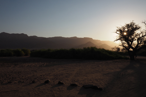
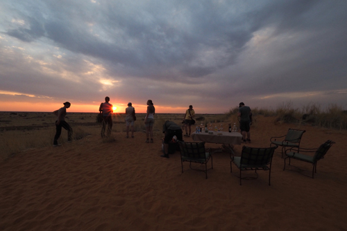
What’s not promoted and a missed opportunity for the hotel is the ‘Sundowners’ walk. Just behind the hotel is a hill with a well laid out path to the top. There you get great views of the surrounding landscape and, more importantly, the setting sun.

There were six of us up there the night we went, all wishing we had taken a drink to celebrate the sunset.

I am sure the hotel could have provided a bar service, as well as snacks.

After all there was no shortage of chefs.

PA214876

Day 11, October 21: Helmeringhausen to Sossusvlei.

We drove north up the C14 then turned west on the C19 towards Sossusvlei.

Again there was a dispute between the TomTom and MapsME, in regard to the distance we had to travel.

This time the TomTom won.

Sossusvlei is in the Namib Desert, one of the world’s oldest. It stretches for nearly 1,000km along the Atlantic coast.

Sossusvlei is one of the easiest places to access the desert and our hotel, the Sossus Dune Lodge, was surrounded by it.

There was a rocky ridge behind our room and a vast expanse of the Namib Desert in front.

At check-in we received yet another baboon warning, telling us not to leave any windows or doors open. After our experience at the Ngorongoro Crater Conservation Area, everything remained shut.

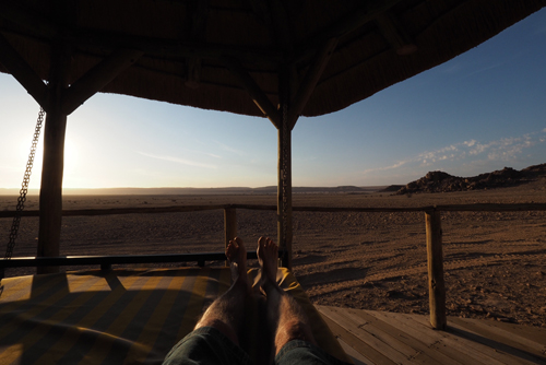
Why we were booked into the honeymoon suite I have no idea. It was about as far away from the office, restaurant and bar as you could get. Our area was huge and it even had a swinging day bed at one end of the wide veranda.

Being in the heart of the desert the winds ebbed and flowed, gently rocking our day bed. This was a wonderful vantage point to take in the spectacular desert scenery.

In the late afternoon we headed out to explore the famed dunes of the Namib Desert, especially Dune 45.

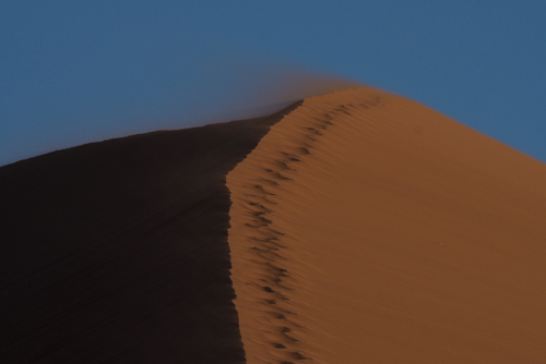
This is what’s called a ‘star dune’ and gets its name from the fact that it’s 45 kilometres on the road that connects the Sesriem Gate and Sossusvlei. It’s made up of 5 million year old sand that was accumulated by the Orange River and came from the Kalahari Desert, then blown into the Namib Desert.

As the sun sets, one side of the dune is thrown in shadow, while the other side glows bright orange.

I can understand why Dune 45 is the most photographed dune in the world.

As tourists we tread gently.

Whatever country you travel in, it isn’t yours, unless you live there of course, you therefore need to be mindful of offending people.

Some tourists believe it’s their right to demand. It could be what they want to eat, what language they want to speak, or even where they want to sit.

These people are rude.

We witnessed one such couple rearrange a table for four, at a window seat, just to suit themselves.

Everyone in the restaurant looked on in disgust. Especially those who had taken the tables for two, that were not by the window.

Ironically the light vanished within minutes of them sitting down, so they had no view anyway.

As it turned out the couple were celebrating a seventieth birthday and the restaurant staff made a big fuss, giving him a very large birthday cake.

It was so large that they shared it with the other diners in the restaurant.

We felt that our judgement of them may have been a little harsh.

That’s until we bumped into them again the next day – they were just as obnoxious.

Our first impression was the right one.

PA224986

Day 12, October 22:  Sossusvlei.

We ordered a packed breakfast from the hotel and headed out just before dawn.

It was hazier, with more cloud around, so the photos weren’t as striking as we had taken on the previous evening.

When we reached the end of the 60km stretch of paved road, we went for a walk in the dunes.

Despite the fact that the car park was full of people, 4WDs, buses and safari vehicles, the dunes were surprisingly quiet.

The light had improved and there was a real contrast between the orange dunes and the bright blue sky.

Our only companions were three Oryx grazing in the distance and the occasional lizard scurrying over the sand.

Our next move was a mistake.

We took the shuttle down a 4WD track to see more of the dunes.

So did everyone else.

There were hundreds walking and climbing over the dunes and along the dry river bed.

It was like Kurfurstendamm on a warm summer’s evening, complete with the chatter of Deutsch.

Then, when we decided to return to our car again, so did everyone else.

The shuttle bus drivers never stopped at the same spot, to drop-off and pick-up passengers.

This meant that random groups of people gathered where the last bus made a drop-off.

However they never stopped there.

There was a further complication, in that some of the buses went an extra kilometre down the road to the end of the track – so we never knew where they were going to end up.

Again there was no obvious pattern, so we decided to get on any bus we could, and stay on it until we eventually got back to the car park.

This strategy worked and we had the bonus of doing the full circuit and seeing the last of the Sossusvlei Dunes.

With all the confusion I wished I had taken the Toyota and driven myself, that’s until we saw two 4WDs up to their axils in sand.

Our hotel, the Sossus Dune Lodge, was one of the first lodges to be developed by the Namibia Wildlife Resorts in 2007.

It is literally perched above the Namib Desert.

The lodges, walkways, restaurant and even the pool are all built on stilts. The only footprint left by the lodge are the holes in the desert floor.

Just as we arrived back from our drive in the dunes, a tour bus came out of the dust and heading for the Sossus Dune Lodge.

At dinner we found out it was a Chinese tour group.

Now Chinese tourists are very valuable to a hotel, they can also can be very disruptive, as ‘they want it and they want it now.’

There were 24 in the group and they returned to the restaurant at 8pm, after a sunset tour, looking to be fed. It took well over an hour for them to be served, yet they consumed their meals in less than 20 minutes.

There has to be a more efficient way to service their needs.

If the Namibia Wildlife Resorts want the Chinese tourists they’ll have to do better than that.

PA235008

Day 13, October 23: Sossusvlei to Swakopmund.

Continuing on the C19 we now headed north.

About 70km from Sossusvlei is the tiny town of Solitaire.

It was suggested that we stop there as they have a good bakery and an espresso machine.

The cake was better than the coffee.

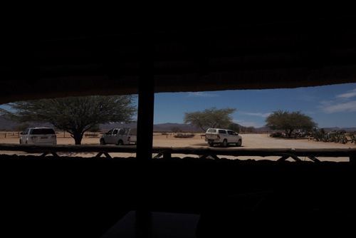
There was no parking in front of Moose McGregors Desert Bakery, so everyone parked under the two trees that were conveniently out the front.

A much better option, considering the temperature was now around 34°C.

It was a rather long, 375km, drive from Solitaire to Swakopmund and the terrain became flatter and dryer with little vegetation.

We hit the Atlantic at Walvis Bay and drove to the Walvis Bay Lagoon to see the flamingos.

There were a lot.

They were the Lesser Flamingo and not surprisingly, smaller in size to the Greater Flamingo.

When we got out of the car to take some snaps, we found that the temperature had plunged about 20°C.

Walvis Bay plays an important role in the oil and gas industry as well as being a vital port for Namibia. It is also growing in tourism and is the second most important coastal resort town next to Swakopmund.

When we arrived in Swakopmund it was as quiet as a church mouse on a Sunday. About the only thing that was slower was the internet in our hotel.

After wandering around the town and finding nothing open we returned to the hotel.

Not surprisingly it was very busy, as everything else was shut.

The Anchor Point Restaurant, within the Swakopmund Beach Hotel, has an interesting history.

It’s named after three rather ornate brick structures that are just outside the hotel. These were anchor points for an 86 meters high communications tower that was used by the Germans during WW1. This transmitter was a vital radio link to Lüderitzbucht, Windhoek and Berlin. In 1914, when war broke out in South West Africa, the local German military destroyed the tower, fearing it would fall into enemy hands.

PA245061

Day 14, October 24: Swakopmund.

Our hotel was right on the junction of the Atlantic Ocean and the Swakop River.

The river was the boundary between the town and the desert.

On our first morning we couldn’t see much as the fog had rolled in and visibility was down to a few hundred metres. This is caused by the hot desert air running headlong into the sea breezes from the cold, moist Atlantic.

Swakopmund is the second largest town in Namibia and the resort capital. It remains cool when the rest of inland Namibia boils.

There is 1,570 kilometres of coastline in the west, stretching from the Kunene River in the north to the Orange River in the south. The coastline north of Walvis Bay is referred to as the Skeleton Coast and most of it is desert. The entire Namibian coastline has been designated as a national park. In fact the Namibian government has become a trailblazer by using tourism to fund conservation.

Walvis Bay and Swakopmund are an oasis of cool sea breezes and Atlantic swells in the otherwise dry south.

We spent the day walking around Swakopmund, meandering through the wide ordered streets.

It was good to get some exercise – we walked over 14km that day.

The fog lifted by late morning but then settled again. However by the late afternoon it was gone completely and the sky was blue.

The air was still chilly and we kept our jumpers on.

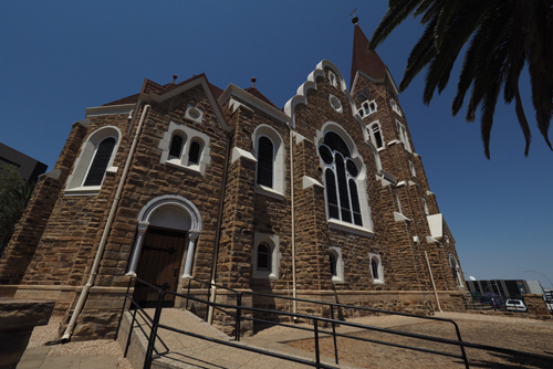
There are number of good examples of Colonial German architecture from the early 1900s in Swakopmund.

There’s the Evangelical German Lutheran Church, built in 1912. Just over the road the Namib High School, built a year later in 1913.

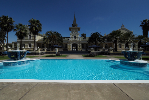
The best for me was the former railway station, or Bahnhof, built in 1901 and now the five star Swokopmund Hotel.

The large in ground pool sits on platform one, where the locomotives once chugged in and out of the station, bringing holiday makers from Windhoek.

In the evening we decided to go German and visit the Swakopmund Brauhaus.

We were lucky we set off early as the place was fully booked.

Monday night was almost as quiet as Sunday and there were only a few places open.

Those who knew had booked the Brauhaus in advance.

We did get a table but were told we had to be out in an hour and a half. However with some clever table manipulation by the staff, we got to stay longer.

The Swakopmund Brauhaus was very German, like a small slice of Bavaria in the heart of the Namib Desert. They served hearty German fare and a great variety of German draught and bottled beer as well as German and South African wines.

PA255105

Day 15, October 25: Swakopmund to Brandberg.

The sea mist was back the morning we left Swokopmund.

It is truly a different part of Namibia, in all aspects. The architecture, the people, the Atlantic and of course the weather.

The drive to Brandberg White Lady Lodge was relatively easy, although there was some confusion as to where it actually was.

For the first 70 km after leaving Swokopmund we were on a sealed and then a salt road.

We had experienced this surface coming into the coast at Walvis Bay and it was a surprisingly smooth ride.

Namibia has more than 44,500 kilometres of roads and they are regarded as some of the best in Africa. There are only 288 kilometres of salt roads, which are limited to the Atlantic coast, inside the mist belt. These road are constructed from concentrated salt water and a gypsum-rich material.

Over half the roads in Namibia are a standard gravel road, covered with imported gravel.

When we arrived in Brandberg White Lady Lodge there were signs warning us of the dangers of Desert Elephants – the place is apparently famous for them.

Was this going to be the same as Sossus Dune Lodge, where were warned about the Baboons but never sighted one?

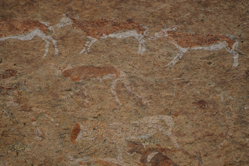
The White Lady Lodge is named after the famous cave paintings that were discovered in 1918 by the German explorer Reinhard Maack. They are in the Brandberg Mountains, not far from our hotel.

There is significant conjecture as to the origins and authorship of the paintings. The current theory is that they were created at least 2,000 years ago by the bushmen or San People.

The ‘White Lady’ is not a woman at all but a medicine man, with painted legs and performing a ritual dance.

In every place we have stayed the layout, style and ambience have been unique. The Brandberg White Lady Lodge was no different.

It was divided into three distinct areas: The restaurant, bar and swimming pools were the hub, then about 200 metres into the bush were the stand alone chalets, where we were staying. There were seven of these, spread throughout the bush and all under trees. The trees kept the room cool and also provided shade for our car. Within this area there were also two sets of seven rooms apartments.

The third area was for the campers. There was a combination of tented camps and camp sites. These were set around the dry beds of the Teisen and Ugub Rivers.

All this was set against the backdrop of the Brandberg Mountains.

Brandberg or Fire Mountain is Namibia’s highest peak, with its zenith, the Königstein or ‘King’s Stone’, 2573 metres high.

It was a hot, dry and dusty environment, that was both hostile and stunning.

Power for our chalet came from a 12 volt battery that’s charged by a solar panel that was just outside. While the hot water was provided by a solid fuel boiler, that was behind a high stone wall next to our chalet – it was lit twice a day.

There was no WiFi or connectivity of any sort. If you needed to charge your devices you had to take them to the main lodge area, where there was a generator.

Dinner was served at 7:30 so we went up to the lodge to have a pre dinner drink at the bar.

We were alone.

Everyone was up on the hill, behind the bar, at the ‘Sundowners’ seats.

We didn’t bother. I think we have become a little blasé about sunsets, as we get one most nights in Sandringham.

PA265141

Day 16, October 26: Brandberg.

In the morning we headed out to visit the site of the White Lady rock art.

This is only one of a reported 40,000 individual pieces that are on Brandberg Mountain.

The art in the caves vary from 2,000 to 5,000 years old.

The White Lady was name as such by the French anthropologist Henri Breuil in 1929, believing the art could have been painted by Phoneticians from the Mediterranean. The headwear was very similar to that worn by Egyptian women.

This theory has since been discounted.

The organisation of the cave walk was very well done. Firstly we were checked in and had everything explained to us. Then we were given a guide for our 45 minute walk to and from the cave.

Marcus could talk and didn’t stop chatting the entire time.

On the way there we were in constant lookout for the elusive Desert Elephant.

Native Africans have a very well developed fear of elephants, more than any other animal it seems. We noticed this in Kenya, Tanzania and now in Namibia.

There’s were plenty of smelly signs that elephants were in the area and it was only when we arrived at the cave did we actually see them.

They should be really called ‘Rock Elephants’ as they were perched on a rocky ledge, over the dry river bed that was opposite the cave.

We heard them before we saw them, as they were snapping off tree branches for food.

All along the track to the cave the trees had also been devastated by the hungry mammals.

Camp gossip told us that there might be more elephants up the dry river bed, not far from the lodge.

So in the afternoon we headed off, hoping that my limited 4WD experience would get us through the sandy river bed.

We gave up on the elephants after travelling 6km up the river and turned around. Then we sighted two on the river bank – one was giving himself a sand shower, while the other was asleep under a tree.

Dinner is a fixed menu with an entrée, main course and desert.

There is little variation.

There was a family of seven, mum dad and five children, ranging from five to fifteen.

All the family were served the same meal as everyone else and it was interesting to watch them divide up the food. In the end all the appetites seemed to be satisfied.

I guessed they had done this before.

At the end of dinner the staff put on a performance. On our first night there were fifteen of them and on our last, seven.

The size of the ensemble is determined by how many guests they have to serve.

PA275167

Day 17, October 27: Brandberg to Damaraland.

There was no water in our chalet on our last morning. We went outside and discovered our hot water service lying on its side, with all the connections broken.

After reporting it to the staff, we were told to shower at one of the campsite facilities.

When we got back to our room after breakfast there was a guy there repairing our broken water heater.

He explained that the damage was done by an elephant looking for water – they can smell it.

Apparently this happens all the time.

In the end we didn’t see the Desert Elephants in the camp but knew that they had been there.

It was a long drive from Brandberg to Damaraland, as we had to make two diversions.

One to the Petrified Forest and the other to the San rock engravings at Twyfelfontein.

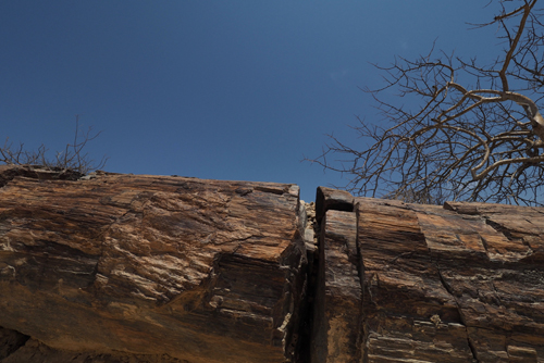
The Petrified Forest is an area of land where 280 million years ago large pine trees were washed into Namibia from Central Africa.

They were subsequently covered by alluvial sand. Deprived of oxygen, they couldn’t rot and over millions of years underwent silicification, fossilised, and subsequently turned to stone.

Almost of as much interest as the trees, was the Welwitschia. This is ancient plant that taps water from the coastal fog. If can live for hundreds of years and is considered a living fossil.

The rock engravings at Twyfelfontein date back 2,000 to 2,500 years but the site has been inhabited for 6,000 years.

The area was made Namibia’s first UNESCO World heritage site in 2007.

The most famous is the ‘Lion Man’ engraving. This depicts a lion with five human like toes on its feet and one on its tail.

This is believed to be a depiction of a Sharman or Witchdoctor’s dream of his afterlife form.

The image of the lion is a cross between an animal and a man.

A lot of the rock art was created to be as much educational as spiritual. Many engravings were designed to teach current and future generations about the bush, animals and where to find water.

They were like a ‘blackboard’ of information on learning about nature.

There was one particular engraving of an ostrich with four heads. This was a form of animation that depicted the ostrich standing then lowering its head to drink. The direction the bird faced indicated where water could be found.

The name Twyfelfontein means ‘Doubtful Spring’ in Afrikaans. It was used by a German settler, David Levin, to describe the place. He didn’t believe that the water from the local spring could sustain his cattle. Levin’s friends started to call him David Twyfelfontein or David Doubts-the-spring.

The name stuck.

Because of our diversions it was 3pm before we started the drive to Darmaland. And as usual there was confusion between the TomTom and MapsME as to how long it would take.

However the difference wasn’t as large this time.

It was going to be a long drive whatever device we used. And all of it, apart from two short stretches, was in gravel roads.

The benefit of travelling on dirt roads is that you can see vehicles coming, way before they get to you. The plume of dust is visible, even if the car isn’t.

We covered about 500 kilometres that day, so my evening beer was very welcome.

PA285292

Day 18, October 28: Damaraland.

We were staying at Toko Lodge in Damaraland. Now Toko is the local word for Hornbill and they were everywhere.

Their squawk woke us up at five and just to make sure we were awake, they then knocked on our window at seven.

There is plenty of food for them, both indigenous and provided, so they naturally hang around the hotel.

The birds and animals took it in turn to eat at the feeding points.

In the morning the Tree Squirrels were there, they were replaced by the Hornbills who grazed all day. In the evening the Guinea Fowls then waddled in for a meal.

After breakfast one of the staff told us that there was a problem with our car.

Fearing the worst we went to have a look. As It turned out we only had a slow leak in the right rear tyre and it was soon repaired.

The staff operated like a Formula One pit crew. The problem tyre was soon off the Toyota and replaced with one of the spares. Then they found the cause, it was part of a valve shaft that had imbedded itself through the rubber. Once that was fixed the original tyre went back and then they gave our vehicle a bonus car wash.

All this cost us the equivalent of A$5.

As it turned out this was the only issue we had in the entire 4,800 kilometres of our Namibian road trip.

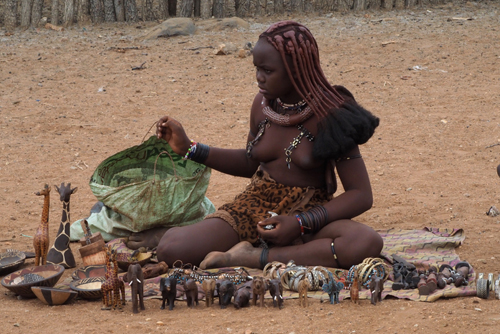
Just down the road from the lodge is a Himbas Village and we decided to do the village tour.

The Himbas people actually come from an area that’s about 300 kilometres north of Damaraland and that’s where they graze their cattle.

Traditionally they were nomadic but these days the women and children live in the village, while the men stay with the cattle.

The Himba are traditional people who escaped being converted to Christianity by the zealots of the German Colonial Missions.

The women are topless and don’t bath. They use a combination of perfumes and smoke, infused with herbs, to cleanse and beautify themselves. They also rub ochre on their skin as another form of beauty treatment.

Their traditional clothing, like belts, anklets, loincloths and headwear all holds spiritual or social significance.

There were single women, mothers, babies, young children and an assortment of small farmyard animals. Often some of the teenage girls have to stay at home, rather than go to school, to learn the Himba ways.

I only sighted one male – I guess the rest were off tending the cattle.

Some of the tourists came laden with Chupa Chups for the children. It wasn’t long before there was a small white stick hanging out of every mouth in the village.

I am sure that that the kids could have been given a more appropriate gift than sweets.

At the end of our visit we were given a very enthusiastic performance of singing and dancing as well as an opportunity to buy souvenirs.

We bought a small carved African Elephant. The tusks were made from the lollypop sticks, so at least they were being put to good use.
Part 1: Namibia, Botswana and Zimbabwe.
Windhoek to Helmeringhausen, Namibia.
(October 2016)

Wednesday, January 11th, 2017

Day 1, October 11: Dar es Salaam to Windhoek.

Our flight from Dar es Salaam to Windhoek, went via Johannesburg.

It was on this first leg of our flight that I read Australia had been thrashed by the Proteas in their fourth ODI.

The article was in a South African newspaper, and were they gloating. It looked like the series could be a whitewash and as it turned out it was.

I certainly wasn’t going to enjoy discussing cricket with the South Africans, once we reached there in a months time.

Having been up since 3am, for our flight to Windhoek, we needed an early night. We found an Italian restaurant a short walk from the hotel.

It was full of Western faces.

PA134252

Day 2, October 12: Windhoek.

Namibia, well at least Windhoek, is very German. The faces look German, they speak German and everything has a German efficiency about it.

Even the breakfast at our hotel, Palmquell Hotel Pension, was typically German with fruit, bread, cold meats and a selection of cheeses.

We were served by a very pleasant, but serious, woman with a very German accent.

Most of the hotel guests were also German. In fact 80% of tourists to Namibia are German.

Getting a new SIM card was the easiest we have experienced.

MTC (Make The Connection), the local provider, put Vodaphoney to shame.

Picking up the car was also very efficient. They knew our name as we walked through the door and then they proceeded to take us through a very thorough process of legalities and responsibilities. We were then passed on to another person who briefed us on the vehicle.

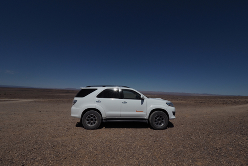
Our rental vehicle was a rather large, white, Toyota Fortuner 4X4, equipped with two spare tyres, an air compressor (for inflating and deflating tyres), towrope, two jacks and jumper leads.

Hopefully I will never have to use any of it.

After picking up the car we drove to Maeria Mall to get some supplies.

We were told not to leave anything visible in the boot of Fortuner. This was made difficult as there was no cover supplied, so we decided to buy a black sheet to put over our luggage. Plus we need a good supply of water and snacks for our days on the road.

The meal on our second night was at a Portuguese restaurant.

The food was very basic.

We decided to have some of the local meat and chose Oryx. It was an island of overcooked meat in a lake of rich, salty sauce and lacking in taste.

PA134268

Day 3, October 13: Windhoek to Kalahari.

Before driving south towards the Kalahari Desert we spent some time motoring around Windhoek.

With a population of less than 400,000, it’s a bit like a large regional town, rather than a capital city.

But then the entire population of Namibia is only 2.2 million.

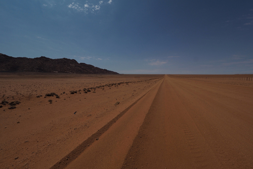
As we drove south the geography changed to a semi-arid red sandy savannah.

The road was good and it was only when we reached the turn off at Kalkrand did we hit the gravel.

It was only 262 km from Windhoek to Kalahari Red Dunes Lodge, so our first drive in Namibia was relatively easy.

The lodges sat along side a dry lake bed, or vlei and there was a small water hole about 150 metres from our veranda.

We were expecting wildlife to visit the waterhole in the evening but they didn’t come until the next morning.

There were four large blocks, that looked like concrete, scattered around the waterhole. When a family of Eland came to drink at the vlei, we discovered that these were blocks of salt.

They are there to give the animals extra minerals.

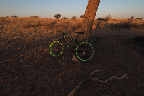
Late in the afternoon, when the temperature had dropped below 30°C, we went for a bike ride.

The lodge has a number of ‘Fat Bikes’ that they encourage you to take out into the dunes.

The super large tyres make it easier to ride on the soft sand.

Unfortunately my bike didn’t have an adjustable seat. It had been set for someone far taller than me, which is most people, so I struggled.

We returned just on sunset and managed to get some hero shots of the sun setting behind the ubiquitous Acacia tree.

The evening meal at Kalahari Red Dunes Lodge was a fixed menu.

Oryx filet was our only choice.

Having had the very badly prepared Oryx steak in Windhoek, I wasn’t happy.

I needn’t have worried, as our meal was in total contrast to the one the previous evening.

It was a small portions with just the right amount of a creamy pepper sauce and plenty of fresh vegetables.

PA144340

Day 4, October 14: Kalahari.

Even though we had our own 4X4 we decided to take the afternoon game drive, provided by the lodge.

Jonathan was our driver and guide for the drive, which started at 4pm, when the heat of the day had subsided.

We were out for three hours, meandering around the park, but not really straying too far from the main camp.

As Jonathan explained, there are no predators in this part of the Kalahari so the animals can wander around in small herds without fear.

And so can the visitors.

There are many walking and hiking tracks around the lodge, which the Germans, being great walkers, love.

We saw oryx, Blue Wildebeest, Common Springbok, Ground Squirrels, ostriches, Black Springbok, Common Zebra and a Yellow Mongoose.

Apart from having an excellent knowledge of the animals, Jonathan also knew about the flora and especially its relationship with the famed Bushmen of the Kalahari or San people.

The San are believed to be the first inhabitants of Botswana and Southern Africa and were traditionally nomadic hunter gatherers.

There were eight guest from the lodge on the drive, all of them spoke German, except Thea and me. Of course they also spoke excellent English. Jonathan’s, sometimes amusing commentary, was in English so everyone could understand.

We ended the drive with drinks and snacks, watching the sun set over the Kalahari.

Our first Namibian ‘Sundowner’ experience.

PA154361

Day 5, October 15: Kalahari to Quivertree Forest.

We continued our drive south on the B1, which was arid with sparse vegetation.

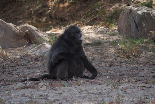
We could be forgiven for thinking we were anywhere in the world that was dry and rocky. That’s until we came across three largish black baboons crossing the road.

We knew we were still in Africa.

Then, just after we arrived at the Quivertree Forest Rest Camp, a warthog wandered past.

It seemed to know its way around, as it headed straight for the restaurant kitchen.

Apart from the warthog there were three Border Collies and a very large, black greyhound hovering around the common area.

Two of the Border Collies like to chase dragon flies around the pool.

The next morning we discovered another three collies, now there were six.

That wasn’t the total menagerie as their was also at least one black cat and two small dogs that seemed to control the inside.

The Quivertree Forest Rest Camp is on the Farm Gariganus, which is 13 km north east of Keetmanshoop. It’s a very large working sheep station and like any farm, domestic animals are always present.  However I don’t think any of these animals did much work around the farm.

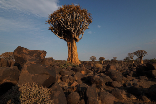
Just on sunset we went for a walk in the Quivertree Forest.

The Quivertree or Aloe Dichotoma, got their local name from the San people who used to hollow out the branches to make quivers for their arrows.

The tree is native to Southern Africa and protected there. There are fears of it becoming extinct due to climate change.

Isolated trees are spread around Southern Namibia but only three areas of forest are left in all of Africa.

Quivertree Forest in one of them, the others are a different variety of Aloe Dichotoma and on the east coast.

The forest is set in a Luna landscape of rocks and boulders and in the twilight the trees looked prehistoric.

Once we got over our excitement of the trees we started to see small brown creatures scurrying over the rocks and bounding up the trees.

We had seen rock rabbits, dassies or rock hyrax, as they are variously known, but certainly nowhere near as many as were here.

PA164424

Day 6, October 16: Quivertree Forest.

The next morning we had an early breakfast as we wanted to visit the Giants Playground before it got too hot, which it never did.

As we arrived at the restaurant we were greeted by the local cheetah who had wandered in for a feed.

She was 18 years old, which is a great age, even for captive cheetah.

Abandoned as a cub, she has lived on the farm all her life. Once rehabilitated she couldn’t be reintroduced back into the wild, as she would have posed too big a risk to the domestic livestock.

She wouldn’t be much of a threat now, as she has hardly any appetite and only eats small portions.

That evening she returned but this time she brought a friend – a seven year old female.

And she could eat.

She finished off both her dinner and that of the old cheetah.

The Giants Playground displays impressively weathered dolerite dykes which form part of the Keetmanshoop Dolerite Complex or Dolerite Swarm.

They were formed when volcanic magma rose to just below the earth’s surface. This was in the form of hundreds of individual dikes or sills that radiated from a single volcanic centre.

Over time, erosion has revealed these columns and blocks of basalt to create an unearthly landscape.

From the Giants Playground we drove a further 25 km to the Mesosaurus Fossil site.

Here the owner of the farm Spitzkoppe, Geil Steenkamp, discovered the fossils of an ancient crocodilian type creature named as a Mesosaurus.

The Mesosaurus came from the Early Permian period and became extinct over 299-280 million years ago.

The Mesosaurus Fossil site is convincing proof to support the theory of drifting continents. The same genus of Mesosaurus, in the same rock formations, can also be found in South America.

Geil was an old bushman who could spin a good yarn and told many stories about discovering the Mesosaurus.

Half of which were believable.

He could also play a tune on the Dolerite rocks that were on his property. These rocks are so dense that they resonate like chiming bells.

Adjacent to the Mesosaurus Fossil site is the grave of J. Splittgerber, a German soldier killed in action on November 13, 1904.

More evidence of Namibia’s colonial past.

PA174649

Day 7, October 17: Quivertree Forest to Fish River Canyon.

The owner of the Quivertree Forest Guest Lodge suggested we take the more scenic route to Ai-Ais Hot Springs on the D545.

We stopped at Naute Kristall for coffee. This is a small vineyard and distillery with a newly installed espresso machine. It’s just next door Naute Fruit Farm, a huge government complex that grows dates, pomegranates, prickly pear and pecans.

Some of the fruit from the farm is used in the distillery. And apparently the dates from the farm are of such a good quality that they are exported to the Middle East as well as Europe.

Not far from Naute Kristall is the Naute Dam, a lunar landscape of rugged rocks and an acacia tree that looks very similar to Australian Wattle.

Water from the dam is used to irrigate the Naute Fruit Farm.

On the way to Ai-Ais, Thea decided that we should make a detour to the premier viewing point of the Fish River Canyon.

This was a great decision as the views were spectacular. The Hobas View Point is situated 820 metres above the canyon and was very well designed with excellent facilities for picnickers.

The formation of the Fish River Canyon started about 350 million years ago.

Measuring 90 to 160 km long, 27 km maximum width and 549 metres maximum depth, is cited as the second largest canyon in the world, after the Grand Canyon in Arizona.

The Mexicans might disputes this as the Copper Canyon is reputed to hold that honour.

There was a dispute between the TomTom and MapsME on how far we needed to travel to get to the Ai-Ais Hot Springs, which is at the southern end of the Fish River Canyon.

The travel phone with MapsME won, as the TomTom was 50 km out.

There were hardly any guests at A-Ais Hot Springs at Fish River Canyon. However there was plenty of enthusiastic staff waiting to please us.

We decided to have a pre-dinner drink on the terrace, overlooking the campground and the river.

Our waiter had the dinner menu in front of us before we took our first sip.

They had a Hansa Draught on tap, which was very good and a pleasant change from bottled beer.

There is very little draught, let alone craft beer, in Namibia, it’s all bottled. The big brewers have a stranglehold on production and distribution. It’s a familiar story of the large breweries trying to restrict competition and then buying out any craft brewery that makes a success of it.

The camp ground was one of the best I have seen. Every site had a solid fuel BBQ, or braai, running water and electricity. Plus there were full camp kitchens and shower blocks every 50 metres or so.

All this was set in a garden area with a huge thermal swimming pool at one end.

The entire area of Ai-Ais is set against a backdrop of rugged mountains, that border both sides of the Fish River.

The dry river bed is etched with footprints, human and animal.

It’s interesting trying to identify the animal ones.

The trip, so far, has been very relaxed and that’s probably due to the fact that we are spending thirty days in Namibia, not five to fourteen as most people do.

We are seeing the ‘A’ sites and probably the ‘B’ and ‘C’ sites as well.

On some days there is nothing to do but relax and see no sites at all.

PA184683

Day 8, October 18: Ai-Ais Hot Springs, Fish River Canyon.

It’s great to be greeted by irony first thing in the morning.

There we were, staying at the Ai-Ais ‘Hot Springs’ and there was no hot water for our shower.

At breakfast almost everyone sat on the terrace, yet all the tables were set inside. It was the same with dinner the previous evening.

Either the guests are silly or the hotel hasn’t noticed where most people prefers to sit.

The customer is always right – allegedly.

Having spent many hours in the car over the last few weeks, Ai-Ais Hot Springs was a good opportunity to go for a long walk.

About 300 metres from the hotel is a dam wall across the Fish River. I fully expected it to be full of water behind the wall. However it was a sandy base with a intermittent springs along the edges.

How could such a relatively dry river have carved out the mighty Fish River Canyon we had seen the day before?

Namibia is in the grip of drought, but when it rains it must really pour down.

There wasn’t much wildlife on our walk but we did see a few family groups of baboons, one lone stallion, a pair of very frightened Kudu and a couple of talkative German tourists.

In the afternoon we took advantage of the hot springs, that were just below our room, and wallowed for a while.

Pale-winged Starlings were everywhere, especially around the restaurant. They have shiny blackish-blue plumage with fiery orange eyes.

I thought they were a member of the crow family at first, that’s until they opened their beaks.

They were definitely not crows as their call was much more melodic.

In Africa there are two types of tourists. The bird watchers and everyone else.

We have constantly run into ‘Birders’ as they are known. They have binoculars as well as cameras and always carry a complete field guide to the birds of whatever country they are currently travelling in.

We met a delightful South African couple in the Quivertree Forest Guest Lodge. They had only been birding for three years but had managed to sight over 700 of the 900 birds species in South Africa.

They were very proud of this achievement.

PA194753

Day 9, October 19: Ai-Ais Hot Springs, Fish River Canyon to Helmeringhausen.

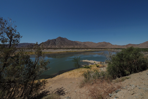
We left Ai-Ais and headed south towards the Orange River, the border between Namibia and South Africa. There was much more water in this river than we had been used to seeing.

The roads were all gravel but excellent and we could drive up to the 80kph speed limit quite comfortably.

The locals drive much faster than that.

Just near the ferry crossing, to South Africa, we headed north, onto a sealed road – this was still on the C13. About 105 km from Helmeringhausen, it reverted to gravel.

Strangely we found our next sealed road again at Helmeringhausen. It was a stretch of about 400 metres that ran through the tiny village, past our hotel.

Helmeringhausen Hotel is on the 11,000 hectare farm, Helmeringhausen. The farm was established during the colonial period, in the early 1900s, by Mr Hubert Hester of the Schutztruppe or German Colonial Infantry.

It was famous for Karakul sheep which originated in Central Asia.

We were certainly made to feel welcome an the Helmeringhausen Hotel, as our names were on the door to our room when we arrived.

Most hotels have their idiosyncrasies, the Hotel Helmeringhausen was no different.

All the staff are chefs, with a chef’s uniform of hat, jacket and checked pants.

Thea was greeted at reception by a chef. All the wait staff, apart from the sons of the owners were chefs. Even the cleaning staff are chefs.

I think they were trying to promote their culinary expertise.

The sea and the city – Zanzibar to
Dar es Salaam. (October 2016)

Sunday, January 1st, 2017

DSC04827

Zanzibar.

Vasco da Gama visited Zanzibar, or Unguja as it was known in 1499. This was at the end of his epic journey that linked Europe and Asia, connecting the Atlantic and the Indian Oceans.

His voyage of discovery gave the Portuguese access to the Indian Spice routes and led to the age of globalisation by the European powers.

Spices became an important industry in Zanzibar, so much so that they are sometimes referred to as the Spice Islands.

The Portuguese took control of Zanzibar from the Arabs in 1504, making it part of the Portuguese Empire.

If remained under their control for nearly two centuries.

In 1698, Zanzibar became part of Oman, under control of the Sultan. In 1840 Said bin Sultan, the Sultan of Oman moved his capital from Muscat, in Oman, to Stone Town, in Zanzibar City.

Britain took formal control through the 1890 Heligoland-Zanzibar Treaty. In 1896 there was an slight altercation, known as the Anglo-Zanzibar War. After which Britain put Hamoud bin Mohammed into power.

This was known as shortest war in history, lasting only 45 minutes.

In 1897 Hamoud bin Mohammed yielded to British pressure and brought an end to Zanzibar’s involvement in the slave trade.

And to add to the magic of Zanzibar, there was even a British administrator, named Harry Potter who was in control from 1954 to 1959.

Zanzibar became an independent nation in December 1963 but it didn’t last long.

A revolution took place in January, 1964 and in April it signed an agreement of confederation with mainland Tanganyika to form the United Republic of Tanzania.

Zanzibar is officially part of Tanzania but it is very different.

We stayed at Hotel Al-Minar, in the heart of Stone Town and only a few minutes walk from most attractions.

It’s was a quaint Arab styled building with carved timber beams and heavy wooden furniture and doors.

The staff were fantastic and even tracked down a lost sock, that vanished from our laundry.

Having spent the last few weeks in the Kenyan and Tanzanian bush, it was great to be beside the seaside again.

There are a number of rooftop bars, along the waterfront, that take advantage of the views and the balmy evening air – we took advantage of them.

We were in Zanzibar for some R&R but with so much history to explore, we doubted that would be the case.

After all Stone Town in Zanzibar City was made a UNESCO World Heritage site in 2000, so there is plenty to see.

Stone Town is the largest, living, Swahili stone town in the world. There are over 1000 coral ‘stone’ buildings with architectural significance.

The features that make this city unique are written on a sign at the door of the House of Wonders Museum.

“It is the confluence between Africa and the Indian Ocean. 

From a fishing village at Shangani, it developed as a cosmopolitan society with a unique architectural synthesis. 

This was based on Swahili building technology, the elegant simplicity of Arab tradition and ‘saracenic’ features imposed by the British.”

Coral stone isn’t as robust as granite, marble or even concrete and the city had a distinct feeling of being in decay.

Zanzibar is predominantly Muslim with over 50 mosques on the island.

Each morning we were woken to the sound of the Imam calling the faithful to prayer.

A majority of the women wear modest clothing and there are even some full burkas.

The big difference is that the clothes are much more colourful, compared to Arab countries, especially the headscarves.

The first morning was spent on some housekeeping. Firstly we extended our stay by another night, then it was off to find an ATM and after that, down to the ferry office to buy tickets to Dar es Salaam.

I was well overdue for a haircut, so that was another challenge we had to face.

I eventually did find a barber and paid more for a cut in Stone Town than in Barcelona.

They saw me coming.

In Zanzibar there are more taxis than passengers and more guides than tourists.

It’s the low season but at every turn you are expected to part with your money. It can be a bracelet, a selection of spices, a taxi or a full day guided tour.

There are even people hanging around cafes, restaurants and the ferry terminal. They are waiting to guide you, those last metres, to where you were heading anyway.

Of course they are expecting a tip from you or a commission from the business, of both.

After our chores were done we headed off to do some exploring.

The Old Dispensary, was formerly the Jubilee Hospital, built by a wealthy Ismali Indian, in 1887, to celebrate Queen Victoria’s Golden Jubilee. It is currently the Stone Town Cultural Centre.

It’s a testament to Zanzibar’s diverse history.

The wooden carved balconies and stained glass are of Indian influence. While the walls were made from Zanzibar coral rag and covered in European neo-classical ornaments.

We visited a private museum that was dedicated to Emily Ruete (1844-1924). Born Sayyida Salme, Princess of Zanzibar, she was the youngest of 36 children, born to Sayyid Said bin Sultan Al-Busaid, Sultan of Zanzibar and Oman. Emily is the author of ‘Memoirs of an Arabian Princess from Zanzibar’ This is an autobiography describing her love for a German merchant, Rudolph Heinrich Ruete, and her subsequent elopement to Europe. She then converted to Christianity and married him.

The Anglican Christ Church Cathedral is built on the site of the old slave market. The only remains of the market are the holding cells beneath one of the church buildings.

There is a well designed display giving a full history of Zanzibar’s involvement in the slave trade.

Many slaves that were freed were put into Christian missions. They were educated and indoctrinated into Christianity. This caused problems, once they left the mission, as they could not assimilate into a mainly Muslim society.

Zanzibar was one of the largest slave ports in the indian Ocean slave trade. It was dominated by Arab traders and originated before the creation of Islam.

Dr. David Livingstone (1813-1873) was a missionary, explorer and an important activist in pushing for Britain to ban the East African Arab-Swahili slave trade.

“Dr. Livingstone, I presume.”

Was the famous greeting by Henry Morton Stanley when he located David Livingstone in Africa on November 10, 1871.

One of Livingstone’s life goals was to find the source of the river Nile.

After his death Livingstone became a national hero in Britain. His exploits were a catalyst for the British and European’s rush to occupy Africa.

“It is not worth the while to go around the world to count the cats in Zanzibar.” 

There is some conjecture as to whether this quote, from Henry David Thoreau’s book Walden, is literal or metaphorical. 

I do however believe there is a lot of truth in the passage.

Zanzibar is a city of cats, they are everywhere.

The House of Wonders is one of six palaces built by Barghhash bin Said, the second Sultan of Zanzibar. At present it houses the Museum of History and Culture of Zanzibar. It was built in 1883 and at the time a pinnacle of modernity, having electricity and even an elevator. It again used traditional coral rag but this was combined with concrete slabs and cast-iron columns, allowing for exceptionally high ceilings.

The Museum was as dusty and in need of upkeep as most of Stone Town’s historic buildings.

The Old Fort or Arab Fort was built around 1700 and is the oldest building in Zanzibar. It was constructed with materials obtained from a Portuguese chapel and ironically was designed to defend the island from the Portuguese.

There’s not much to see inside as it’s totally occupied with souvenir stalls.

However in one part an amphitheater has been built, this is home to the annual Zanzibar Film Festival.

Considering the heritage of Zanzibar it seemed only reasonable that we embark on a spice tour.

We engaged a driver through the hotel and travelled north, on Malawi Road, out of Stone Town, we then turned east towards Kizimbani.

The Ziti Spice Farm was a slick operation.

Our tour was three hours door to door but we did see and learn a lot. It was a show farm, just for the tourists and the only things they sell are to the visitors.

Apart from spices, Ziti sells soap and a perfume they call Chanel No. O. This is because it contains zero chemicals.

The main spice grown and exported from Zanzibar are cloves. These were introduced by the Omanis as a way of creating wealth. There is very little in the way of indigenous fruits or spices in Zanzibar. Everything comes from somewhere else.

The Omanis were also involved in the export of ivory, which was tied to the slave trade.

All the important exports in Zanzibar are controlled by the Tanzanian government. This seemed to be a pattern in eastern and southern Africa.

We finished our tour with a fruit feast. The fruit was excellent as it has been in all of our African travels so far.

In fact all the food in Stone Town was excellent. We had modern cuisine, local Zanzibar fare, Indian and on our last night we even had Ethiopian at Abyssinian Maritim. This had been recommended to us by the manager at our hotel.

We ordered lamb and beef, as well as an avocado salad.

When the meat dishes arrived they were ceremoniously poured onto a large woven basket. This was covered at the bottom with a very light pancake. We were also given a roll of the pancake to help us soak up the gravy.

The meats were infused with all sorts of spices.

It was interesting to taste the spices in our evening meal, that we had seen growing in the morning.

This was all washed down with a very pleasant Cabernet Sauvignon from South Africa.

I am sure that this wouldn’t feature with normal Ethiopian fair.

We checked out late from the hotel on our final morning as we were booked on the 12:30 ferry to Dar es Salaam.

This was a two hour journey by high speed catamaran.

DSC04838

Dar es Salaam.

On our first morning in Dar es Salaam we were again woken early, this time by Gospel music, not prayers. They were coming from the Azania Front Lutheran Church, which was right next door to our hotel.

Dar es Salaam is the largest city in Tanzania and the largest in eastern Africa. There is a decidedly German influence in the city, which is probably due to the establishment of the German East Africa Company in 1887.

Even though it’s not the capital of Tanzania, Dar es Salaam has the bulk of its people, wealth, industry and commerce.

The Chinese influence on present day Tanzania goes back to 1965.

The first President of the United Republic of Tanzania, Mwalimu J. K. Nyerere (1922-1999) had a strong bond with China and its system of socialism. He is still controversially regarded as the Father of the Nation, yet he left it one of the poorest and most corrupt countries in Africa.

Like the late Fidel Castro, Nyerere created a brand of socialism that was more a dictatorship than a benevolent state.

By eliminating any opposition, from political rivals or unions, he managed to control power for twenty years.

We only had one full day in Dar es Salaam before we flew to Namibia so we decided to visit the National Museum of Tanzania.

We needed to put a cultural and historic perspective on all that we had seen and the museum was within walking distance from our hotel.

When the Portuguese visited Kilwa, an island of the southern coast of Tanzania, they were impressed by the wealth of the indigenous upper class. They wore silk and cotton with jewellery of gold and silver.

They subsequently returned to conquer the people and reap the rewards.

When the first Europeans visited Australia, the indigenous people would have appeared very poor.

There was no gold, silver or fine clothes, which is probably why they turned around and went somewhere else.

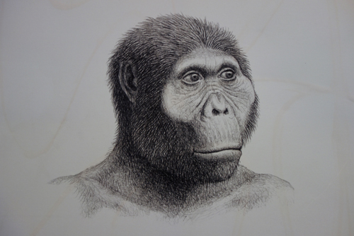
The museum exhibition included African rock art, European settlement, contemporary Tanzanian politics and human evolution.

The exhibition of human development was my favourite as it provided us with the other bookend to our trip to Ngorongoro Crater. There were some excellent illustrations depicting the path of evolution.

This was one of the best TSh13,000 (Aus $8) we have ever spent.