Again we flew with Copa Airlines, this time from Managua to Guatemala City.
As a bonus we were upgraded to Business Class. It’s a pity it was only a 55 minute flight.
Even for that small time it’s good to feel more important than you are.
We then rented another car, this time a Toyota Yaris, and drove straight to Antigua. We had been told that Guatemala City is only worth passing through, so we did just that.
It took time to get out of the city but even longer to get over the mountains. It seemed to be a main truck route and we got caught behind countless slow moving, underpowered and overloaded lorries.
Antigua.
We checked into the Hotel Convento Santa Catalina which was built in 1613. As the name suggests it was formally a convent and school. Our room had a rather large wooden cross on the wall to prove it.
The hotel is beside the Santa Catalina Arch, which was used by the cloistered nuns to cross from the convent to the school without being seen.
This is one of the most photographed sites in the city.
Antigua was originally the capital of Guatemala and the first Capital of Central America. That’s until the earthquake of 1773, when most of the city was destroyed.
It was rebuilt and is now the tourist capital of the country. Full of beautiful old colonial buildings and cobblestone streets, it’s regarded as a gem within Central America.
It was given UNESCO World Heritage status in 1979.
As much as there are renovated buildings in Antigua,there are ruins, again a result of the earthquake.
The most spectacular is the San Josè Cathedral. The original church of Guatemala, built in 1680, it has three enormous domes and a labyrinth of catacombs.
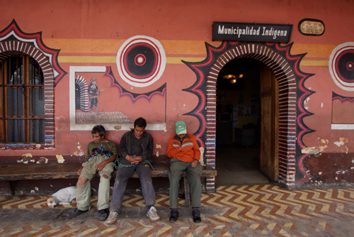
As we found in Mérida, Mexico, the indigenous population add another rich cultural layer to the local Hispanics.
The women and girls still wear traditional clothes and sell their handicrafts on the streets. There are no stalls, they just squat down on the pavement and the tourists and locals mill around them.
A thunderstorm hit on our first afternoon. No one seemed perturbed and just waited for it to blow over.
The next day we decided to walk to the lookout at Cerro de La Cruz. This is a hilltop overlooking the city. It gives you a wonderful perspective of the classic colonial city layout.
It’s much like Melbourne and built on a grid system. However the grid in Antigua is perfectly aligned on a north, south axis.
The Casa Santo Domingo is a museum, of pre and post Columbian art and artifacts, plus contemporary art, all set within an archeological area, adjacent to a five star hotel.
I was initially reluctant to visit ‘yet another museum’ but Thea talked me into it.
What started out as a simple ethnological display turned out to be an ever unfolding trip though ancient and modern Guatemalan history. This was all housed in what was the church and convent of Santo Domingo and the Santo Tomás de Aquino College.
Much of the church and convent were destroyed in the 1773 earthquake. This Museum Promenade, or cultural route, has renovated the ruins to house their exhibits.
We continued our walk to the San Francisco Church and ruins. There was an almost festival feel in the church grounds, with many families filing in and out of the church and others having picnics in the back of their utes.
There was one, rather corpulent, friar sitting under a tree and blessing the children of passing families with his bucket and brush.
There were food and souvenir stalls lining the church yard.
The next day we went to the last church on our list, La Merced. Again it had a festival feel.
There were girls dressed in white, for their first communion, others taking communion and many more just hanging around the entrance, chatting to friends or having their photos taken.
Outside was more like a fairground with hawkers and stalls selling everything from hand crafts to the off cuts of the ‘Host’ wafers.
It was a special day for ‘mans best friend’ and there were dogs of all shapes and sizes all over Antigua.
The dog food brand Purina seemed to be the sponsor. There were water stations set up to keep Fido hydrated. There were also Purina branded bibs on many of the dogs.
We even saw one poor pooch served Coke in its bowl.
Lunch is the main meal of the day in Latin America and the restaurants in Antigua were full.
Many brought their dogs along for the treat, with lots of scraps being dropped under the table.
The dogs would have slept well that Sunday night.
Apart from the one who had the Coke that is.
Panajachel.
It’s only 76km from Antigua to Panajachel but it was one of the longest drives of my life.
It took us just under three and a half hours.
Leaving the relative calm of Antigua we joined Highway 14 and suddenly encountered a nose to tail line of trucks entering Chimaltenango. This continued for what seemed an eternity.
Then we hit the Pan American Highway and I thought that the worst was over.
My relief was short lived.
Our route took us from four lanes to one as we passed over the mountains. There were potholes, landslides and a river to forge before we reached Panajachel.
The river crossing was both scary and amusing.
As we rounded a bend the road suddenly ended – there was nothing but a ravine in front of us. We backed up and took what appeared to be the road, now a dirt track, down a steep incline.
At the bottom was a rather quickly flowing river.
A road gang, working on replacing the bridge that had been washed away, assured us it was safe to pass.
Also other vehicles seemed to be coming and going, so this was obviously the way.
We then, very cautiously, crossed the river. We were in a Toyota Yaris not a Landcruiser, so I had visions if us being washed down stream.
When we reached the other side there seemed to be no obvious way to rejoin the main road. Again more locals ushered us in the right direction, gabbling in Spanish and madly gesticulating.
Getting to our hotel in Panajachel wasn’t as dramatic but it still took ages.
Most of these small towns have a one way road system which are not, as I have experienced, clearly marked. We therefore had to circle around until we approached the street from the right direction.
After three and a half hours it was a great relief to reach our hotel and find that we could park in front of our room.
It was now late in the day and we went for a short walk down to Lake Atitlán.
It had been a harrowing drive and a cool beverage was needed.
It then started to pour, as a thunderstorm rolled in over the lake. From our vantage point at the bar the sound and light show was spectacular.
Lake Atitlán was the reason we had come to Panajachel.
It’s a large freshwater lake with jagged peaks, like the Atitlán and Jolimán volcanoes, plunging into the water.
Atitlán is an ancient caldera formed only 85,000 years ago, which makes it quiet young.
It is regarded by the tourist authorities and guide books as one of the most beautiful lakes in the world.
The 130 square kilometre lake is fed by the three rivers, a waterfall, springs, rainfall and watershed from the surrounding mountains.
The Reserva Natural Atitlán is on the lakeside and was once the finest coffee plantations in Guatemala. The bushes have now all but gone and the forest has grown back.
There are a number of walks you can take. One to the lake and another through the forest to a waterfall.
We took both but unfortunately didn’t finish the forest walk as we could hear another thunderstorm approaching.
The reserve was well designed with tracks, linked by swing bridges. There was also a butterfly enclosure, teeming with life.
We even got to see some more spider monkeys. These are amazing primates that have long limbs and an even longer, prehensile tail that’s used as a fifth limb.
As seems to be the trend, there was also Zip Lining. We could hear the screech of the cable and hoots from the riders as they passed through the forrest above us.
Built in 1948, Casa Cakchiquel was one of the first hotels on the lake. It was visited by the likes of Ernersto “Che” Guevara and Ingrid Bergman.
There is a small photo gallery showing Guatemalan life from the turn of last century.
It’s also home to Restaurante Hana, serving traditional Japanese food. We decided that Japanese would be a good change from the local fare and Classic Italian, that seems to have become the ‘World Food’ of choice in most tourist destinations.
No matter where you travel pizza and pasta is much easier to find, than local food, in most cities.
Japanese and Koreans seem to have a liking for Panajachel and have started businesses there.
The best coffee, that we found in Panajachel, was at Cafe Loco and it was run by Koreans.
The young barista was taking it all very seriously. When we were there he was experimenting with a cold filtered coffee, that took twelve hours to prepare.
Chichicastenango.
The trip to Chichicastenango was less than 50km. With a small diversion to San Catarina Palopó, more heavy traffic and endless mountain villages to negotiate, it took us over two hours.
Our hotel was the Museo Mayan, a quaint and eclectic establishment that was built in 1932 by Alfred S Clark (1893-1937).
Alfred was a pioneer of tourism to Guatemala but had a problem with where to accommodate his tour groups. He saw the potential to bring Westerners to Chichicastenango and its unique cultural experience.
He was so successful that within two years of building the Mayan Inn he had to build an extension.
The only available WiFi in the hotel was near the front desk and it was there that we met José. He supposedly spoke five languages, had been a guide for over forty years and was there to help us get the most out of Chichicastenango, meaning ‘Place of the Nettles’. The locals call it Chichi, which is much easier to say.
José was hard to resist.
He showed us through the two main churches, Calvario del Sr. Sepuitado and Santo Thomás. They sit at either end of the Central market square.
The market is the main attraction of Chichi but the churches are a revelation. Here both Catholicism and Mayan rituals exist side by side. There seems to be a strange blend of both faiths.
San Thomás Church, which is 400 years old, was built over the ruins of a Mayan temple. The difference here is that the Mayans disregard the church and still go there to carry out their religious activities and rituals.
Fires and the smell of incense permeates the Chichi air.
The same happens in the cemetery. Here tombs are painted in different colours, according to the day of the week that the first person who is buried there died. They are gaudy shades of blues, greens, mauves, oranges, yellows and reds.
In the midst of the graveyard are Mayan sacrificial fires, where offerings are made to help the deceased in the afterlife.
Below the graveyard is a Mayan temple, built at the end of 26,000 years on the Mayan calendar, which was in 2012.
The mask and costume maker, Miguel Ignacio, is an important part of the Chichi community. Here they make the masks and costumes for the Festival of Santo Thomas, which is held in late December.
Inside they had a shrine for San Simón, the god of cigarettes and booze.
We had a brief walk through the market area and preparation was in full swing for next day’s activities. Markets are held on Thursdays and Sundays.
Next to the Central Square is a large mural depicting Mayan life, which runs along the walls of the Regional Museum.
The next day was market day and we had a quick walk around before breakfast.
Jose had told us to go to the church early, where the flowers sellers display their blooms on the steps, before the sun gets too hot.
This is an excellent and colourful market with a huge variety of merchandise on offer.
It’s all laid out in areas that seems to radiate out from the small square that lies between the two churches.
There’s handicrafts, clothing, fruit, vegetables, meat and livestock.
There was quiet a kerfuffle in the livestock area when a rather large sow escaped.
As we walked around there was the gentle sound of clapping. We soon discovered that it was the local ladies making tortillas. Three or four would gather around a hot plate and pat the dough until it became flat enough to bake.
The Guatemalans, especially the Mayan women are minute and I was continually feeling a rush of air under my elbow as another Indian rushed past.
The Regional Museum has a small display of Pre-Hispanic artefacts, which was nothing to get excited about. It did however explain the importance of the Highland region to Guatemala, both in terms of Mayan culture and the provision of fresh produce.
When we went out for dinner on the Thursday night most of the market had been dismantled.
A bi-product of the Chichicastenango Market is a very healthy pack of stray dogs. At the end of market day they were eagerly devouring a large pile of scraps and leftovers before they were removed.
We drove from Chichicastenango to Guatemala City Airport, where we dropped off the Yaris.
We gave ourselves plenty of time, knowing the slowness of traffic in Guatemala.
We needed most of it.
Apart from the inevitable time spent in traffic, it took over an hour to check in the rental car.
They go over the vehicle with a magnifying glass, trying to find the slightest blemish in the body work, that wasn’t there before. This is a scam to try and get you to pay for repairing the car.
I usually take my own photos and that tends to put them off.
Flores and Tikal.
Late in the day we flew 300km north from Guatemala City to Flores, an island town on Lago Petén Itzá. A causeway connects the Island to the twin towns Santa Elena and San Benito.
In Pre-Columbian times Flores was the Mayan city of Nojpetén.
We were in Flores primarily to tour to the ancient Mayan city of Tikal, which is about 63km away.
Our bus had a mixture of Spanish and English speakers. Our English guide was Manuel, a very sprightly Guatemalan, who seemed to possess amazing reserves of energy.
We walked for fours hours around Tikal, much of it through the tropical rainforest. Manuel would stride ahead leaving the younger members of the group behind.
At our first Mayan Pyramid he bounded up the stairs, demonstrating the best way to climb. Then he virtually ran down, again showing us the way to descend.
Tikal was designated a UNESCO World Heritage Site in 1979.
The Mayans chose the area because of the abundance of limestone, their primary building material.
The area was gradually deforested as roads, temples, public buildings, housing and crops covered the landscape.
The clearing of the jungle caused a drastic climate change, culminating in a severe drought that left the city, of over 100,000 inhabitants, without any water.
Because there was no natural source of water, the Mayans built a series of reservoirs. These were fed by rainwater that was abundant when there was nothing but rainforest, but sadly lacking when there was none.
The main part of Tikal covers about 16 square kilometres and includes around 4,000 structures. At its zenith it covered a much lager area than this.
Very few of the original buildings are visible.
It was primarily built during the Early Classic Period, 4th to 6th centuries AD, but started in 750 BC.
There was an alliance between Tikal and Teotihuacan, near Mexico City, making the twin cities the most powerful in Mesoamerica.
Tikal’s power fluctuated, reaching its zenith in the early 8th century but it then went into decline. By the year 1,000 it was abandoned and not rediscovered again, and publicly recognised, until 1848.
During that time the jungle repossessed the land and now the vast majority of the buildings are just mounds of vegetation.


